Chiapili di Sotto – Ceresole Reale
Alpen › Grajische Alpen › Maurienne
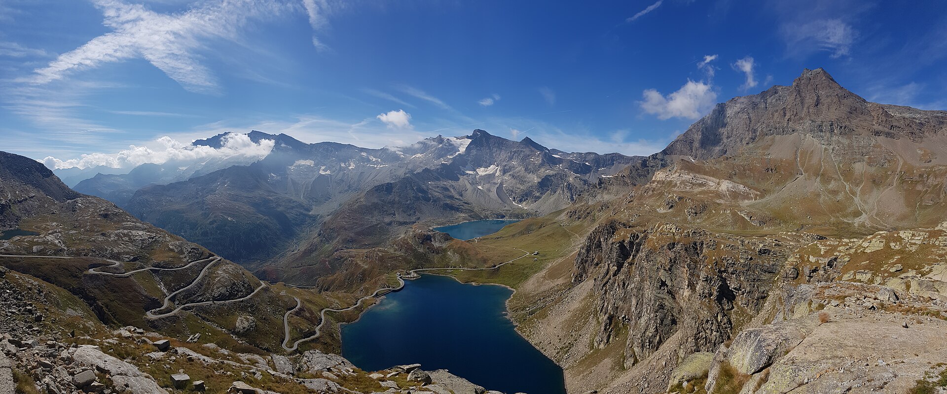
Live-Webcam
Schneebericht
- Letzte 24h (1714 m): 1 cm
- Letzte 72h (1714 m): 4 cm
- Letzte 7 Tage: Gipfel (1747 m) 13cm · Mittelstation (1714 m) 8cm · Tal (1680 m) 11cm
- Saisonsumme (1714 m): 0 cm
Skigebiete jetzt geöffnet · Schneebericht
About Chiapili di Sotto – Ceresole Reale
A quiet stone hamlet serving as the gateway to the wild Gran Paradiso, where silence and raw nature outshine any resort luxury.
Highlights
- Traditional stone architecture
- High-altitude solitude
- National park access
- Piedmontese mountain grit
Key Facts
- Altitude: 1680m
- Top lift: 1747m
- Ski pistes: 1km
- Ski lifts: 1
- Population: 152
- 4000m+ peaks nearby: 1
- Lakes nearby: 33
- MTB trails: 55.2km
- Mountain huts: 20
Ski Area
Weather and 10-day forecast for Chiapili di Sotto – Ceresole Reale
- Today: -1 to 4 °C, snow showers, 0 h of sunshine
- Freezing level today: about 2013 m (1770 to 2250 m)
- Snowfall in the last 7 days: 10 cm
| Day | Min / max | Sky | Precipitation | Sunshine |
|---|---|---|---|---|
| So., 22. Nov. | -1 / 4 °C | snow showers | 5 cm snow | 0 h sun |
| Mo., 23. Nov. | 0 / 2 °C | clear sky | 2 mm rain | 8 h sun |
| Di., 24. Nov. | -2 / 1 °C | overcast | 2 cm snow | 1 h sun |
| Mi., 25. Nov. | -2 / 0 °C | snow | 10 cm snow | 0 h sun |
| Do., 26. Nov. | 0 / 4 °C | partly cloudy | dry | 5 h sun |
| Fr., 27. Nov. | -1 / 2 °C | clear sky | dry | 9 h sun |
| Sa., 28. Nov. | -1 / 5 °C | clear sky | dry | 8 h sun |
| So., 29. Nov. | -4 / 3 °C | overcast | dry | 7 h sun |
| Mo., 30. Nov. | -11 / -4 °C | snow | 1 cm snow | 9 h sun |
| Di., 1. Dez. | -12 / -5 °C | snow | 1 cm snow | 9 h sun |
Things to do in Chiapili di Sotto – Ceresole Reale
Hikes nearby - Chiapili di Sotto – Ceresole Reale (6)
6 curated hiking trails around Chiapili di Sotto – Ceresole Reale, sourced from OpenStreetMap and enriched with distance, elevation gain and difficulty.
-
Mulattiera reale
Der Weg steigt aus Erlengebüsch an Ruinen auf 1858 m und einem Wasserfall vorbei, der in die breite Mulde von Chiapili di Sopra stürzt, und führt durch Felsblockfelder und hochalpine Weiden — Alpe Pertica, Alpe Fumetta, Alpe Pianass — während die Nordwände des Levanne-Massivs den gesamten Weg über vor einem liegen. Oben, nahe der Alpe Comba, trifft er auf die alte königliche Jagdstraße, die einst das Plateau von Nivolet über den Colle della Terra und den Colle della Porta mit Noasca verband.
-
Alta Via Canavesana
-
3C, Col Rosset
-
Sentiero Duca degli Abruzzi
-
Sentiero Bruno Tempo
The Sentiero Bruno Tempo branches right from the main royal path (*sentiero reale*) just beyond the barrier at Chiapili, climbing through the Gran Paradiso National Park and delivering what those who have walked it describe as "truly interesting and remarkable panoramas." It lies within reach of the Colle del Nivolet approaches, offering a worthwhile detour from the main route.
-
Tour de Truc de Tsanteleina
Mountainbiken bei Chiapili di Sotto – Ceresole Reale
- MTB-Singletrail-Tour am Gran Paradiso – Etappe 1
- Sentiero Videsott
Alle Mountainbike-Touren bei Chiapili di Sotto – Ceresole Reale
Hier gedreht
- The Italian Job (1969)
Getting to Chiapili di Sotto – Ceresole Reale
Door-to-door travel times as used by the MR. ALPS ranking.
- Nearest airport: Turin Airport (TRN), 46 km away, about 1h35 by road
- Torino: 1h48 by car, 89 km
- Milano: 2h48 by car, 181 km
- Genova: 3h21 by car, 240 km
- Brescia: 3h39 by car, 267 km
- Genève: 3h58 by car, 266 km
- Annecy: 4h07 by car, 278 km