Vögelinsegg – Speicher
About Vögelinsegg – Speicher
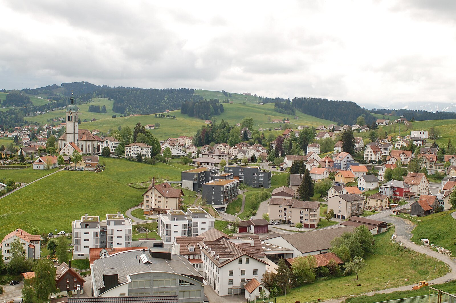
A rolling Appenzell hilltop retreat where historic trams meet panoramic views of Lake Constance and rugged peaks.
Highlights
- Historic tram access
- Rolling green hills
- Panoramic lake views
- Appenzell farmhouse architecture
Key Facts
- Altitude: 967m
- Top lift: 1030m
- Ski pistes: 1km
- Ski lifts: 1
- Population: 4,453
- Lakes nearby: 14
- MTB trails: 263.3km
- Mountain huts: 9
Ski Area
Weather and 10-day forecast for Vögelinsegg – Speicher
- Today: 12 to 20 °C, partly cloudy, 7 h of sunshine
- Freezing level today: about 4040 m (3550 to 4160 m)
| Day | Min / max | Sky | Precipitation | Sunshine |
|---|---|---|---|---|
| 9月20日周日 | 12 / 20 °C | partly cloudy | dry | 7 h sun |
| 9月21日周一 | 9 / 15 °C | overcast | dry | 2 h sun |
| 9月22日周二 | 6 / 14 °C | clear sky | dry | 12 h sun |
| 9月23日周三 | 6 / 17 °C | clear sky | dry | 11 h sun |
| 9月24日周四 | 10 / 19 °C | clear sky | dry | 8 h sun |
| 9月25日周五 | 10 / 20 °C | partly cloudy | dry | 6 h sun |
| 9月26日周六 | 11 / 22 °C | clear sky | dry | 11 h sun |
| 9月27日周日 | 12 / 22 °C | clear sky | dry | 8 h sun |
| 9月28日周一 | 11 / 19 °C | clear sky | dry | 11 h sun |
| 9月29日周二 | 12 / 20 °C | clear sky | dry | 12 h sun |
Things to do in Vögelinsegg – Speicher
Hikes nearby — Vögelinsegg – Speicher (20)
20+ curated hiking trails around Vögelinsegg – Speicher, sourced from OpenStreetMap and enriched with distance, elevation gain and difficulty.
-
Alte Konstanzerstrasse
-
ViaJacobi
-
Alpenpanorama-Weg
-
Alpenpanorama-Weg
-
Kulturspur Appenzellerland
所提供的摘录描述的是穿越阿彭策尔外罗登州、途经乌尔内施/雷赫托贝尔至瓦尔岑豪森的Kulturspur Appenzellerland步道,而非格劳宾登州Wiesen–Gruob的步道。摘录中没有任何内容涉及与指定地点相符的步道。
-
Rund um Speicher
-
Rehtobel-Trogen
-
St. Galler Panoramaweg
The trail traces a high arc above St. Gallen, threading through meadows and woods past the Art Nouveau Drei Weieren swimming baths — three pools perched directly above the city's historic centre — with the town's UNESCO-listed abbey district constantly shifting into view from new angles below.
-
Heiden-Rehetobel
-
Appenzeller Weg
-
Aussichtsweg "obedöri"
-
St.Galler Brückenweg
Der St. Galler Brückenweg ist ein 8,2 Kilometer langer Wanderweg, der am Bahnhof in St. Gallen-Haggen beginnt und bis nach Spisegg führt. Der als Nahtour 4 markierte Weg verläuft an 18 Viadukten, Holz-, Betonbrücken und Hängestegen vorbei durch die Flusslandschaft des Naturschutzgebietes Sitter- und Wattbachlandschaft. Bei jeder Brücke enthält eine Informationstafel Details über Bau, Baujahr und K
-
Pfeff ond Lischt Weg
-
Wasserlehrpfad Hundwil
-
Barfussweg
-
Kulturspur Appenzellerland: Teufen - Trogen
-
ViaJacobi: Rorschach Hafen - Platz Herisau Zentrum
-
Kulturspur Appenzellerland: Trogen - Heiden Kirchplatz
-
Alpenpanorama-Weg: Trogen Landsgemeindeplatz - Tourist Information
-
Lauras Lieblingsplätze
Mountain biking near Vögelinsegg – Speicher
- Wildmannli Bike
- Appenzeller Vorderland-Route
- Appenzeller Mittelland-Route
- Panorama Bike - Etappe 2
- Kaien-Route
- Gern
- Egghöhenweg
- Schellerstrasse
Getting to Vögelinsegg – Speicher
Door-to-door travel times as used by the MR. ALPS ranking.
- Nearest airport: Sankt Gallen Altenrhein Airport (ACH), 12 km away, about 24 min by road
- Zürich: 1h11 by car, 92 km
- Luzern: 1h51 by car, 144 km
- Basel: 2h05 by car, 172 km
- Biel/Bienne: 2h30 by car, 209 km
- Bern: 2h31 by car, 211 km
- München: 2h37 by car, 234 km
Where to stay in Vögelinsegg – Speicher
184 places to stay for a night on 2026-09-25, from 84 EUR per night, median 214 EUR. Prices are direct with hotels and destinations, compared live on the Vögelinsegg – Speicher page.