Vögelinsegg – Speicher
About Vögelinsegg – Speicher
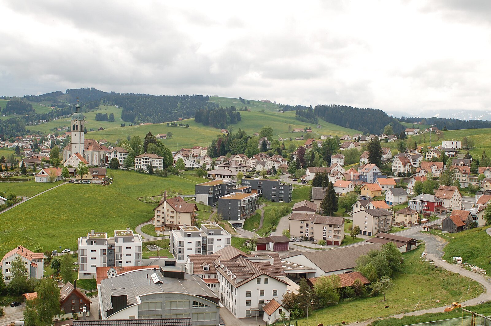
A rolling Appenzell hilltop retreat where historic trams meet panoramic views of Lake Constance and rugged peaks.
Highlights
- Historic tram access
- Rolling green hills
- Panoramic lake views
- Appenzell farmhouse architecture
Key Facts
- Altitude: 967m
- Top lift: 1030m
- Ski pistes: 1km
- Ski lifts: 1
- Population: 4,453
- Lakes nearby: 14
- MTB trails: 289.8km
- Mountain huts: 9
Ski Area
Weather and 10-day forecast for Vögelinsegg – Speicher
- Today: 6 to 14 °C, clear sky, 11 h of sunshine
- Freezing level today: about 3435 m (3180 to 3890 m)
| Day | Min / max | Sky | Precipitation | Sunshine |
|---|---|---|---|---|
| 9月22日(火) | 6 / 14 °C | clear sky | dry | 11 h sun |
| 9月23日(水) | 8 / 17 °C | clear sky | dry | 11 h sun |
| 9月24日(木) | 9 / 14 °C | overcast | dry | 2 h sun |
| 9月25日(金) | 6 / 15 °C | clear sky | dry | 12 h sun |
| 9月26日(土) | 7 / 19 °C | partly cloudy | dry | 6 h sun |
| 9月27日(日) | 10 / 20 °C | overcast | dry | 3 h sun |
| 9月28日(月) | 10 / 21 °C | clear sky | dry | 9 h sun |
| 9月29日(火) | 9 / 21 °C | clear sky | dry | 12 h sun |
| 9月30日(水) | 12 / 21 °C | clear sky | dry | 8 h sun |
| 10月1日(木) | 12 / 18 °C | rain showers | dry | 1 h sun |
Things to do in Vögelinsegg – Speicher
Hikes nearby — Vögelinsegg – Speicher (20)
20+ curated hiking trails around Vögelinsegg – Speicher, sourced from OpenStreetMap and enriched with distance, elevation gain and difficulty.
-
Alte Konstanzerstrasse
-
ViaJacobi
-
Alpenpanorama-Weg
-
Alpenpanorama-Weg
-
Kulturspur Appenzellerland
NONE (提供された抜粋は、Urnäsch/RehetobelとWalzenhausenの間のAppenzell Ausserhodenを通るKulturspur Appenzellerlandトレイルを説明するものであり、GraubündenのWiesen–Gruobのトレイルではありません。指定された場所に一致するトレイルに関する情報を含む抜粋はありません。)
-
Rund um Speicher
-
Rehtobel-Trogen
-
St. Galler Panoramaweg
The trail traces a high arc above St. Gallen, threading through meadows and woods past the Art Nouveau Drei Weieren swimming baths — three pools perched directly above the city's historic centre — with the town's UNESCO-listed abbey district constantly shifting into view from new angles below.
-
Heiden-Rehetobel
-
Appenzeller Weg
-
Aussichtsweg "obedöri"
-
St.Galler Brückenweg
Der St. Galler Brückenweg ist ein 8,2 Kilometer langer Wanderweg, der am Bahnhof in St. Gallen-Haggen beginnt und bis nach Spisegg führt. Der als Nahtour 4 markierte Weg verläuft an 18 Viadukten, Holz-, Betonbrücken und Hängestegen vorbei durch die Flusslandschaft des Naturschutzgebietes Sitter- und Wattbachlandschaft. Bei jeder Brücke enthält eine Informationstafel Details über Bau, Baujahr und K
-
Pfeff ond Lischt Weg
-
Wasserlehrpfad Hundwil
-
Barfussweg
-
Kulturspur Appenzellerland: Teufen - Trogen
-
ViaJacobi: Rorschach Hafen - Platz Herisau Zentrum
-
Kulturspur Appenzellerland: Trogen - Heiden Kirchplatz
-
Alpenpanorama-Weg: Trogen Landsgemeindeplatz - Tourist Information
-
Lauras Lieblingsplätze
Mountain biking near Vögelinsegg – Speicher
- Wildmannli Bike
- Appenzeller Vorderland-Route
- Appenzeller Mittelland-Route
- Panorama Bike - Etappe 2
- Kaien-Route
- Schellerstrasse
- Leimensteigstrasse
- Gern
Getting to Vögelinsegg – Speicher
Door-to-door travel times as used by the MR. ALPS ranking.
- Nearest airport: Sankt Gallen Altenrhein Airport (ACH), 12 km away, about 24 min by road
- Zürich: 1h11 by car, 92 km
- Luzern: 1h51 by car, 144 km
- Basel: 2h05 by car, 172 km
- Biel/Bienne: 2h30 by car, 209 km
- Bern: 2h31 by car, 211 km
- München: 2h37 by car, 234 km
Where to stay in Vögelinsegg – Speicher
170 places to stay for a night on 2026-09-25, from 93 EUR per night, median 240 EUR. Prices are direct with hotels and destinations, compared live on the Vögelinsegg – Speicher page.