Oberwald
About Oberwald
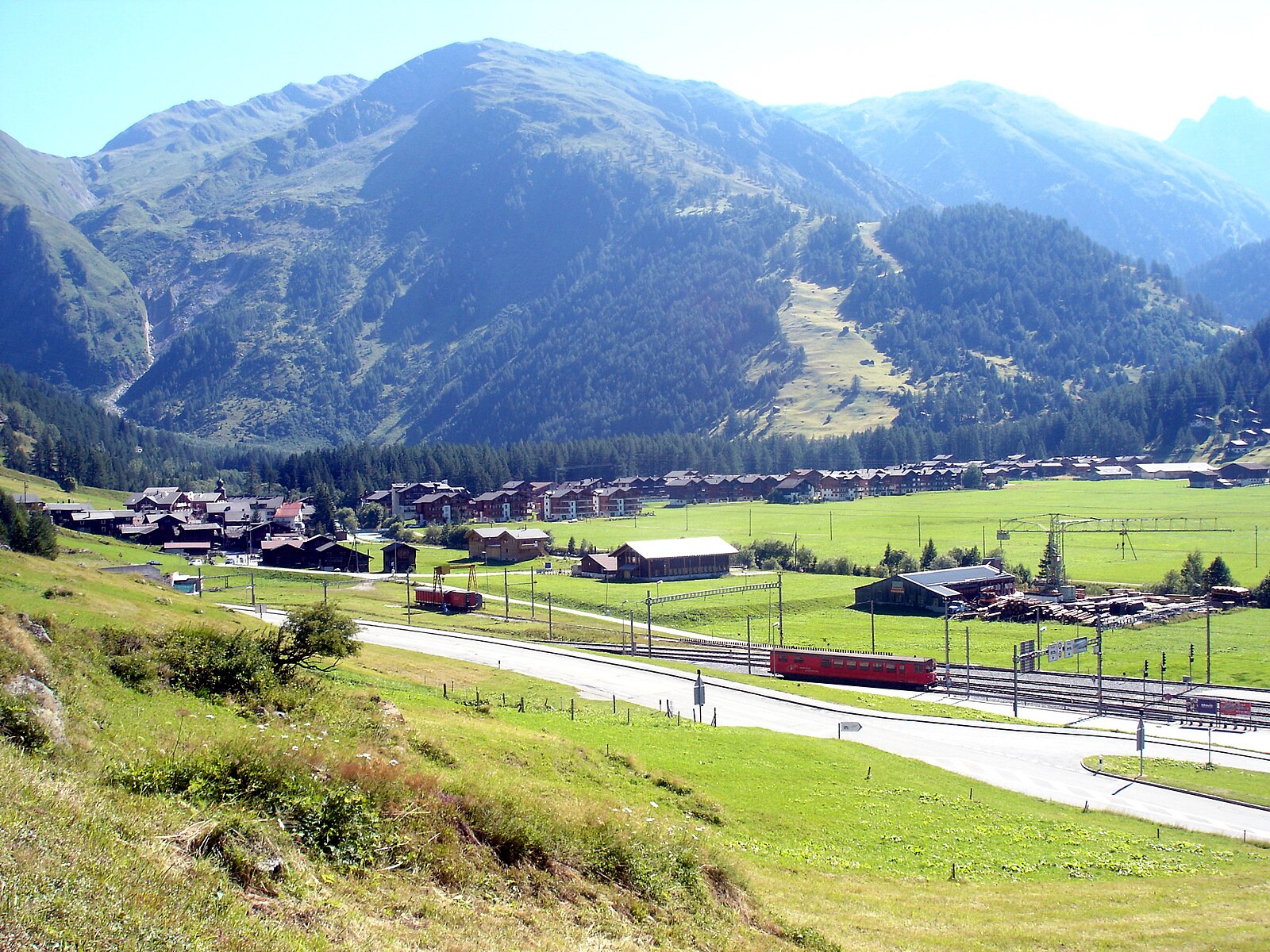
A serene gateway to the Furka Pass, where cross-country trails wind through a quiet valley defined by tradition and deep winter snow.
Highlights
- Nordic skiing hub
- Historic timber architecture
- Furka Steam Railway
- Quiet valley escape
Key Facts
- Altitude: 1375m
- Top lift: 1404m
- Ski lifts: 1
- Population: 277
- 4000m+ peaks nearby: 3
- Lakes nearby: 31
- MTB trails: 70.4km
- Mountain huts: 23
Ski Area
已包含在以下滑雪通票中
Weather and 10-day forecast for Oberwald
- Today: 4 to 19 °C, clear sky, 12 h of sunshine
- Freezing level today: about 3977 m (3800 to 4200 m)
| Day | Min / max | Sky | Precipitation | Sunshine |
|---|---|---|---|---|
| 9月23日周三 | 4 / 19 °C | clear sky | dry | 12 h sun |
| 9月24日周四 | 6 / 18 °C | partly cloudy | dry | 6 h sun |
| 9月25日周五 | 6 / 19 °C | clear sky | dry | 8 h sun |
| 9月26日周六 | 10 / 21 °C | clear sky | dry | 12 h sun |
| 9月27日周日 | 11 / 22 °C | clear sky | dry | 9 h sun |
| 9月28日周一 | 11 / 22 °C | clear sky | dry | 12 h sun |
| 9月29日周二 | 11 / 21 °C | clear sky | dry | 12 h sun |
| 9月30日周三 | 9 / 20 °C | clear sky | dry | 11 h sun |
| 10月1日周四 | 10 / 14 °C | rain showers | dry | 1 h sun |
| 10月2日周五 | 3 / 9 °C | snow showers | dry | 10 h sun |
Things to do in Oberwald
Hikes nearby — Oberwald (20)
20+ curated hiking trails around Oberwald, sourced from OpenStreetMap and enriched with distance, elevation gain and difficulty.
-
9 Seen-Weg
The 9 Seen-Weg departs from the Grimselpass and follows a path with alpine character past the Trützisee before descending to Geschinen. The route runs far above the valley floor, threading through dramatic high-alpine scenery on its way between nine lakes.
-
Oberwald - Gletsch
-
14a-Sentiero dei passi alpini
-
Furka-Höhenweg
The Furka-Höhenweg traces the stony south-eastern slopes above the Urseren Valley, with views down to Realp and Hospental, the pass road, and the historic Furka steam railway threading the valley below. Along the way, tiny alpine lakes, mountain streams, jagged cliffs, and bellflowers — including the yellow bellflower (*Campanula thy…*) — punctuate terrain that passes within sight of the Rhone Glacier and the Belle Époque Hotel Belvédère, made famous by the Bond film *Goldfinger*.
-
Vier-Quellen-Weg
Als Vier-Quellen-Weg wird die Schweizer Wanderroute 49 in der Gotthard-Gruppe bezeichnet. Sie beginnt am Oberalppass und führt in fünf Etappen durch die Kantone Graubünden, Uri, Tessin und Wallis im Uhrzeigersinn zum Furkapass.
-
Oberwald - Grimselpass
-
Zahnstangensafari
-
Triebtenseelücke - Grimselpass
-
Oberwald - Obergesteln
-
Obergesteln - Mällige - Oberwald
-
Gerewasserweg
-
Unterwassern - Furkapass
-
Grimselpass - Gletsch
-
Ladstafel-Ulrichen
-
Triebtenseelücke - Trützisee
-
Grimselpass - Oberaar
-
Grimselpass - Rhonegletscher
-
Räterichsboden - Grimselpass
-
Grimsel/Hospiz - Lauteraarhütte
-
Gletsch - Furkapass
The trail begins in Gletsch, which also serves as the endpoint of the Grimsel Pass road, and the Valais side of the Furka Pass is well developed with multiple spots to stop and admire the Rhône Glacier. Several pullouts along the ascent invite you to linger over the glacier before the route continues toward the pass.
Mountain biking near Oberwald
- Gotthard Bike Nufenen Andermatt
- Gommer Höhenweg
- OberwaldFurkapass
- Winterstrasse
Getting to Oberwald
Door-to-door travel times as used by the MR. ALPS ranking.
- Nearest airport: Lugano Airport (LUG), 73 km away, about 1h47 by road
- Luzern: 1h36 by car, 110 km
- Bern: 1h59 by car, 129 km
- Zürich: 2h06 by car, 147 km
- Biel/Bienne: 2h22 by car, 165 km
- Lausanne: 2h35 by car, 191 km
- Milano: 2h37 by car, 201 km
Where to stay in Oberwald
48 places to stay for a night on 2026-09-25, from 198 EUR per night, median 235 EUR. Prices are direct with hotels and destinations, compared live on the Oberwald page.