Gernsbach
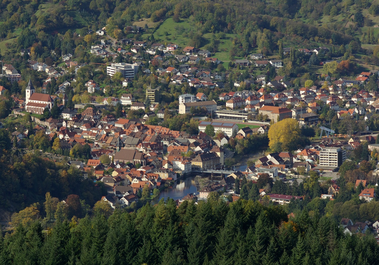
About Gernsbach
A historic timber-framed gem in the Murg Valley, where aristocratic history meets the rugged hiking trails of the Black Forest.
Highlights
- Old town architecture
- Murg river walks
- Fairytale castle views
- Lush forest trails
Key Facts
- Altitude: 859m
- Top lift: 953m
- Ski pistes: 0.8km
- Ski lifts: 2
- Lakes nearby: 6
- MTB trails: 157.7km
Ski Area
Weather and 10-day forecast for Gernsbach
- Today: 16 to 24 °C, partly cloudy, 4 h of sunshine
- Freezing level today: about 3891 m (3780 to 4060 m)
| Day | Min / max | Sky | Precipitation | Sunshine |
|---|---|---|---|---|
| śr., 30 wrz | 16 / 24 °C | partly cloudy | dry | 4 h sun |
| czw., 1 paź | 12 / 18 °C | rain showers | dry | 1 h sun |
| pt., 2 paź | 11 / 15 °C | overcast | dry | 2 h sun |
| sob., 3 paź | 11 / 18 °C | partly cloudy | dry | 5 h sun |
| niedz., 4 paź | 10 / 17 °C | partly cloudy | dry | 6 h sun |
| pon., 5 paź | 8 / 17 °C | partly cloudy | dry | 5 h sun |
| wt., 6 paź | 8 / 20 °C | clear sky | dry | 11 h sun |
| śr., 7 paź | 9 / 19 °C | partly cloudy | dry | 5 h sun |
| czw., 8 paź | 7 / 12 °C | drizzle | dry | 0 h sun |
| pt., 9 paź | 5 / 11 °C | overcast | dry | 1 h sun |
Things to do in Gernsbach
Hikes nearby — Gernsbach (20)
20+ curated hiking trails around Gernsbach, sourced from OpenStreetMap and enriched with distance, elevation gain and difficulty.
-
European Long distance path E1 - part Germany, Baden-Wuerttemberg (region Schwarzwald north)
-
Westweg [02. Dobel→Forbach]
-
Westweg [03. Forbach→Unterstmatt]
Forbach - Badener Höhe - Unterstmatt
-
Murgleiter, Etappe 2
-
Dobel - Wildseemoor
Dobel (Westweg) - Lehmannshof - Wildseemoor (Mittelweg)
-
Gompelscheuer - Urnagold
-
Murgleiter, Etappe 3
-
Raumünzach - Sand
Raumünzach - Schwarzenbachtalsperre (Westweg) - Herrenwies - Sand (Westweg)
-
Baden-Baden - Badener Höhe
-
Rundweg Nr. 2
Postweg - Mannslohweg - Kreuzlehütte - Kaltenbronn
-
Kreuzlehütte - Saatschulhütte
-
Rundweg Nr. 7
Kreuzlehütte - Mannslohweg - Postweg - Kaltenbronn - Kreuzleweg - Binsenberg
-
Naturerlebnisweg Kaltenbronn
Parkplatz F - Mannslohweg - Leonhardhütte - Wildsee - Abzweig Hornweg
-
Kreuzlehütte - Schlagbaum
-
Diebstich - Gernsbacher Steige
-
Mittelweg
Mittelweg jest, obok Westweg i Ostweg, jednym z trzech długodystansowych szlaków turystycznych biegnących z północy na południe przez Schwarzwald. Prowadzi z Pforzheim do Waldshut. Ten liczący około 230 kilometrów szlak grzbietowy został wytyczony w 1903 roku i od tego czasu jest utrzymywany i obsługiwany przez Schwarzwaldverein. Jego znak szlaku to czerwony romb z białym paskiem na białym tle.
-
Enztalweg
Gompelscheuer - Enzklösterle - Bad Wildbad (Mittelweg)
-
Albtal.Abenteuer.Track - Etappe 1
-
AugenBlick-Runde Bad Herrenalb Schweizerkopf
-
Aichelberger Traumtour
Mountain biking near Gernsbach
- Oberer Hornweg
- Kreuzleweg
Getting to Gernsbach
Door-to-door travel times as used by the MR. ALPS ranking.
- Nearest airport: Karlsruhe Baden-Baden Airport (FKB), 27 km away, about 50 min by road
- Strasbourg: 1h18 by car, 94 km
- Stuttgart: 1h19 by car, 75 km
- Mannheim: 1h26 by car, 117 km
- Frankfurt am Main: 2h05 by car, 188 km
- Basel: 2h15 by car, 204 km
- Zürich: 2h48 by car, 229 km
Where to stay in Gernsbach
97 places to stay for a night on 2026-10-02, from 88 EUR per night, median 153 EUR. Prices are direct with hotels and destinations, compared live on the Gernsbach page.