Gernsbach
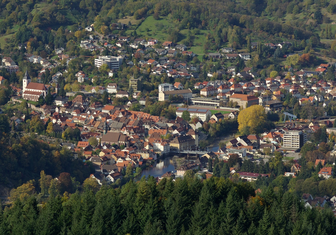
About Gernsbach
A historic timber-framed gem in the Murg Valley, where aristocratic history meets the rugged hiking trails of the Black Forest.
Highlights
- Old town architecture
- Murg river walks
- Fairytale castle views
- Lush forest trails
Key Facts
- Altitude: 859m
- Top lift: 953m
- Ski pistes: 0.8km
- Ski lifts: 2
- Lakes nearby: 6
- MTB trails: 157.7km
Ski Area
Weather and 10-day forecast for Gernsbach
- Today: 12 to 18 °C, rain showers, 0 h of sunshine
- Freezing level today: about 3613 m (3440 to 3740 m)
| Day | Min / max | Sky | Precipitation | Sunshine |
|---|---|---|---|---|
| Thu, Oct 1 | 12 / 18 °C | rain showers | dry | 0 h sun |
| Fri, Oct 2 | 11 / 16 °C | overcast | dry | 3 h sun |
| Sat, Oct 3 | 12 / 18 °C | partly cloudy | dry | 8 h sun |
| Sun, Oct 4 | 10 / 17 °C | rain | dry | 3 h sun |
| Mon, Oct 5 | 8 / 18 °C | overcast | dry | 2 h sun |
| Tue, Oct 6 | 8 / 20 °C | clear sky | dry | 9 h sun |
| Wed, Oct 7 | 9 / 20 °C | partly cloudy | dry | 6 h sun |
| Thu, Oct 8 | 9 / 13 °C | drizzle | dry | 2 h sun |
| Fri, Oct 9 | 6 / 11 °C | drizzle | dry | 2 h sun |
| Sat, Oct 10 | 4 / 13 °C | clear sky | dry | 7 h sun |
Things to do in Gernsbach
Hikes nearby - Gernsbach (20)
20+ curated hiking trails around Gernsbach, sourced from OpenStreetMap and enriched with distance, elevation gain and difficulty.
-
European Long distance path E1 - part Germany, Baden-Wuerttemberg (region Schwarzwald north)
-
Westweg [02. Dobel→Forbach]
-
Westweg [03. Forbach→Unterstmatt]
Forbach - Badener Höhe - Unterstmatt
-
Murgleiter, Etappe 2
-
Dobel - Wildseemoor
Dobel (Westweg) - Lehmannshof - Wildseemoor (Mittelweg)
-
Gompelscheuer - Urnagold
-
Murgleiter, Etappe 3
-
Raumünzach - Sand
Raumünzach - Schwarzenbachtalsperre (Westweg) - Herrenwies - Sand (Westweg)
-
Baden-Baden - Badener Höhe
-
Rundweg Nr. 2
Postweg - Mannslohweg - Kreuzlehütte - Kaltenbronn
-
Kreuzlehütte - Saatschulhütte
-
Rundweg Nr. 7
Kreuzlehütte - Mannslohweg - Postweg - Kaltenbronn - Kreuzleweg - Binsenberg
-
Naturerlebnisweg Kaltenbronn
Parkplatz F - Mannslohweg - Leonhardhütte - Wildsee - Abzweig Hornweg
-
Kreuzlehütte - Schlagbaum
-
Diebstich - Gernsbacher Steige
-
Mittelweg
Der Mittelweg ist neben Westweg und Ostweg eine der drei Nord-Süd-Fernwanderstrecken durch den Schwarzwald. Er führt von Pforzheim nach Waldshut. Der etwa 230 Kilometer lange Höhenweg wurde im Jahre 1903 angelegt und wird seither vom Schwarzwaldverein gepflegt und betreut. Sein Wegzeichen ist eine rote Raute mit weißem Balken auf weißem Grund.
-
Enztalweg
Gompelscheuer - Enzklösterle - Bad Wildbad (Mittelweg)
-
Albtal.Abenteuer.Track - Etappe 1
-
AugenBlick-Runde Bad Herrenalb Schweizerkopf
-
Aichelberger Traumtour
Mountain biking near Gernsbach
- Oberer Hornweg
- Kreuzleweg
Getting to Gernsbach
Door-to-door travel times as used by the MR. ALPS ranking.
- Nearest airport: Karlsruhe Baden-Baden Airport (FKB), 27 km away, about 50 min by road
- Strasbourg: 1h18 by car, 94 km
- Stuttgart: 1h19 by car, 75 km
- Mannheim: 1h26 by car, 117 km
- Frankfurt am Main: 2h05 by car, 188 km
- Basel: 2h15 by car, 204 km
- Zürich: 2h48 by car, 229 km
Where to stay in Gernsbach
97 places to stay for a night on 2026-10-02, from 101 EUR per night, median 198 EUR. Prices are direct with hotels and destinations, compared live on the Gernsbach page.