Hospental
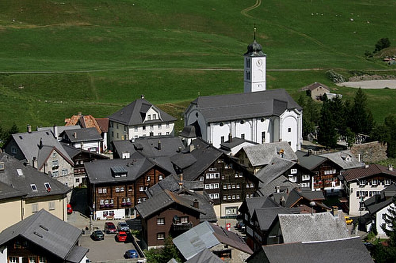
About Hospental
A quiet, historic crossroads in the Urseren Valley where medieval stone architecture meets the rugged solitude of the Gotthard Pass.
Highlights
- Medieval watchtower
- High-alpine serenity
- Historic transit point
- Rustic stone architecture
Key Facts
- Altitude: 1493m
- Population: 182
- Lakes nearby: 28
- MTB trails: 166.3km
- Mountain huts: 18
Weather and 10-day forecast for Hospental
- Today: 5 to 16 °C, clear sky, 10 h of sunshine
- Freezing level today: about 4090 m (3560 to 4290 m)
| Day | Min / max | Sky | Precipitation | Sunshine |
|---|---|---|---|---|
| pt., 25 wrz | 5 / 16 °C | clear sky | dry | 10 h sun |
| sob., 26 wrz | 8 / 18 °C | clear sky | dry | 10 h sun |
| niedz., 27 wrz | 8 / 21 °C | clear sky | dry | 12 h sun |
| pon., 28 wrz | 11 / 22 °C | clear sky | dry | 11 h sun |
| wt., 29 wrz | 10 / 20 °C | overcast | dry | 4 h sun |
| śr., 30 wrz | 10 / 19 °C | overcast | dry | 2 h sun |
| czw., 1 paź | 12 / 17 °C | rain | dry | 4 h sun |
| pt., 2 paź | 7 / 11 °C | rain | dry | 0 h sun |
| sob., 3 paź | 8 / 18 °C | clear sky | dry | 9 h sun |
| niedz., 4 paź | 6 / 18 °C | clear sky | dry | 11 h sun |
Things to do in Hospental
Hikes nearby — Hospental (20)
20+ curated hiking trails around Hospental, sourced from OpenStreetMap and enriched with distance, elevation gain and difficulty.
-
ViaSuworow
-
Walserweg Gottardo - Etappe 10
The route descends from the Gotthard Pass — a historic crossroads of northern and southern Europe — along the old cobbled pass road past dammed lakes, wind turbines, and high-voltage lines before dropping through Hospental and following the Reuss river alongside the expansive golf course of the Swiss Alps Resort into Andermatt. Along the way, the National Gotthard Museum and the historic hospice mark the storied pass summit.
-
Walserweg Gottardo - Etappe 11
-
Furka-Höhenweg
Furka-Höhenweg biegnie kamienistymi południowo-wschodnimi zboczami ponad doliną Urseren, z widokiem na Realp i Hospental, drogę przełęczową oraz historyczną parową kolejkę Furka wijącą się przez dolinę poniżej. Po drodze małe alpejskie jeziorka, górskie strumienie, postrzępione klify i dzwonki — w tym żółty dzwonek (*Campanula thy…*) — urozmaicają teren, który przebiega w zasięgu wzroku lodowca Rhone i Belle Époque Hotel Belvédère, rozsławionego przez film o Bondzie *Goldfinger*.
-
Ursener Höhenweg
-
Trans Swiss Trail
Trasa biegnie wzdłuż bruku dawnego szlaku mulego prowadzącego do Przełęczy Gotthard, przeprawy używanej przez muletierów do transportu towarów już od XIII wieku. Po drodze charakterystyczna instalacja wentylacyjna tunelu drogowego Gotthard wznosi się niczym pawilon muzyczny, a na szczycie przełęczy znajduje się muzeum poświęcone epoce dyliżansu pocztowego.
-
ViaGottardo
-
Trans Swiss Trail
This stage of the Trans Swiss Trail follows the paving of an old mule track to the Gotthard Pass — a route that muleteers have used since the 13th century — passing the striking ventilation plant of the Gotthard road tunnel and a vast variety of colourful Alpine flora. At the pass head, a museum dedicated to the post-coach era marks the end of one of the most historically important Alpine crossings in Switzerland.
-
ViaGottardo
-
ViaSuworow
-
Golfrundweg
-
Andermatt-Rüssenbiel
-
Kräuterlehrpfad Hospental-Realp
-
Ospizio San Gottardo-Hospental
Szlak biegnie wzdłuż rzeki Gotthardreuss przez wysokogórski płaskowyż, gdzie pokryte porostami głazy leżą rozrzucone po zielonych łąkach, przechodząc przez historyczną wioskę przełęczową Hospental, zanim wspina się do Ospizio San Gottardo, gdzie turbiny wiatrowe wyznaczają szczyt. Po drodze stare Säumerpfade (ścieżki poganiaczów mułów) biegną z dala od ruchu drogowego, a historyczna dyliżans pocztowy nadal jeździ drogą przełęczową w pobliżu Mätteli.
-
Blumen- und Lawinenlehrpfad Chilchenberg
-
Walserweg Gottardo: Ospizio S.Gottardo - Andermatt
-
ViaGottardo: Andermatt - Ospizio S.Gottardo
-
ViaSuworow: Ospizio S.Gottardo - Andermatt
-
Trans Swiss Trail: Andermatt - Ospizio S.Gottardo
-
Furka-Höhenweg: Furkapass - Andermatt
Mountain biking near Hospental
- Ursener Höhenweg
- Rundweg Andermatt-Rohr-Mur
- Unteralpstrasse
Getting to Hospental
Door-to-door travel times as used by the MR. ALPS ranking.
- Nearest airport: Lugano Airport (LUG), 73 km away, about 1h24 by road
- Luzern: 1h02 by car, 75 km
- Zürich: 1h32 by car, 112 km
- Basel: 2h05 by car, 169 km
- Biel/Bienne: 2h15 by car, 182 km
- Bern: 2h16 by car, 184 km
- Milano: 2h17 by car, 182 km
Where to stay in Hospental
54 places to stay for a night on 2026-10-02, from 191 EUR per night, median 472 EUR. Prices are direct with hotels and destinations, compared live on the Hospental page.