Hospental
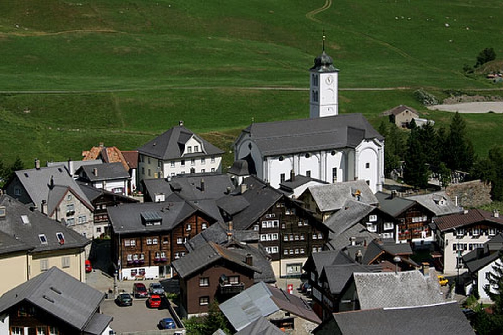
About Hospental
A quiet, historic crossroads in the Urseren Valley where medieval stone architecture meets the rugged solitude of the Gotthard Pass.
Highlights
- Medieval watchtower
- High-alpine serenity
- Historic transit point
- Rustic stone architecture
Key Facts
- Altitude: 1493m
- Population: 182
- Lakes nearby: 28
- MTB trails: 166.3km
- Mountain huts: 18
Weather and 10-day forecast for Hospental
- Today: 5 to 16 °C, clear sky, 12 h of sunshine
- Freezing level today: about 3894 m (3730 to 4070 m)
| Day | Min / max | Sky | Precipitation | Sunshine |
|---|---|---|---|---|
| wo 23 sep | 5 / 16 °C | clear sky | dry | 12 h sun |
| do 24 sep | 6 / 16 °C | clear sky | dry | 9 h sun |
| vr 25 sep | 5 / 18 °C | partly cloudy | dry | 5 h sun |
| za 26 sep | 8 / 20 °C | clear sky | dry | 12 h sun |
| zo 27 sep | 6 / 21 °C | clear sky | dry | 12 h sun |
| ma 28 sep | 9 / 23 °C | clear sky | dry | 11 h sun |
| di 29 sep | 14 / 23 °C | clear sky | dry | 12 h sun |
| wo 30 sep | 11 / 21 °C | clear sky | dry | 12 h sun |
| do 1 okt | 8 / 13 °C | rain showers | dry | 0 h sun |
| vr 2 okt | 4 / 8 °C | snow showers | dry | 0 h sun |
Things to do in Hospental
Hikes nearby — Hospental (20)
20+ curated hiking trails around Hospental, sourced from OpenStreetMap and enriched with distance, elevation gain and difficulty.
-
ViaSuworow
-
Walserweg Gottardo - Etappe 10
The route descends from the Gotthard Pass — a historic crossroads of northern and southern Europe — along the old cobbled pass road past dammed lakes, wind turbines, and high-voltage lines before dropping through Hospental and following the Reuss river alongside the expansive golf course of the Swiss Alps Resort into Andermatt. Along the way, the National Gotthard Museum and the historic hospice mark the storied pass summit.
-
Walserweg Gottardo - Etappe 11
-
Furka-Höhenweg
De Furka-Höhenweg volgt de stenige zuidoostelijke hellingen boven het Urseren-dal, met uitzicht op Realp en Hospental, de pasweg en de historische Furka-stoomspoorlijn die zich door het dal beneden slingert. Onderweg accentueren kleine alpenmeren, bergbeken, gekartelde kliffen en klokjesbloemen — waaronder de gele klokjesbloem (*Campanula thy…*) — een terrein dat binnen zichtafstand van de Rhônegletsjer en het Belle Époque Hotel Belvédère passeert, beroemd geworden door de Bondfilm *Goldfinger*.
-
Ursener Höhenweg
-
Trans Swiss Trail
De route volgt de bestrating van een oud muilezelpad naar de Gotthardpas, een oversteek die al sinds de 13e eeuw door muilezeldrijvers werd gebruikt om goederen te vervoeren. Onderweg rijst de opvallende ventilatieinstallatie van de Gotthardwegtunnel op als een muziekpaviljoen, en op de paskop bevindt zich een museum gewijd aan het tijdperk van de postkoets.
-
ViaGottardo
-
Trans Swiss Trail
This stage of the Trans Swiss Trail follows the paving of an old mule track to the Gotthard Pass — a route that muleteers have used since the 13th century — passing the striking ventilation plant of the Gotthard road tunnel and a vast variety of colourful Alpine flora. At the pass head, a museum dedicated to the post-coach era marks the end of one of the most historically important Alpine crossings in Switzerland.
-
ViaGottardo
-
ViaSuworow
-
Golfrundweg
-
Andermatt-Rüssenbiel
-
Kräuterlehrpfad Hospental-Realp
-
Ospizio San Gottardo-Hospental
The trail follows the Gotthardreuss river through a high alpine plateau where lichen-covered boulders lie scattered across green meadows, passing through the historic pass village of Hospental before climbing to the Ospizio San Gottardo, where wind turbines mark the summit. Along the way, the old Säumerpfade (mule-driver paths) run clear of traffic, and the historic postal coach still travels the pass road near Mätteli.
-
Blumen- und Lawinenlehrpfad Chilchenberg
-
Walserweg Gottardo: Ospizio S.Gottardo - Andermatt
-
ViaGottardo: Andermatt - Ospizio S.Gottardo
-
ViaSuworow: Ospizio S.Gottardo - Andermatt
-
Trans Swiss Trail: Andermatt - Ospizio S.Gottardo
-
Furka-Höhenweg: Furkapass - Andermatt
Mountain biking near Hospental
- Ursener Höhenweg
- Rundweg Andermatt-Rohr-Mur
- Unteralpstrasse
Getting to Hospental
Door-to-door travel times as used by the MR. ALPS ranking.
- Nearest airport: Lugano Airport (LUG), 73 km away, about 1h24 by road
- Luzern: 1h02 by car, 75 km
- Zürich: 1h32 by car, 112 km
- Basel: 2h05 by car, 169 km
- Biel/Bienne: 2h15 by car, 182 km
- Bern: 2h16 by car, 184 km
- Milano: 2h17 by car, 182 km
Where to stay in Hospental
54 places to stay for a night on 2026-09-25, from 225 EUR per night, median 976 EUR. Prices are direct with hotels and destinations, compared live on the Hospental page.