Cheggio
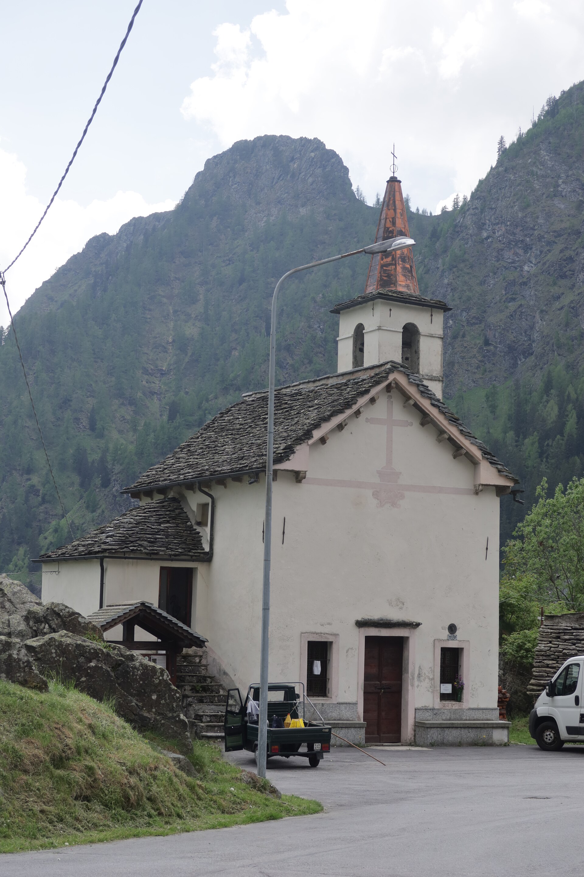
About Cheggio
A tranquil stone hamlet in the Antrona Valley, known as a gateway to high-altitude trekking and reflections on its mirror-like lake.
Highlights
- Traditional stone architecture
- High-altitude dam walks
- Piedmontese mountain cuisine
- Glacial lake views
Key Facts
- Altitude: 1461m
- Top lift: 1540m
- Ski pistes: 1.1km
- Ski lifts: 2
- 4000m+ peaks nearby: 8
- Lakes nearby: 21
- Mountain huts: 18
Ski Area
Weather and 10-day forecast for Cheggio
- Today: 10 to 18 °C, clear sky, 7 h of sunshine
- Freezing level today: about 4329 m (4230 to 4530 m)
| Day | Min / max | Sky | Precipitation | Sunshine |
|---|---|---|---|---|
| dom 20 set | 10 / 18 °C | clear sky | dry | 7 h sun |
| lun 21 set | 12 / 19 °C | overcast | dry | 1 h sun |
| mar 22 set | 10 / 15 °C | clear sky | dry | 9 h sun |
| mer 23 set | 9 / 12 °C | partly cloudy | dry | 5 h sun |
| gio 24 set | 10 / 16 °C | partly cloudy | dry | 7 h sun |
| ven 25 set | 9 / 14 °C | partly cloudy | dry | 8 h sun |
| sab 26 set | 8 / 15 °C | partly cloudy | dry | 6 h sun |
| dom 27 set | 10 / 18 °C | clear sky | dry | 11 h sun |
| lun 28 set | 8 / 17 °C | clear sky | dry | 12 h sun |
| mar 29 set | 9 / 16 °C | clear sky | dry | 12 h sun |
Things to do in Cheggio
Hikes nearby — Cheggio (19)
19 curated hiking trails around Cheggio, sourced from OpenStreetMap and enriched with distance, elevation gain and difficulty.
-
Via Alpina Blue D9
-
Via Alpina Blue D10
-
Via Alpina Blue D7
Via Alpina Blue, section 7, Zwischbergen » Alpe il Laghetto
-
Via Alpina Blue D6
Via Alpina Blue, Section 6, Simplonpass » Zwischbergen
-
Simplon Fletschhorn Trekking
-
C24 - Cheggio - Passo del Fornalino
-
C22 - Cheggio - Passo del Fornetto
-
C26 - Cheggio - Alpe Pasquale - Alpe Pianei - Castello - Passo della preia
-
C32 - Forcola di Cheggio
Percorso panoramico che collega la Valle Troncone con la Val Loranco attraverso il colle della Forcola e i suoi alpeggi
-
C27 - Antronapiana - Bivio C99 (Coronette)
Percorso lungo e, nell'ultima parte, impegnativo. Da Antronapiana si risale tutta la Valle Loranco fino al Lago Ciapivul per finire al bivio con C99 alle Coronette
-
C26a - bivio C26 - Alpe Teste - Alpe Preia - Passo della Preia
-
C20 - Ponte delle Vacche - Alpe le Fraccie - Alpi di Cama - Pizzo Ciapé
-
Da Rifugio a Rifugio - Tappa 3
-
C25 - Alpe Campolamana - Laghi dei Pozzoli - Lanche di Camasco
-
D19 - bivio D20 presso Picciola - Passo del Fornalino
Percorso per il passo del Fornalino e la Valle Antrona , a tratti ripido ed esposto segnaletica scarsa.
-
ViaStockalper: _ - Gondo
-
Höhenweg Almagelleralp
-
C00 - Strada Antronesca tappa 3
-
Da Rifugio a Rifugio - Tappa 1
Mountain biking near Cheggio
- BergWeg
- 606 Anello Casale
- Stockalperweg
Getting to Cheggio
Door-to-door travel times as used by the MR. ALPS ranking.
- Nearest airport: Milan Malpensa International Airport (MXP), 69 km away, about 2h10 by road
- Milano: 2h22 by car, 145 km
- Torino: 2h52 by car, 197 km
- Brescia: 3h13 by car, 231 km
- Genova: 3h26 by car, 260 km
- Lausanne: 3h49 by car, 242 km
- Verona: 3h50 by car, 296 km
Where to stay in Cheggio
20 places to stay for a night on 2026-09-25, from 94 EUR per night, median 136 EUR. Prices are direct with hotels and destinations, compared live on the Cheggio page.