Cheggio
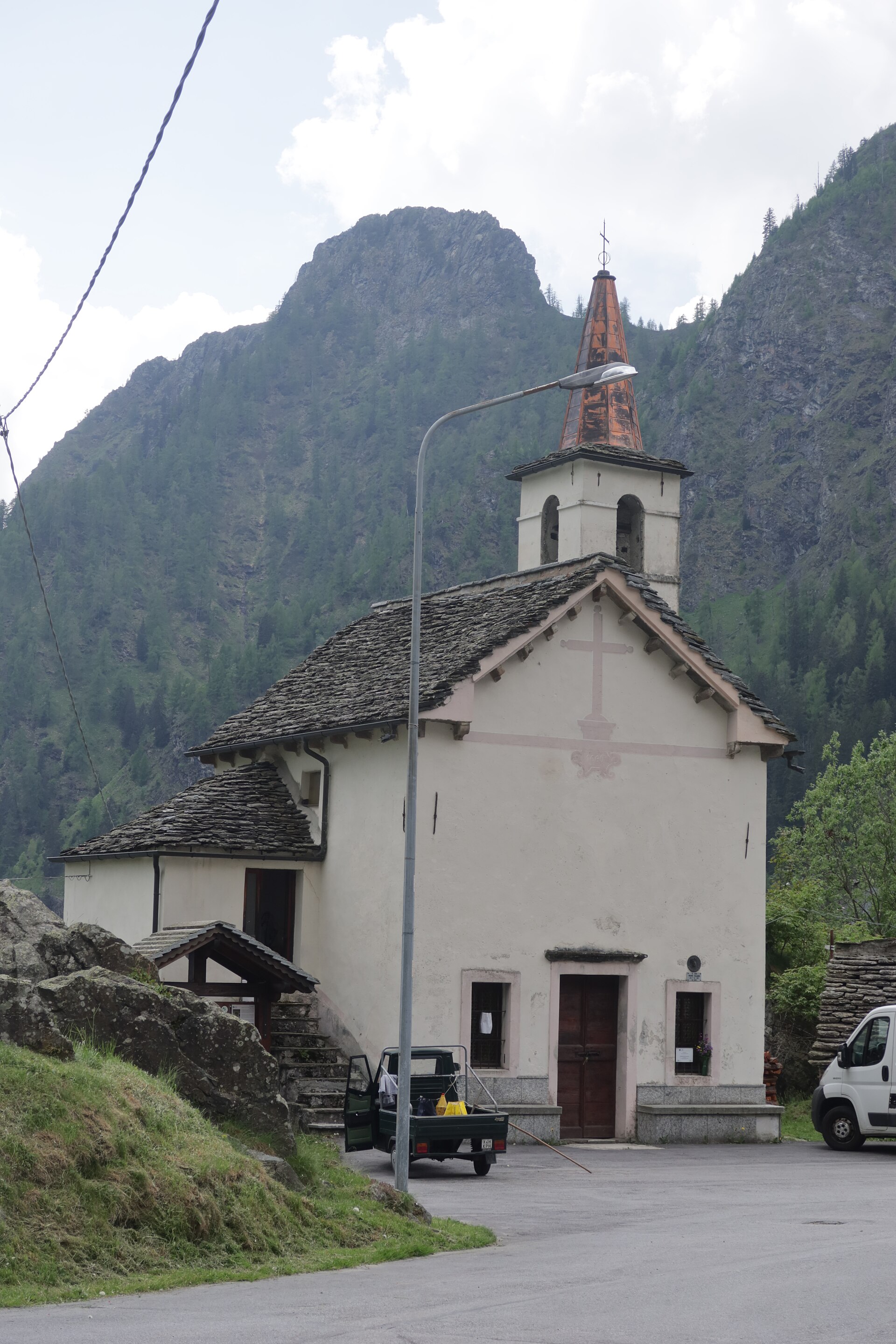
About Cheggio
A tranquil stone hamlet in the Antrona Valley, known as a gateway to high-altitude trekking and reflections on its mirror-like lake.
Highlights
- Traditional stone architecture
- High-altitude dam walks
- Piedmontese mountain cuisine
- Glacial lake views
Key Facts
- Altitude: 1461m
- Top lift: 1540m
- Ski pistes: 1.1km
- Ski lifts: 2
- 4000m+ peaks nearby: 8
- Lakes nearby: 21
- Mountain huts: 18
Ski Area
Weather and 10-day forecast for Cheggio
- Today: 10 to 18 °C, clear sky, 7 h of sunshine
- Freezing level today: about 4329 m (4230 to 4530 m)
| Day | Min / max | Sky | Precipitation | Sunshine |
|---|---|---|---|---|
| Sun, Sep 20 | 10 / 18 °C | clear sky | dry | 7 h sun |
| Mon, Sep 21 | 12 / 19 °C | overcast | dry | 1 h sun |
| Tue, Sep 22 | 10 / 15 °C | clear sky | dry | 9 h sun |
| Wed, Sep 23 | 9 / 12 °C | partly cloudy | dry | 5 h sun |
| Thu, Sep 24 | 10 / 16 °C | partly cloudy | dry | 7 h sun |
| Fri, Sep 25 | 9 / 14 °C | partly cloudy | dry | 8 h sun |
| Sat, Sep 26 | 8 / 15 °C | partly cloudy | dry | 6 h sun |
| Sun, Sep 27 | 10 / 18 °C | clear sky | dry | 11 h sun |
| Mon, Sep 28 | 8 / 17 °C | clear sky | dry | 12 h sun |
| Tue, Sep 29 | 9 / 16 °C | clear sky | dry | 12 h sun |
Things to do in Cheggio
Hikes nearby — Cheggio (19)
19 curated hiking trails around Cheggio, sourced from OpenStreetMap and enriched with distance, elevation gain and difficulty.
-
Via Alpina Blue D9
-
Via Alpina Blue D10
-
Via Alpina Blue D7
Via Alpina Blue, section 7, Zwischbergen » Alpe il Laghetto
-
Via Alpina Blue D6
Via Alpina Blue, Section 6, Simplonpass » Zwischbergen
-
Simplon Fletschhorn Trekking
-
C24 - Cheggio - Passo del Fornalino
-
C22 - Cheggio - Passo del Fornetto
-
C26 - Cheggio - Alpe Pasquale - Alpe Pianei - Castello - Passo della preia
-
C32 - Forcola di Cheggio
Panoramic route that connects the Troncone Valley with the Loranco Valley through the Forcola pass and its mountain pastures
-
C27 - Antronapiana - Bivio C99 (Coronette)
Long path and, in the last part, challenging. From Antronapiana you go up all the Valle Loranco up to Lake Ciapivul to end up at the junction with C99 at the Coronette
-
C26a - bivio C26 - Alpe Teste - Alpe Preia - Passo della Preia
-
C20 - Ponte delle Vacche - Alpe le Fraccie - Alpi di Cama - Pizzo Ciapé
-
Da Rifugio a Rifugio - Tappa 3
-
C25 - Alpe Campolamana - Laghi dei Pozzoli - Lanche di Camasco
-
D19 - bivio D20 presso Picciola - Passo del Fornalino
Route for the Fornalino pass and the Antrona Valley, steep at times and exposed, poor signposts
-
ViaStockalper: _ - Gondo
-
Höhenweg Almagelleralp
-
C00 - Strada Antronesca tappa 3
-
Da Rifugio a Rifugio - Tappa 1
Mountain biking near Cheggio
- BergWeg
- 606 Anello Casale
- Stockalperweg
Getting to Cheggio
Door-to-door travel times as used by the MR. ALPS ranking.
- Nearest airport: Milan Malpensa International Airport (MXP), 69 km away, about 2h10 by road
- Milano: 2h22 by car, 145 km
- Torino: 2h52 by car, 197 km
- Brescia: 3h13 by car, 231 km
- Genova: 3h26 by car, 260 km
- Lausanne: 3h49 by car, 242 km
- Verona: 3h50 by car, 296 km
Where to stay in Cheggio
20 places to stay for a night on 2026-09-25, from 94 EUR per night, median 136 EUR. Prices are direct with hotels and destinations, compared live on the Cheggio page.