Percha / Perca
Alpi › Dolomiti › Northeastern Dolomites

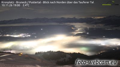
Webcam in diretta




Impianti aperti: 0/32
Bollettino neve
- Ultime 24h (1624 m): 0 cm
- Ultime 72h (1624 m): 5 cm
- Ultimi 7 giorni: Cima (2275 m) 7cm · Mezza montagna (1624 m) 5cm · Valle (973 m) 0cm
- Totale stagionale (1624 m): 0 cm
Comprensori sciistici aperti ora · Bollettino neve
About Percha / Perca
A practical South Tyrolean gateway offering seamless train-to-gondola access for those who prioritize efficiency over resort glitz.
Highlights
- Direct rail connections
- Kronplatz access
- Ladin culture
- Low-key atmosphere
Key Facts
- Altitude: 973m
- Top lift: 2275m
- Ski pistes: 91.2km
- Ski lifts: 31
- Population: 1,728
- Lakes nearby: 8
- MTB trails: 134.7km
- Mountain huts: 3
Ski Area
Incluso in questi abbonamenti stagionali
Weather and 10-day forecast for Percha / Perca
- Today: -2 to 0 °C, snow, 0 h of sunshine
- Freezing level today: about 1613 m (1500 to 1910 m)
- Snowfall in the last 7 days: 6 cm
| Day | Min / max | Sky | Precipitation | Sunshine |
|---|---|---|---|---|
| dom 22 nov | -2 / 0 °C | snow | dry | 0 h sun |
| lun 23 nov | -5 / 1 °C | partly cloudy | dry | 5 h sun |
| mar 24 nov | -6 / 0 °C | clear sky | dry | 7 h sun |
| mer 25 nov | -4 / -1 °C | snow | dry | 0 h sun |
| gio 26 nov | -7 / 0 °C | snow | dry | 1 h sun |
| ven 27 nov | -10 / -2 °C | partly cloudy | dry | 6 h sun |
| sab 28 nov | -7 / 0 °C | clear sky | dry | 8 h sun |
| dom 29 nov | -7 / 2 °C | overcast | dry | 1 h sun |
| lun 30 nov | -7 / 3 °C | partly cloudy | dry | 3 h sun |
| mar 1 dic | -7 / 0 °C | snow | dry | 0 h sun |
Things to do in Percha / Perca
Hikes nearby - Percha / Perca (20)
20+ curated hiking trails around Percha / Perca, sourced from OpenStreetMap and enriched with distance, elevation gain and difficulty.
-
Über die Pragser Hochalm2
-
Wanderroute 22
-
Naturlehrpfad
-
Panoramaweg
The Panoramaweg leads from the parish church of Niederolang through the quiet, shaded forest of the Riedwald, past the historic Schloss Lamprechtsburg, before descending into Bruneck along the Pustertal. Trail marker 15 threads through the Riedlerhöfe farmsteads before joining trail 14 for the final stretch into town.
-
Pyramidenweg
-
Rundweg Reischach
The trail sets out from the Tschurtschenthaler Park near the Ursuline Church in Bruneck's centre, crossing beneath the road before following trail no. 20 through forest to a Soldiers' Cemetery, then continuing partly through woodland and partly along open pathfields to reach Reischach/Riscone.
-
Kehlburgweg
-
Sagenweg - Sentiero delle leggende
-
Dorfrundweg Rasen
-
Archäologischer Panoramaweg - Sentiero panoramico archeologico
-
Panoramaweg
-
Koflsteig
-
Panoramasteig
-
Rundweg Klosterwald
-
Kirchweg
-
Steine erzählen
Il sentiero si snoda attraverso prati aperti e terreni agricoli, una foresta ombreggiata, e passa davanti a pannelli informativi sulla pietra e la geologia, con panchine posizionate lungo il percorso per riposarsi. Dal sentiero, il panorama si estende sulle Dolomiti e scende nella valle della Pustertal.
-
1 - Al Plan de Mareo => Kronplatz
-
11 - Ehrenburg
-
Almsteig
-
Biotopweg - Via del Biotopo
Mountain bike vicino a Percha / Perca
- Andreas Trail
- Hans
- Korer Trail
- Alex Trail
- Uschi-Trail
Getting to Percha / Perca
Door-to-door travel times as used by the MR. ALPS ranking.
- Nearest airport: Innsbruck Airport (INN), 71 km away, about 1h47 by road
- Bolzano - Bozen: 1h10 by car, 77 km
- Innsbruck: 1h38 by car, 110 km
- Trento: 1h40 by car, 133 km
- Verona: 2h38 by car, 228 km
- Padova: 3h04 by car, 235 km
- Brescia: 3h09 by car, 264 km
Where to stay in Percha / Perca
411 places to stay for a night on 2026-11-27, from 88 EUR per night, median 237 EUR. Prices are direct with hotels and destinations, compared live on the Percha / Perca page.