Avers
Webcam in diretta

Bollettino neve
- Ultime 24h (2264 m): 1 cm
- Ultime 72h (2264 m): 8 cm
- Ultimi 7 giorni: Cima (2539 m) 14cm · Mezza montagna (2264 m) 11cm · Valle (1988 m) 9cm
- Totale stagionale (2264 m): 67 cm
Comprensori sciistici aperti ora · Bollettino neve
About Avers
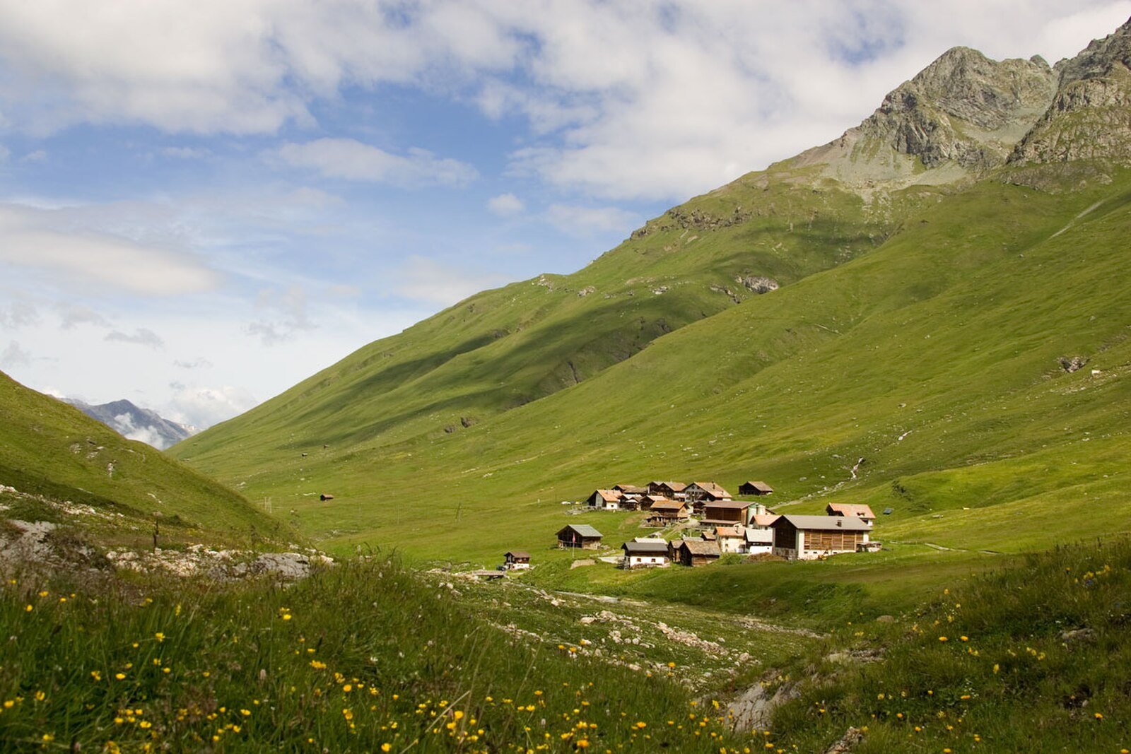
A starkly beautiful high-altitude escape where Walser heritage meets a quiet, end-of-the-road solitude away from the masses.
Highlights
- Walser timber houses
- High-alpine serenity
- Endless ski touring
- Remote mountain stillness
Key Facts
- Altitude: 1988m
- Top lift: 2539m
- Ski pistes: 8.4km
- Ski lifts: 3
- Population: 31
- Lakes nearby: 29
- MTB trails: 76.2km
- Mountain huts: 7
Ski Area
Incluso in questi abbonamenti stagionali
Weather and 9-day forecast for Avers
- Today: -7 to -1 °C, snow, 0 h of sunshine
- Freezing level today: about 2020 m
- Snowfall in the last 7 days: 9 cm
| Day | Min / max | Sky | Precipitation | Sunshine |
|---|---|---|---|---|
| dom 22 nov | -7 / -1 °C | snow | dry | 0 h sun |
| lun 23 nov | -10 / -3 °C | overcast | dry | 1 h sun |
| mar 24 nov | -10 / -4 °C | partly cloudy | dry | 4 h sun |
| mer 25 nov | -6 / -2 °C | snow | dry | 4 h sun |
| gio 26 nov | -11 / -4 °C | snow | dry | 0 h sun |
| ven 27 nov | -14 / -7 °C | snow | dry | 1 h sun |
| sab 28 nov | -10 / -4 °C | clear sky | dry | 9 h sun |
| dom 29 nov | -10 / 0 °C | partly cloudy | dry | 3 h sun |
| lun 30 nov | -8 / -1 °C | partly cloudy | dry | 3 h sun |
Things to do in Avers
Hikes nearby - Avers (20)
20+ curated hiking trails around Avers, sourced from OpenStreetMap and enriched with distance, elevation gain and difficulty.
-
Radons - Val Faller - Tga
-
Sur-Alp Flix-Sur
-
Bivio Rundtour
-
Walserweg - Etappe 10
-
Walserweg - Etappe 9
-
Alte Averserstrasse
Il percorso si snoda attraverso la selvaggia Gola di Rofla lungo la vecchia strada di Avers, seguendo il fiume Ragn oltre formazioni rocciose e storici ponti ad arco in pietra. Oltre Innerferrera, il sentiero sale sopra imponenti muri di sostegno e un ben conservato ponte del Reno, attraversando un terreno aperto, in parte roccioso, con poca protezione dal sole.
-
Senda Leg Columban
From Bivio — the only Italian-speaking village north of the Alpine watershed, threaded with trails dating to Roman times — this circular route climbs past the Leg Columban mountain lake to the high point of "Uf da Flüe," where the Averstal valley and Juf, the highest permanently inhabited settlement in Europe, spread out below. The descent follows the "Steinmännliweg" past a scatter of smaller lakes via Stallerberg back to the start.
-
Gletscherhorn - 3107 m
-
Juf - Pass da Sett
-
Stallerberg - Bivio
-
02-Alpenpässe-Weg
-
Senda Segantini - Etappe 2
Da Bivio, il sentiero sale costantemente lungo un'antica via commerciale romana, formando la seconda tappa del sentiero di lunga percorrenza Senda Segantini attraverso il Parc Ela, terminando a Maloja.
-
ViaSett
-
ViaSett
-
ViaSett
Il sentiero sale attraverso la regione di Lenzerheide passando davanti al castello di Riom — sede del teatro musicale romano «Origen» — prima di scendere verso Savognin, con i fiumi Albula e Gelgia che segnano il punto di partenza storico a Tiefencastel, un villaggio che si trova all'incrocio delle vie alpine nord-sud ed est-ovest dall'antichità.
-
Senda Segantini - Etappe 1
-
Pass da Sett-Maroz Dora
-
Maroz Dora-Casaccia
-
Walserweg: Juf - Tigias (Alp Flix)
-
Senda Segantini: Bivio - Maloja Posta
Mountain bike vicino a Avers
- Alpine Bike - Etappe 4
- Alp Flix Bike
Getting to Avers
Door-to-door travel times as used by the MR. ALPS ranking.
- Nearest airport: Milan Malpensa International Airport (MXP), 112 km away, about 2h51 by road
- Zürich: 2h28 by car, 182 km
- Luzern: 2h47 by car, 205 km
- Milano: 2h55 by car, 204 km
- Basel: 3h25 by car, 265 km
- Brescia: 3h47 by car, 290 km
- Innsbruck: 3h50 by car, 279 km
Where to stay in Avers
23 places to stay for a night on 2026-11-27, from 215 EUR per night, median 216 EUR. Prices are direct with hotels and destinations, compared live on the Avers page.