Andermatt
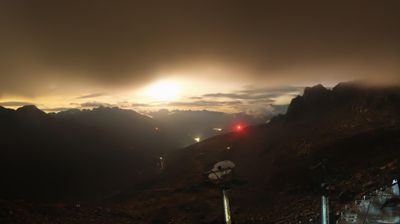
Webcam en directo

Remontes abiertos: 18%
Parte de nieve
- Últimas 24h: 0 cm
- Últimas 72h: 0 cm
- Últimos 7 días: 0 cm
- Últimos 7 días: Valle 0cm · Media montaña 0cm · Cumbre 0cm
- Acumulado de temporada: 17.5 cm
Estaciones de esquí abiertas ahora · Parte de nieve
About Andermatt
A rugged mountain crossroads transformed into a sleek enclave for those who value minimalist luxury over flashy resort scenes.
Highlights
- Modernist architecture
- Deep powder bowls
- High-end hospitality
- Year-round connectivity
Key Facts
- Altitude: 1443m
- Top lift: 2961m
- Ski pistes: 161km
- Ski lifts: 29
- Population: 1,578
- Lakes nearby: 31
- MTB trails: 188.8km
- Mountain huts: 18
Ski Area
Incluido en estos pases de temporada
Weather and 10-day forecast for Andermatt
- Today: 7 to 16 °C, partly cloudy, 6 h of sunshine
- Freezing level today: about 3693 m (3370 to 3970 m)
| Day | Min / max | Sky | Precipitation | Sunshine |
|---|---|---|---|---|
| jue, 24 sept | 7 / 16 °C | partly cloudy | dry | 6 h sun |
| vie, 25 sept | 5 / 16 °C | mainly clear | dry | 6 h sun |
| sáb, 26 sept | 8 / 21 °C | clear sky | dry | 11 h sun |
| dom, 27 sept | 8 / 21 °C | clear sky | dry | 12 h sun |
| lun, 28 sept | 9 / 23 °C | clear sky | dry | 12 h sun |
| mar, 29 sept | 13 / 23 °C | clear sky | dry | 12 h sun |
| mié, 30 sept | 14 / 23 °C | partly cloudy | dry | 8 h sun |
| jue, 1 oct | 9 / 20 °C | drizzle | 1 mm rain | 12 h sun |
| vie, 2 oct | 8 / 13 °C | drizzle | 4 mm rain | 4 h sun |
| sáb, 3 oct | 7 / 16 °C | overcast | dry | 11 h sun |
Things to do in Andermatt
Hikes nearby — Andermatt (20)
20+ curated hiking trails around Andermatt, sourced from OpenStreetMap and enriched with distance, elevation gain and difficulty.
-
Furka-Höhenweg
El Furka-Höhenweg recorre las pedregosas laderas sureste sobre el valle de Urseren, con vistas hacia Realp y Hospental, la carretera del paso y el histórico ferrocarril de vapor Furka que serpentea por el valle. En el camino, pequeños lagos alpinos, arroyos de montaña, escarpados acantilados y campanillas —incluida la campanilla amarilla (*Campanula thy…*)— salpican un terreno que pasa a la vista del Glaciar del Ródano y el Belle Époque Hotel Belvédère, hecho famoso por la película de Bond *Goldfinger*.
-
Ursener Höhenweg
-
Trans Swiss Trail
This stage of the Trans Swiss Trail follows the paving of an old mule track to the Gotthard Pass — a route that muleteers have used since the 13th century — passing the striking ventilation plant of the Gotthard road tunnel and a vast variety of colourful Alpine flora. At the pass head, a museum dedicated to the post-coach era marks the end of one of the most historically important Alpine crossings in Switzerland.
-
ViaGottardo
-
Trans Swiss Trail
La ruta sigue el empedrado de un antiguo camino de mulas hasta el paso del Gotthard, un cruce utilizado por los arrieros para transportar mercancías desde el siglo XIII. A lo largo del camino, la llamativa planta de ventilación del túnel de carretera del Gotthard se eleva como un pabellón de música, y la cabecera del paso alberga un museo dedicado a la era del coche de postas.
-
ViaGottardo
-
ViaSuworow
-
Walserweg Gottardo - Etappe 10
The route descends from the Gotthard Pass — a historic crossroads of northern and southern Europe — along the old cobbled pass road past dammed lakes, wind turbines, and high-voltage lines before dropping through Hospental and following the Reuss river alongside the expansive golf course of the Swiss Alps Resort into Andermatt. Along the way, the National Gotthard Museum and the historic hospice mark the storied pass summit.
-
Walserweg Gottardo - Etappe 11
-
ViaSuworow
-
Andermatt-Rüssenbiel
-
Blumen- und Lawinenlehrpfad Chilchenberg
-
Golfrundweg
-
Andermatt-Göschenen
-
Kräuterlehrpfad Mur
-
Andermatt - Vermigel
-
Schöni - Pazolalücke
-
Kräuterlehrpfad Hospental-Realp
-
Ospizio San Gottardo-Hospental
El sendero sigue el río Gotthardreuss a través de una alta meseta alpina donde rocas cubiertas de líquenes yacen dispersas entre prados verdes, pasando por el histórico pueblo de paso de Hospental antes de ascender al Ospizio San Gottardo, donde las turbinas eólicas marcan la cumbre. A lo largo del camino, los antiguos Säumerpfade (caminos de los arrieros) discurren alejados del tráfico, y la histórica diligencia postal sigue recorriendo la carretera del paso cerca de Mätteli.
-
Walserweg Gottardo: Andermatt - Oberalppass
Mountain biking near Andermatt
- Unteralpstrasse
- Ursener Höhenweg
- Rundweg Andermatt-Rohr-Mur
Getting to Andermatt
Door-to-door travel times as used by the MR. ALPS ranking.
- Nearest airport: Zürich Airport (ZRH), 92 km away, about 1h59 by road
- Luzern: 1h01 by car, 73 km
- Zürich: 1h30 by car, 110 km
- Basel: 2h04 by car, 167 km
- Biel/Bienne: 2h14 by car, 180 km
- Bern: 2h15 by car, 181 km
- Milano: 2h21 by car, 184 km
Where to stay in Andermatt
59 places to stay for a night on 2026-09-25, from 275 EUR per night, median 1042 EUR. Prices are direct with hotels and destinations, compared live on the Andermatt page.