Andermatt
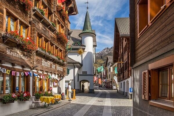
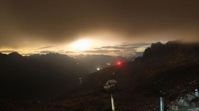
Živá webkamera

Otevřené vleky: 18%
Sněhová zpráva
- Posledních 24h: 0 cm
- Posledních 72h: 0 cm
- Posledních 7 dní: 0 cm
- Posledních 7 dní: Údolí 0cm · Střední část 0cm · Vrchol 0cm
- Sezónní úhrn: 17.5 cm
Lyžařská střediska otevřená právě teď · Sněhová zpráva
About Andermatt
A rugged mountain crossroads transformed into a sleek enclave for those who value minimalist luxury over flashy resort scenes.
Highlights
- Modernist architecture
- Deep powder bowls
- High-end hospitality
- Year-round connectivity
Key Facts
- Altitude: 1443m
- Top lift: 2961m
- Ski pistes: 161km
- Ski lifts: 29
- Population: 1,578
- Lakes nearby: 31
- MTB trails: 188.8km
- Mountain huts: 18
Ski Area
Zahrnuto v těchto sezonních permanentkách
Weather and 10-day forecast for Andermatt
- Today: 7 to 17 °C, clear sky, 8 h of sunshine
- Freezing level today: about 3702 m (3410 to 3970 m)
| Day | Min / max | Sky | Precipitation | Sunshine |
|---|---|---|---|---|
| čt 24. 9. | 7 / 17 °C | clear sky | dry | 8 h sun |
| pá 25. 9. | 5 / 16 °C | clear sky | dry | 7 h sun |
| so 26. 9. | 9 / 21 °C | clear sky | dry | 11 h sun |
| ne 27. 9. | 8 / 21 °C | clear sky | dry | 12 h sun |
| po 28. 9. | 9 / 23 °C | clear sky | dry | 12 h sun |
| út 29. 9. | 13 / 23 °C | clear sky | dry | 12 h sun |
| st 30. 9. | 14 / 23 °C | partly cloudy | dry | 8 h sun |
| čt 1. 10. | 10 / 20 °C | overcast | dry | 12 h sun |
| pá 2. 10. | 10 / 11 °C | drizzle | 6 mm rain | 0 h sun |
| so 3. 10. | 6 / 14 °C | overcast | dry | 10 h sun |
Things to do in Andermatt
Hikes nearby — Andermatt (20)
20+ curated hiking trails around Andermatt, sourced from OpenStreetMap and enriched with distance, elevation gain and difficulty.
-
Furka-Höhenweg
Furka-Höhenweg sleduje kamenité jihovýchodní svahy nad údolím Urseren s výhledy dolů na Realp a Hospental, silnici přes průsmyk a historickou parní železnici Furka vinoucí se údolím níže. Cestou drobná alpská jezírka, horské potoky, zubaté útesy a zvonky — včetně žlutého zvonku (*Campanula thy…*) — oživují terén, který prochází v dohledu Rhonského ledovce a Belle Époque Hotel Belvédère, proslaveného bondovským filmem *Goldfinger*.
-
Ursener Höhenweg
-
Trans Swiss Trail
This stage of the Trans Swiss Trail follows the paving of an old mule track to the Gotthard Pass — a route that muleteers have used since the 13th century — passing the striking ventilation plant of the Gotthard road tunnel and a vast variety of colourful Alpine flora. At the pass head, a museum dedicated to the post-coach era marks the end of one of the most historically important Alpine crossings in Switzerland.
-
ViaGottardo
-
Trans Swiss Trail
Trasa sleduje dlažbu staré mulí stezky vedoucí na průsmyk Gotthard, přechod, který muleteři využívali k přepravě zboží již od 13. století. Cestou se nápadná větrací stanice silničního tunelu Gotthard tyčí jako hudební pavilon a na hlavě průsmyku se nachází muzeum věnované éře poštovního dostavníku.
-
ViaGottardo
-
ViaSuworow
-
Walserweg Gottardo - Etappe 10
The route descends from the Gotthard Pass — a historic crossroads of northern and southern Europe — along the old cobbled pass road past dammed lakes, wind turbines, and high-voltage lines before dropping through Hospental and following the Reuss river alongside the expansive golf course of the Swiss Alps Resort into Andermatt. Along the way, the National Gotthard Museum and the historic hospice mark the storied pass summit.
-
Walserweg Gottardo - Etappe 11
-
ViaSuworow
-
Andermatt-Rüssenbiel
-
Blumen- und Lawinenlehrpfad Chilchenberg
-
Golfrundweg
-
Andermatt-Göschenen
-
Kräuterlehrpfad Mur
-
Andermatt - Vermigel
-
Schöni - Pazolalücke
-
Kräuterlehrpfad Hospental-Realp
-
Ospizio San Gottardo-Hospental
Stezka sleduje řeku Gotthardreuss přes vysokohorskou náhorní plošinu, kde balvany pokryté lišejníky leží roztroušeny po zelených loukách, prochází historickou průsmykovou vesnicí Hospental a poté stoupá k Ospizio San Gottardo, kde větrné turbíny označují vrchol. Cestou vedou staré Säumerpfade (cesty soumarů) stranou od provozu a historický poštovní dostavník stále jezdí po průsmykové silnici poblíž Mätteli.
-
Walserweg Gottardo: Andermatt - Oberalppass
Mountain biking near Andermatt
- Unteralpstrasse
- Ursener Höhenweg
- Rundweg Andermatt-Rohr-Mur
Getting to Andermatt
Door-to-door travel times as used by the MR. ALPS ranking.
- Nearest airport: Zürich Airport (ZRH), 92 km away, about 1h59 by road
- Luzern: 1h01 by car, 73 km
- Zürich: 1h30 by car, 110 km
- Basel: 2h04 by car, 167 km
- Biel/Bienne: 2h14 by car, 180 km
- Bern: 2h15 by car, 181 km
- Milano: 2h21 by car, 184 km
Where to stay in Andermatt
59 places to stay for a night on 2026-09-25, from 275 EUR per night, median 1042 EUR. Prices are direct with hotels and destinations, compared live on the Andermatt page.