La Forclaz
Alps › Swiss Prealps › Vaud and Freiburger Prealps
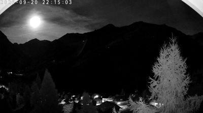
Live webcam


Lifts open: 0/13
Snow report
- Last 24h (2302 m): 8 cm
- Last 72h (2302 m): 39 cm
- Last 7 days: Top (2877 m) 67cm · Mid-mountain (2302 m) 68cm · Valley (1726 m) 42cm
- Season total (2302 m): 4 cm
Ski resorts open now · Snow report
About La Forclaz
A quiet, traditional mountain outpost favored by ski tourers and hikers seeking the raw, unpolished soul of the Valais Alps.
Highlights
- Backcountry access
- Rustic stone architecture
- Quiet mountain trails
- Authentic Swiss character
Key Facts
- Altitude: 1726m
- Top lift: 2877m
- Ski pistes: 45km
- Ski lifts: 13
- Population: 225
- Lakes nearby: 13
- MTB trails: 53.8km
- Mountain huts: 19
Ski Area
Included in these season passes
Weather and 10-day forecast for La Forclaz
- Today: -4 to -1 °C, snow showers, 0 h of sunshine
- Freezing level today: about 2209 m (1960 to 2740 m)
- Snowfall in the last 7 days: 85 cm
| Day | Min / max | Sky | Precipitation | Sunshine |
|---|---|---|---|---|
| Sun, Nov 22 | -4 / -1 °C | snow showers | dry | 0 h sun |
| Mon, Nov 23 | -6 / -4 °C | snow showers | dry | 3 h sun |
| Tue, Nov 24 | -7 / -1 °C | overcast | dry | 1 h sun |
| Wed, Nov 25 | -6 / -2 °C | snow | dry | 0 h sun |
| Thu, Nov 26 | -8 / -5 °C | snow | dry | 3 h sun |
| Fri, Nov 27 | -11 / -8 °C | partly cloudy | dry | 5 h sun |
| Sat, Nov 28 | -8 / -3 °C | clear sky | dry | 9 h sun |
| Sun, Nov 29 | -7 / 1 °C | overcast | dry | 1 h sun |
| Mon, Nov 30 | -7 / 2 °C | overcast | dry | 1 h sun |
| Tue, Dec 1 | -7 / 1 °C | snow showers | dry | 5 h sun |
Things to do in La Forclaz
Hikes nearby - La Forclaz (20)
20+ curated hiking trails around La Forclaz, sourced from OpenStreetMap and enriched with distance, elevation gain and difficulty.
-
27-Chemin des cols alpins
-
26-Chemin des cols alpins
-
04-Tour pédestre du Val d'Hérens
-
01-Tour pédestre du Val d'Hérens
From alpine pastures and a 13,000-year-old raised bog — the Gouilles d'Essertze, where information panels describe local fauna — the route builds toward the Grande Dixence dam: at 285 metres high and 15 million tonnes, the world's tallest gravity dam, holding 400 billion litres of water in Switzerland's largest reservoir. The entire stage unfolds above 2,000 m, with views across the Val d'Hérémence to glacier-covered peaks of the Valais Alps.
-
02-Tour pédestre du Val d'Hérens
From the crest of the Grande Dixence — the world's highest gravity dam — the route traces the western shore of Switzerland's longest reservoir, where snow-covered peaks and glaciers crowd the skyline. A steep climb then delivers you to the Col de Riedmatten, the legendary pass of the Patrouille des Glaciers ski mountaineering race, before a long descent into Arolla.
-
03-Tour pédestre du Val d'Hérens
-
25-Chemin des cols alpins
From Grimentz — a sun-darkened village of historic wooden houses whose car-free lanes are strung with geraniums — the trail climbs relentlessly in zigzags to Bendolla, then skirts a chairlift to Les Crêts, passes the Lac de Lona, crosses the Col de Lona, and finally reaches the highest mountain hut on the entire route.
-
Villa - Cotter
-
Tour du Cervin
A grand circuit around the Matterhorn linking six valleys and three cultures — German-speaking Upper Valais, French-speaking Central Valais, and the Italian Aosta Valley — crossing passes above 3000 m and two glaciers, including the Theodul Glacier, while passing through places like Zinal, the Lac de Moiry, Arolla, and Breuil/Cervinia. Along the way, more than 25 peaks exceeding 4000 m come into view, alongside working alpine pastures with intact flora and fauna and traditional villages carrying centuries of layered history.
-
Cotter - Volvovron
-
24-Chemin des cols alpins
-
Volvovron - L'A Vieille
-
28-Chemin des cols alpins
-
Becs de Bosson - Le Louché Lac
-
Chemin des villages d’Evolène
-
L'Ar du Tsan - Le Louché Lac (B)
-
Alpenpässe-Weg: Evolène - Arolla
-
Grand Bisse de St-Jean
-
Alpenpässe-Weg: Arolla - Les Dix
-
Alpenpässe-Weg: Grimentz - Becs de Bosson
Mountain biking near La Forclaz
- Sentier de Vendes
- Route de Soreboix
- Chemin de Volovron
- Route de Chemeuille
- Chemin des Arpilles
Getting to La Forclaz
Door-to-door travel times as used by the MR. ALPS ranking.
- Nearest airport: Geneva International Airport (GVA), 75 km away, about 1h45 by road
Where to stay in La Forclaz
41 places to stay for a night on 2026-11-27, from 131 EUR per night, median 192 EUR. Prices are direct with hotels and destinations, compared live on the La Forclaz page.