Champoussin
Alps › Savoy Prealps › Chablais Massif
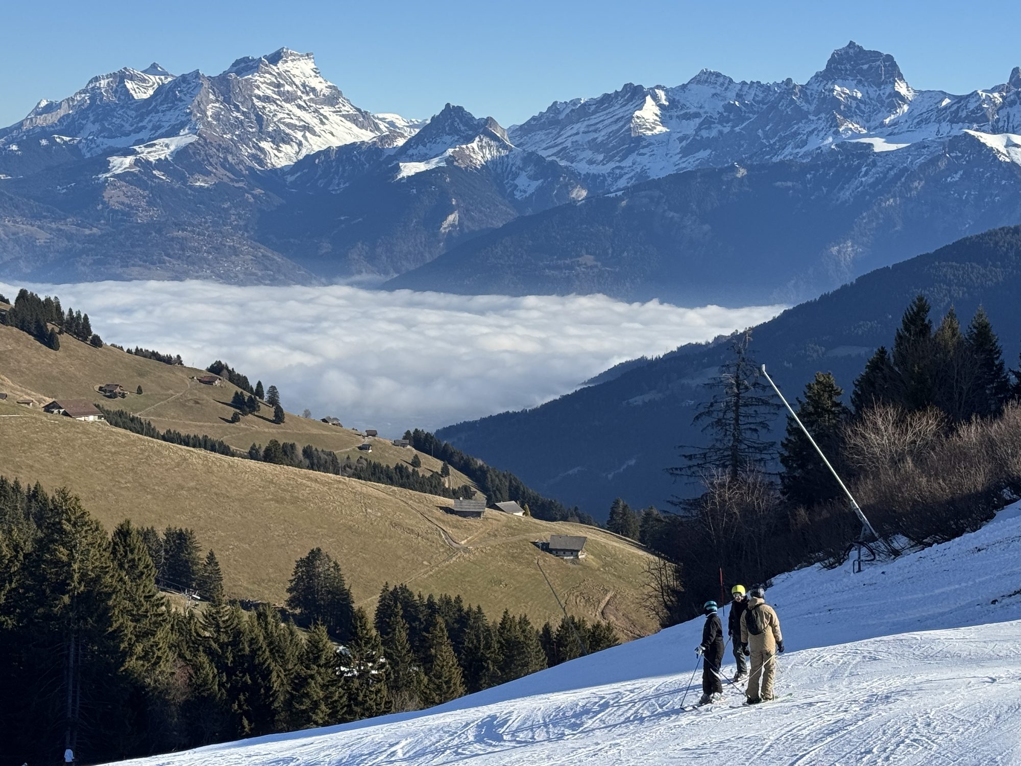
Live webcam


Lifts open: 0/163
Snow report
- Last 24h (1925 m): 11 cm
- Last 72h (1925 m): 28 cm
- Last 7 days: Top (2238 m) 39cm · Mid-mountain (1925 m) 37cm · Valley (1611 m) 23cm
- Season total (1925 m): 34 cm
Ski resorts open now · Snow report
About Champoussin
A rustic, balcony-style outpost where dark-timbered chalets offer a quiet, unpretentious gateway to the vast Portes du Soleil circuit.
Highlights
- Traditional wooden chalets
- Ski-in ski-out ease
- Low-key family vibe
- Cross-border trail access
Key Facts
- Altitude: 1611m
- Top lift: 2238m
- Ski pistes: 411km
- Ski lifts: 165
- Population: 6
- Lakes nearby: 16
- MTB trails: 62.2km
- Mountain huts: 16
Ski Area
Les Portes du Soleil – Morzine/Avoriaz/Les Gets/Châtel/Morgins/Champéry
Included in these season passes
Weather and 10-day forecast for Champoussin
- Today: 0 to 3 °C, snow showers, 0 h of sunshine
- Freezing level today: about 2045 m (1820 to 2820 m)
- Snowfall in the last 7 days: 111 cm
| Day | Min / max | Sky | Precipitation | Sunshine |
|---|---|---|---|---|
| Sun, Nov 22 | 0 / 3 °C | snow showers | 34 cm snow | 0 h sun |
| Mon, Nov 23 | -4 / 0 °C | snow showers | 25 cm snow | 0 h sun |
| Tue, Nov 24 | -5 / 3 °C | overcast | 0 cm snow | 1 h sun |
| Wed, Nov 25 | -2 / 1 °C | snow | 9 cm snow | 0 h sun |
| Thu, Nov 26 | -2 / 0 °C | snow showers | 4 cm snow | 1 h sun |
| Fri, Nov 27 | -7 / 0 °C | clear sky | dry | 7 h sun |
| Sat, Nov 28 | -2 / 5 °C | partly cloudy | dry | 4 h sun |
| Sun, Nov 29 | -8 / 2 °C | rain | 1 mm rain | 5 h sun |
| Mon, Nov 30 | -11 / 1 °C | overcast | dry | 9 h sun |
| Tue, Dec 1 | -11 / 2 °C | overcast | dry | 7 h sun |
Things to do in Champoussin
Hikes nearby - Champoussin (20)
20+ curated hiking trails around Champoussin, sourced from OpenStreetMap and enriched with distance, elevation gain and difficulty.
-
Les Crosets-Sur Cou
A winding descent through the Malatry Forest passes quaint alpine chalets typical of the Illiez Valley, crosses the Poijeur Bridge over the Chavalet River, and opens onto spectacular views of the Dents du Midi and Dents Blanches mountain ranges. The route ends at the alpine restaurant Cantine sur Coux, a welcome refuge in the snowy forest.
-
Sur Cou-Champery
A steep climb up grassy hillsides above Champéry leads to the Cantine Sur Cou restaurant, perched on a grassy outcropping with panoramic views of the Dents du Midi. The loop continues through Ayerne before descending back to the village via the Planachaux road.
-
40-Chemin des cols alpins
-
Tour des Dents du Midi
A multi-day loop around a 3-kilometre-long massif of seven summits all exceeding 3,000 metres — dominated by the Haute Cime at 3,257 m — the route threads through craggy passes, crystalline alpine lakes, glaciers, waterfalls, and forests while the jagged silhouette of the Dents du Midi looms overhead, visible from the Illiez and Rhone valleys alike. Inaugurated in 1972, this pioneer of Valais walking tours traces its roots to a mountain running race that shaped the path for nearly 40 years.
-
41-Chemin des cols alpins
-
Boucle des Mattes
-
Tour du Mont de Grange
-
Les Chalets du Mouet
-
Sentier des alpages de Vionnaz
-
Le Linleu par les quatre cols
-
Les Bords de Dranse
-
39-Chemin des cols alpins
-
Tour des Dents Blanches
-
Tour des Deux Rives
-
Tour de la Vallée du Trient
-
Alpenpässe-Weg: Barme - Morgins
-
Alpenpässe-Weg: Salanfe - Barme
-
Alpenpässe-Weg: Morgins - Torgon
-
Sentier de Salanfe
-
Itinéraire du Plateau de Vérossaz
Mountain biking near Champoussin
- Grand Conche MTB DH (Black)
- Downhill Crosets (MTB)
Getting to Champoussin
Door-to-door travel times as used by the MR. ALPS ranking.
- Nearest airport: Geneva International Airport (GVA), 58 km away, about 1h52 by road
- Lausanne: 1h08 by car, 67 km
- Bern: 1h44 by car, 124 km
- Genève: 1h47 by car, 130 km
- Biel/Bienne: 2h12 by car, 163 km
- Annecy: 2h20 by car, 171 km
- Chambéry: 2h45 by car, 215 km
Where to stay in Champoussin
345 places to stay for a night on 2026-11-27, from 122 EUR per night, median 201 EUR. Prices are direct with hotels and destinations, compared live on the Champoussin page.