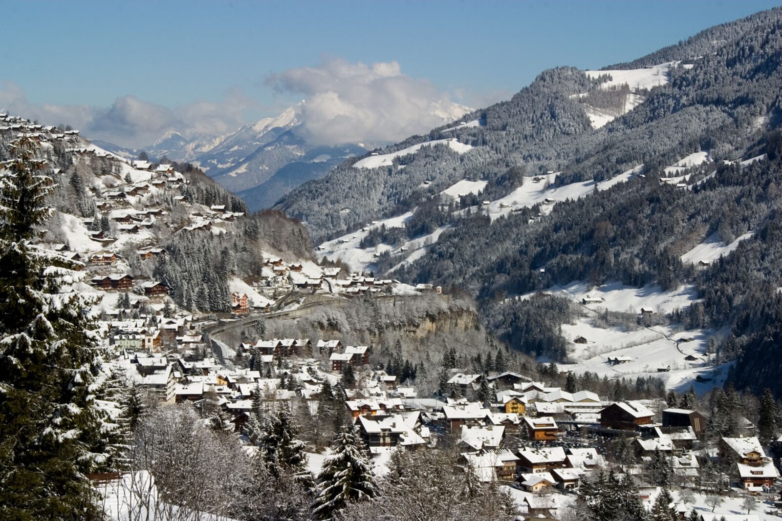
Champéry
Živá webkamera



Otevřené vleky: 0/163
Sněhová zpráva
- Posledních 24h: 0 cm
- Posledních 72h: 0 cm
- Posledních 7 dní: 0 cm
- Posledních 7 dní: Údolí 0cm · Střední část 0cm · Vrchol 0cm
- Sezónní úhrn: 1.4 cm
Lyžařská střediska otevřená právě teď · Sněhová zpráva
About Champéry
A rustic gateway to the Portes du Soleil, blending traditional Valaisan architecture with direct access to legendary technical terrain.
Highlights
- Savoyard farmhouse charm
- Steep mogul runs
- Cross-border skiing
- Authentic village life
Key Facts
- Altitude: 1050m
- Top lift: 2238m
- Ski pistes: 292km
- Ski lifts: 165
- Population: 1,404
- Lakes nearby: 16
- MTB trails: 62.2km
- Mountain huts: 20
Ski Area
Les Portes du Soleil – Morzine/Avoriaz/Les Gets/Châtel/Morgins/Champéry
Zahrnuto v těchto sezonních permanentkách
Weather and 10-day forecast for Champéry
- Today: 11 to 19 °C, partly cloudy, 4 h of sunshine
- Freezing level today: about 3927 m (3740 to 4140 m)
| Day | Min / max | Sky | Precipitation | Sunshine |
|---|---|---|---|---|
| čt 24. 9. | 11 / 19 °C | partly cloudy | dry | 4 h sun |
| pá 25. 9. | 10 / 19 °C | clear sky | dry | 9 h sun |
| so 26. 9. | 12 / 20 °C | clear sky | dry | 11 h sun |
| ne 27. 9. | 13 / 23 °C | clear sky | dry | 12 h sun |
| po 28. 9. | 14 / 23 °C | clear sky | dry | 12 h sun |
| út 29. 9. | 14 / 24 °C | partly cloudy | dry | 7 h sun |
| st 30. 9. | 14 / 22 °C | overcast | dry | 1 h sun |
| čt 1. 10. | 14 / 23 °C | overcast | dry | 11 h sun |
| pá 2. 10. | 9 / 15 °C | drizzle | 7 mm rain | 0 h sun |
| so 3. 10. | 5 / 17 °C | overcast | dry | 11 h sun |
Things to do in Champéry
Hikes nearby — Champéry (19)
19 curated hiking trails around Champéry, sourced from OpenStreetMap and enriched with distance, elevation gain and difficulty.
-
Les Crosets-Sur Cou
A winding descent through the Malatry Forest passes quaint alpine chalets typical of the Illiez Valley, crosses the Poijeur Bridge over the Chavalet River, and opens onto spectacular views of the Dents du Midi and Dents Blanches mountain ranges. The route ends at the alpine restaurant Cantine sur Coux, a welcome refuge in the snowy forest.
-
Sur Cou-Champery
A steep climb up grassy hillsides above Champéry leads to the Cantine Sur Cou restaurant, perched on a grassy outcropping with panoramic views of the Dents du Midi. The loop continues through Ayerne before descending back to the village via the Planachaux road.
-
40-Chemin des cols alpins
-
39-Chemin des cols alpins
-
Tour des Dents du Midi
Vícedenní okruh kolem 3 kilometry dlouhého masivu sedmi vrcholů přesahujících 3 000 metrů — s dominantní Haute Cime ve výšce 3 257 m — trasa prochází skalnatými průsmyky, křišťálově čistými alpskými jezery, ledovci, vodopády a lesy, zatímco zubaté obrysy Dents du Midi se tyčí nad hlavou, viditelné z údolí Illiez i údolí Rhôny. Tento průkopník pěších túr ve Valais, inaugurovaný v roce 1972, má své kořeny v horském běhu, který formoval trasu po téměř 40 let.
-
Tour des Dents Blanches
A Franco-Swiss border route managed by the International Association for Tour of the Dents Blanches, this challenging wilderness circuit swings between hospitable alpine pastures — such as those at Barme in Switzerland — and raw, technical terrain like the wild Ottants pass, where several sections cross into high-mountain hiking territory.
-
41-Chemin des cols alpins
-
Boucle des Mattes
-
Tour du Mont de Grange
-
38-Chemin des cols alpins
-
Tour de la Vallée du Trient
Pětidenní okruh procházející Švýcarskem i Francií vede divokými soutěskami Trento, Trège a Dailley podél nádrží Salanfe a Emosson — kde se u břehu vody dochovaly stopy dinosaurů — přičemž po celou dobu dominují obzoru ledovec Trient a masiv Mont Blanc.
-
Tour des Deux Rives
-
Itinéraire du Plateau de Vérossaz
-
Tour du Vallon de Van
-
Géoglyphe de Grande Tête
-
Alpenpässe-Weg: Barme - Morgins
-
Alpenpässe-Weg: Salanfe - Barme
-
Sentier de Salanfe
-
Alpenpässe-Weg: Emosson Barrage - Salanfe
Mountain biking near Champéry
- Grand Conche MTB DH (Black)
- Downhill Crosets (MTB)
- Coupe du Monde
Getting to Champéry
Door-to-door travel times as used by the MR. ALPS ranking.
- Nearest airport: Geneva International Airport (GVA), 59 km away, about 1h42 by road
- Lausanne: 55 min by car, 64 km
- Bern: 1h31 by car, 121 km
- Genève: 1h34 by car, 126 km
- Biel/Bienne: 1h59 by car, 160 km
- Annecy: 2h07 by car, 167 km
- Chambéry: 2h32 by car, 211 km
Where to stay in Champéry
200 places to stay for a night on 2026-09-25, from 125 EUR per night, median 237 EUR. Prices are direct with hotels and destinations, compared live on the Champéry page.