Weissenbach (Alpinwellt)
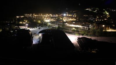
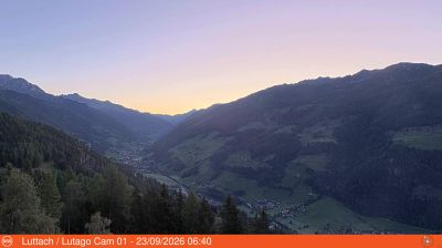
实时摄像头

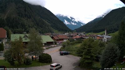
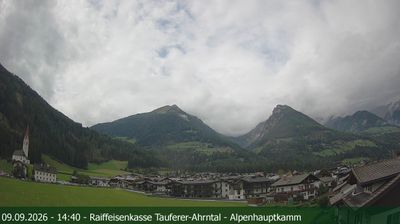
积雪报告
- 过去24小时: 0 厘米
- 过去72小时: 0 厘米
- 过去7天: 0 厘米
- 过去7天: 山谷 0.2厘米 · 山腰 0厘米 · 山顶 0.2厘米
- 本季累计: 0 厘米
About Weissenbach (Alpinwellt)
A secluded South Tyrolean retreat where deep-rooted folk traditions meet a silent, snow-sure valley far from the lift-line crowds.
Highlights
- Authentic Ahrntal culture
- Pristine winter hiking
- Traditional woodcarving heritage
- High-altitude culinary stops
Key Facts
- Altitude: 1329m
- Top lift: 1433m
- Ski pistes: 1km
- Ski lifts: 1
- Population: 1,256
- Lakes nearby: 12
- MTB trails: 34.8km
- Mountain huts: 11
Ski Area
Weather and 10-day forecast for Weissenbach (Alpinwellt)
- Today: 4 to 17 °C, clear sky, 11 h of sunshine
- Freezing level today: about 3368 m (2660 to 3630 m)
| Day | Min / max | Sky | Precipitation | Sunshine |
|---|---|---|---|---|
| 9月23日周三 | 4 / 17 °C | clear sky | dry | 11 h sun |
| 9月24日周四 | 5 / 18 °C | rain showers | dry | 2 h sun |
| 9月25日周五 | 5 / 15 °C | clear sky | dry | 11 h sun |
| 9月26日周六 | 8 / 20 °C | clear sky | dry | 12 h sun |
| 9月27日周日 | 8 / 20 °C | clear sky | dry | 12 h sun |
| 9月28日周一 | 10 / 22 °C | clear sky | dry | 11 h sun |
| 9月29日周二 | 11 / 21 °C | clear sky | dry | 11 h sun |
| 9月30日周三 | 11 / 19 °C | clear sky | dry | 8 h sun |
| 10月1日周四 | 7 / 16 °C | overcast | dry | 3 h sun |
| 10月2日周五 | 7 / 12 °C | rain showers | dry | 11 h sun |
Things to do in Weissenbach (Alpinwellt)
Hikes nearby — Weissenbach (Alpinwellt) (17)
17 curated hiking trails around Weissenbach (Alpinwellt), sourced from OpenStreetMap and enriched with distance, elevation gain and difficulty.
-
Stabeler Höhenweg
-
Via Alpina Red R33
Ahornach / Acereto - Chemnitzer Hütte / Rifugio G. Porro
-
Pieterstein
-
Chemnitzerhütte
-
Daimerweg
-
Panoramaweg Speikboden
-
Kellerbauerweg
-
Mühlwalder Almweg
-
Pieterstein
-
Lappacher Jöchl
From the village of Weißenbach at 1.350 m, trail Nr. 22 climbs steeply via the Stifteralm to the Lappacher Jöchl at 2.370 m, where it meets the Kellerbauerweg and traverses the rocky northeast flank beneath the Tristenspitz (2.716 m), passing the Tristensee before reaching the Chemnitzerhütte at 2.419 m on the Nevesjoch — all with panoramic views throughout.
-
Höhenweg
-
Pieterstein
-
Putzweg
-
Höfeweg
-
Gorner Joch
-
Pfunderer Höhenweg - Alta Via di Fundres
-
Durchs Toul
Getting to Weissenbach (Alpinwellt)
Door-to-door travel times as used by the MR. ALPS ranking.
- Nearest airport: Innsbruck Airport (INN), 53 km away, about 2h19 by road
- Bolzano - Bozen: 1h33 by car, 99 km
- Innsbruck: 2h02 by car, 131 km
- Trento: 2h04 by car, 155 km
- Verona: 3h02 by car, 250 km
- Padova: 3h33 by car, 262 km
- Brescia: 3h33 by car, 286 km
Where to stay in Weissenbach (Alpinwellt)
200 places to stay for a night on 2026-09-25, from 106 EUR per night, median 364 EUR. Prices are direct with hotels and destinations, compared live on the Weissenbach (Alpinwellt) page.