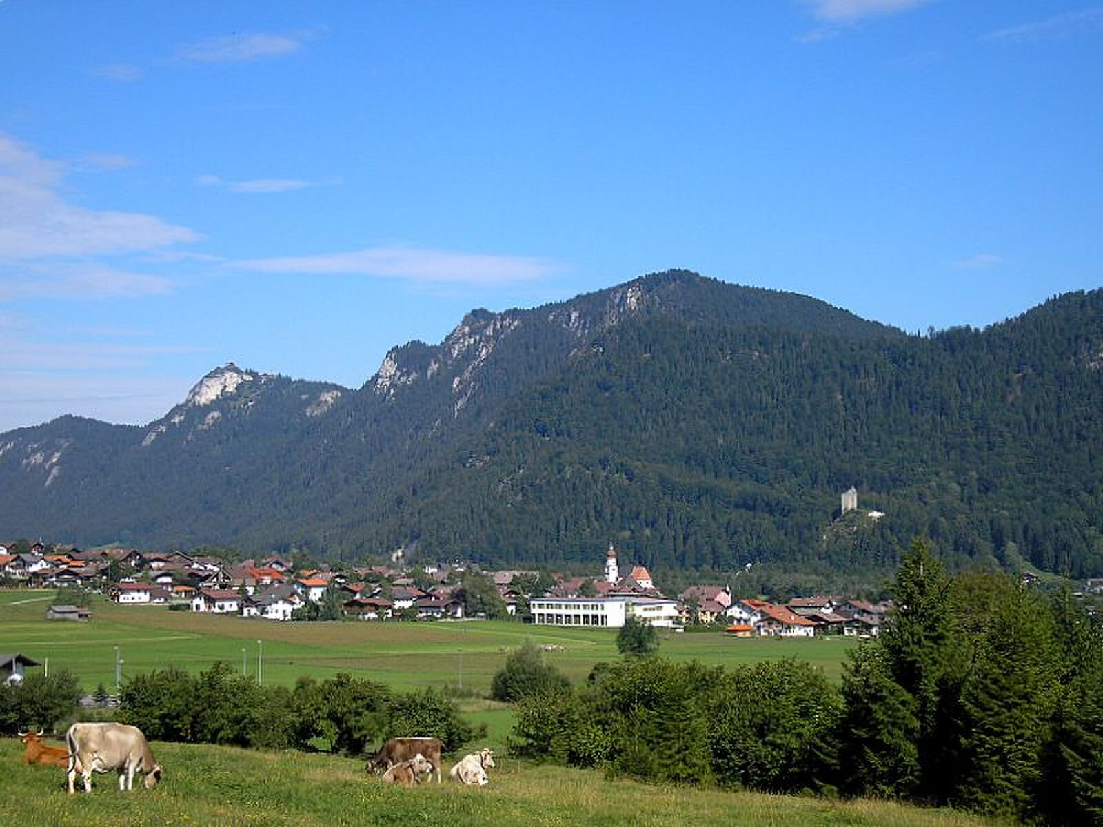
Vils
实时摄像头


开放缆车: 0%
积雪报告
- 过去24小时: 0 厘米
- 过去72小时: 0 厘米
- 过去7天: 0 厘米
- 过去7天: 山谷 0厘米 · 山腰 0厘米 · 山顶 0厘米
- 本季累计: 0 厘米
About Vils
A quiet border town where Tyrolean tradition meets Bavarian influence, defined by its medieval ruins and artisanal brewing heritage.
Highlights
- Medieval castle ruins
- Traditional craft breweries
- Cross-border hiking trails
- Quiet pastoral charm
Key Facts
- Altitude: 918m
- Top lift: 1102m
- Ski pistes: 1km
- Ski lifts: 1
- Population: 1,483
- Lakes nearby: 40
- MTB trails: 207.5km
- Mountain huts: 37
Ski Area
Weather and 10-day forecast for Vils
- Today: 6 to 17 °C, clear sky, 12 h of sunshine
- Freezing level today: about 3666 m (3320 to 3870 m)
| Day | Min / max | Sky | Precipitation | Sunshine |
|---|---|---|---|---|
| 9月23日周三 | 6 / 17 °C | clear sky | dry | 12 h sun |
| 9月24日周四 | 8 / 16 °C | overcast | dry | 1 h sun |
| 9月25日周五 | 7 / 16 °C | clear sky | dry | 10 h sun |
| 9月26日周六 | 9 / 21 °C | clear sky | dry | 12 h sun |
| 9月27日周日 | 12 / 22 °C | clear sky | dry | 12 h sun |
| 9月28日周一 | 14 / 24 °C | clear sky | dry | 12 h sun |
| 9月29日周二 | 15 / 23 °C | clear sky | dry | 12 h sun |
| 9月30日周三 | 14 / 23 °C | clear sky | dry | 11 h sun |
| 10月1日周四 | 12 / 19 °C | rain showers | dry | 1 h sun |
| 10月2日周五 | 8 / 11 °C | drizzle | dry | 0 h sun |
Things to do in Vils
Hikes nearby — Vils (18)
18 curated hiking trails around Vils, sourced from OpenStreetMap and enriched with distance, elevation gain and difficulty.
-
Lechweg
The Lechweg follows the Lech River from its source at Formarinsee lake through one of Europe's last wild river landscapes, passing Europe's largest ibex colony, swinging suspension bridges, and mysterious waterfalls framed by the Lechtal and Allgäu Alps. The route threads through river meadows and forests before arriving at views of the Bavarian royal castles of Neuschwanstein and Hohenschwangau near Füssen.
-
LechErlebnisWeg
-
Via Alpina Purple A63
Füssen - Pfronten
-
Via Alpina Purple A64
Pfronten - Tannheim
-
Via Alpina Purple A62
Kenzenhütte - Füssen
-
Jakobsweg Tirol - Allgäu
-
Alpsee-Rundweg
Rund um den Hopfensee
-
Hopfensee-Rundweg
Rund um den Hopfensee
-
Breitenbergbahn -Ostlerhütte - Fallmühle
-
Dürrenbergweg
-
Fallmühle-Schwarzwandweg
-
Drachenblick-Rundwanderweg
-
Schutzengelweg
-
Wanderwegenetz Gemeinde Rieden am Forggensee
Wanderwege (meist) ohne Nummerierung
-
Von Hütte zu Hütte rund um den Edelsberg
-
82
-
Naturpfad Ahornreitweg
这条小径沿着马克西米利安二世国王约于1850年规划的路线延伸,他曾骑马沿此路前往位于泰格尔贝格山的狩猎小屋。沿途关键节点设有信息牌,讲述这条小径所经山脉与森林的历史。
-
Bilderbuchwanderung am Forggensee
Mountain biking near Vils
- Naturbiken Füssen - Vilser Alm
- Reintalweg
- Schwarzenberg - Dreiländereck
- Vilser Alm
- Kratzer
- Lusweg
- Alatsee
Getting to Vils
Door-to-door travel times as used by the MR. ALPS ranking.
- Nearest airport: Memmingen Allgau Airport (FMM), 59 km away, about 1h06 by road
- Innsbruck: 1h38 by car, 110 km
- München: 1h55 by car, 138 km
- Stuttgart: 2h30 by car, 222 km
- Zürich: 3h02 by car, 232 km
- Bolzano - Bozen: 3h02 by car, 223 km
- Nürnberg: 3h14 by car, 307 km
Where to stay in Vils
200 places to stay for a night on 2026-09-25, from 266 EUR per night, median 318 EUR. Prices are direct with hotels and destinations, compared live on the Vils page.