Veysonnaz
实时摄像头




开放缆车: 0/68
积雪报告
- 过去24小时: 0 厘米
- 过去72小时: 0 厘米
- 过去7天: 0 厘米
- 过去7天: 山谷 0厘米 · 山腰 0厘米 · 山顶 0厘米
- 本季累计: 0.8 厘米
About Veysonnaz
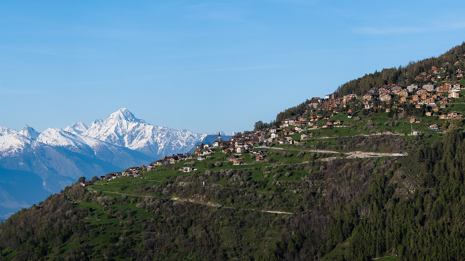
A quiet balcony over the Rhone Valley, known for its steep legendary descent and authentic Valaisan sun-baked timber chalets.
Highlights
- Steep Piste de l'Ours
- Sun-drenched terraces
- Family-run guesthouses
- Panoramic valley views
Key Facts
- Altitude: 1254m
- Top lift: 3308m
- Ski pistes: 225km
- Ski lifts: 67
- Population: 614
- Lakes nearby: 19
- MTB trails: 12.7km
- Mountain huts: 17
Ski Area
已包含在以下滑雪通票中
Weather and 10-day forecast for Veysonnaz
- Today: 7 to 14 °C, clear sky, 9 h of sunshine
- Freezing level today: about 4188 m (3910 to 4300 m)
| Day | Min / max | Sky | Precipitation | Sunshine |
|---|---|---|---|---|
| 9月20日周日 | 7 / 14 °C | clear sky | dry | 9 h sun |
| 9月21日周一 | 7 / 13 °C | overcast | dry | 2 h sun |
| 9月22日周二 | 6 / 14 °C | clear sky | dry | 12 h sun |
| 9月23日周三 | 8 / 15 °C | clear sky | dry | 12 h sun |
| 9月24日周四 | 7 / 15 °C | partly cloudy | dry | 8 h sun |
| 9月25日周五 | 9 / 15 °C | partly cloudy | dry | 7 h sun |
| 9月26日周六 | 8 / 15 °C | clear sky | dry | 12 h sun |
| 9月27日周日 | 9 / 15 °C | rain showers | dry | 2 h sun |
| 9月28日周一 | 4 / 19 °C | clear sky | dry | 12 h sun |
| 9月29日周二 | 5 / 17 °C | clear sky | dry | 12 h sun |
Things to do in Veysonnaz
Hikes nearby — Veysonnaz (20)
20+ curated hiking trails around Veysonnaz, sourced from OpenStreetMap and enriched with distance, elevation gain and difficulty.
-
Chemin Rhin-Reuss-Rhône
Étape 10 Sion - Saillon
-
02-Chemin du Vignoble
-
00-Tour pédestre du Val d'Hérens
The route descends from the Cabane des Becs de Bosson at 2985 m — renovated in 2012 and perched below the 3149 m summit with panoramic views of Valais 4000-metre peaks — through the wild and remote Vallon de Réchy. It finishes at Nax, known as the "Balcony of the Sky" for its elevated position.
-
01-Tour pédestre du Val d'Hérens
From alpine pastures and a 13,000-year-old raised bog — the Gouilles d'Essertze, where information panels describe local fauna — the route builds toward the Grande Dixence dam: at 285 metres high and 15 million tonnes, the world's tallest gravity dam, holding 400 billion litres of water in Switzerland's largest reservoir. The entire stage unfolds above 2,000 m, with views across the Val d'Hérémence to glacier-covered peaks of the Valais Alps.
-
03-Chemin des Bisses
-
02-Chemin des Bisses
-
Mayens-de-Sion ouest - Planchouet
markierter Wanderweg
-
06-Tour pédestre du Val d'Hérens
-
04-Chemin des Bisses
The fifth segment of the Chemin des Bisses runs from St-Martin to Nax, tracing the course of ancient irrigation canals through a landscape of mixed forests, spectacular mountain peaks, and the constant murmur of water channelled through centuries-old bisses. These ingenious waterways, built by Valais farmers to carry water to their fields, thread through a varied flora and carry with them a deep layer of regional history.
-
Chemin du Grand Bisse de Vex
A historic irrigation channel — the "bisse" — runs beside you through dense larch and spruce forest, its quiet broken only by sudden open views across the wide valley floor to the mountain world beyond. Tiny glades and secluded picnic spots punctuate the mostly wide path through this idyllic region above the valley.
-
Chemin des berges du Rhône
A level path tracing the Rhône's embankment from the Fendant wine terraces of Ardon, the route passes a small reflective lake and a man-made swimming lake before skirting Sion's airport and arriving in what the sources call the sunniest city in Switzerland.
-
Le Bleusy - Haute-Nendaz
-
Planchouet - Le Bleusy
This trail follows the course of a historic bisse — a centuries-old water channel that once carried glacial meltwater to rain-starved valleys — linking Planchouet to Le Bleusy via Haute-Nendaz's gondola station. The bisses, part of a network stretching 1,800 km across Valais at their peak, are maintained and refilled with water to this day.
-
Les Tsintres - Les Condémines
-
Plan-Conthey - Vétroz
-
Chemin des Bisses: 40 - Veysonnaz
-
Bisses de Lentine et de Mont d'Orge
-
Chemin des Bisses: Veysonnaz - Saint-Martin
-
Chemin du vignoble: Saillon Village - 5
-
Chemin d’Ossona
Mountain biking near Veysonnaz
- antenne
- DH sous cabine
- Chemin la Planie
- Bisse de Saxon
Getting to Veysonnaz
Door-to-door travel times as used by the MR. ALPS ranking.
- Nearest airport: Geneva International Airport (GVA), 95 km away, about 2h05 by road
- Lausanne: 1h24 by car, 107 km
- Bern: 2h01 by car, 164 km
- Genève: 2h03 by car, 169 km
- Biel/Bienne: 2h29 by car, 203 km
- Annecy: 2h34 by car, 175 km
- Chambéry: 2h59 by car, 219 km
Where to stay in Veysonnaz
200 places to stay for a night on 2026-09-25, from 122 EUR per night, median 182 EUR. Prices are direct with hotels and destinations, compared live on the Veysonnaz page.