Valgrisenche
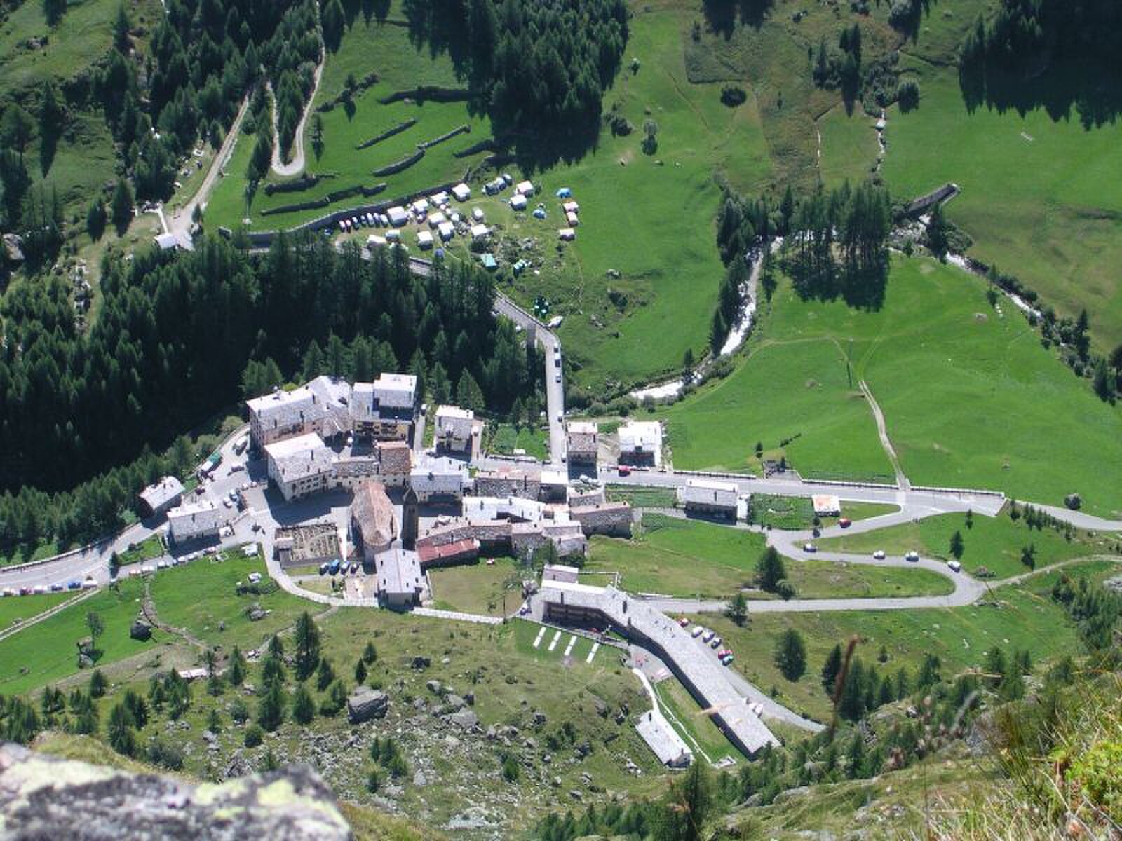
About Valgrisenche
A secluded Aosta Valley outpost where off-piste purists trade crowded lifts for deep powder and raw, silent wilderness.
Highlights
- Heli-skiing hub
- Untamed backcountry
- Traditional stone architecture
- Rugged solitude
Key Facts
- Altitude: 1675m
- Top lift: 2050m
- Ski pistes: 5km
- Ski lifts: 2
- Population: 191
- Lakes nearby: 28
- Mountain huts: 10
Ski Area
已包含在以下滑雪通票中
Weather and 10-day forecast for Valgrisenche
- Today: 8 to 20 °C, partly cloudy, 6 h of sunshine
- Freezing level today: about 4360 m (4120 to 4660 m)
| Day | Min / max | Sky | Precipitation | Sunshine |
|---|---|---|---|---|
| 9月21日周一 | 8 / 20 °C | partly cloudy | dry | 6 h sun |
| 9月22日周二 | 6 / 19 °C | clear sky | dry | 12 h sun |
| 9月23日周三 | 5 / 19 °C | clear sky | dry | 12 h sun |
| 9月24日周四 | 9 / 18 °C | clear sky | dry | 11 h sun |
| 9月25日周五 | 8 / 21 °C | clear sky | dry | 10 h sun |
| 9月26日周六 | 10 / 21 °C | clear sky | dry | 10 h sun |
| 9月27日周日 | 12 / 21 °C | clear sky | dry | 10 h sun |
| 9月28日周一 | 12 / 21 °C | clear sky | dry | 12 h sun |
| 9月29日周二 | 7 / 22 °C | partly cloudy | dry | 5 h sun |
| 9月30日周三 | 6 / 22 °C | clear sky | dry | 12 h sun |
Things to do in Valgrisenche
Hikes nearby — Valgrisenche (9)
9 curated hiking trails around Valgrisenche, sourced from OpenStreetMap and enriched with distance, elevation gain and difficulty.
-
Via Ferrata Bethaz Bovard
An aerial ascent of over 1000 metres of equipped terrain leads to the summit of Becca d'Aouille (2605 m), departing from the valley floor near the "magazzino delle fontine" in Valgrisenche. The route faces east and carries a warning: several sections reach D-level difficulty despite the closely placed footholds that ease much of the climb.
-
Via Alpina Red R119
Valgrisenche - Refuge de l'Archeboc
-
Via Alpina Red R118
Cérellaz - Valgrisenche
-
Alta Via n. 2 della Valle d'Aosta - Tappa 5
Tappa n. 5 - Planaval (Arvier) (1.554 mt.) - Rifugio Chalet de l'Epée (2.370 mt.)
-
Alta Via n. 2 della Valle d'Aosta - Tappa 6
Tappa n. 6 - Rifugio Chalet de l'Épée (2.370 mt.) - Rhêmes-Notre-Dame (1.722 mt.)
-
Alta Via n. 2 della Valle d'Aosta - Tappa 4
Tappa n. 4 - Rifugio Alberto Deffeyes (2.500 mt.) - Planaval (Arvier) (1.554 mt.)
-
Baulin - Alpage du Glacier
-
Leverogne - Grand Haury
-
Leverogne - Relais de la television - Saint-Nicolas
Mountain biking near Valgrisenche
- V.T.T. Route No. 9
Getting to Valgrisenche
Door-to-door travel times as used by the MR. ALPS ranking.
- Nearest airport: Turin Airport (TRN), 66 km away, about 1h53 by road
- Torino: 1h59 by car, 146 km
- Genève: 2h07 by car, 135 km
- Annecy: 2h17 by car, 147 km
- Chambéry: 2h41 by car, 191 km
- Milano: 2h42 by car, 214 km
- Lausanne: 2h49 by car, 173 km
Where to stay in Valgrisenche
55 places to stay for a night on 2026-09-25, from 133 EUR per night, median 152 EUR. Prices are direct with hotels and destinations, compared live on the Valgrisenche page.