Val Formazza
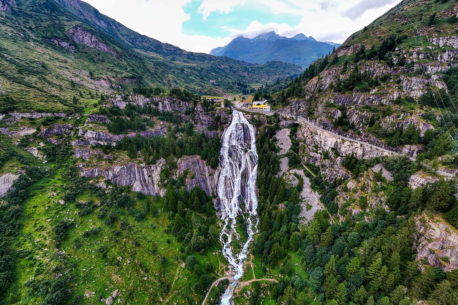
About Val Formazza
A secluded Walser enclave where ancient wooden architecture meets the thunderous power of the Toce Falls in a rugged, high-altitude valley.
Highlights
- Walser heritage
- Cascading waterfalls
- Nordic skiing trails
- Alpine cheese traditions
Key Facts
- Altitude: 1279m
- Top lift: 1772m
- Ski pistes: 3km
- Ski lifts: 3
- Population: 442
- Lakes nearby: 52
- Mountain huts: 24
Ski Area
Weather and 10-day forecast for Val Formazza
- Today: 8 to 17 °C, clear sky, 12 h of sunshine
- Freezing level today: about 4152 m (4040 to 4290 m)
| Day | Min / max | Sky | Precipitation | Sunshine |
|---|---|---|---|---|
| 9月22日周二 | 8 / 17 °C | clear sky | dry | 12 h sun |
| 9月23日周三 | 5 / 16 °C | clear sky | dry | 12 h sun |
| 9月24日周四 | 6 / 18 °C | clear sky | dry | 10 h sun |
| 9月25日周五 | 7 / 15 °C | clear sky | dry | 11 h sun |
| 9月26日周六 | 10 / 18 °C | clear sky | dry | 10 h sun |
| 9月27日周日 | 10 / 17 °C | partly cloudy | dry | 5 h sun |
| 9月28日周一 | 9 / 18 °C | clear sky | dry | 12 h sun |
| 9月29日周二 | 10 / 16 °C | drizzle | dry | 8 h sun |
| 9月30日周三 | 8 / 17 °C | drizzle | dry | 3 h sun |
| 10月1日周四 | 10 / 14 °C | drizzle | dry | 0 h sun |
Things to do in Val Formazza
Hikes nearby — Val Formazza (20)
20+ curated hiking trails around Val Formazza, sourced from OpenStreetMap and enriched with distance, elevation gain and difficulty.
-
Via Alpina Blue D1
-
14-Sentiero dei passi alpini
-
15-Chemin des cols alpins
-
G29 - San Michele - Alpe Matli
-
G16 - Valdo - Bta di Cazoli
-
G00d - Ponte - Sotto Frua
Variant for paths to the Via del Gries G00 which mainly uses the road. Much used by MTB (signs) pay attention.
-
G18 - Canza - Bta di Tamia
Up to Alpe Tamia suitable for mountain hikers, after Alpe Tamia for the difficulty of finding the route due to the lack of track and trail signs and for the exposure on the final bare rock, it is reserved for experts
-
G35 - Cascata del Toce - Lago Vannino
-
G00 - Via del Gries da Ponte a Riale (terza sezione)
Path in an alpine environment of Walser culture. Spectacular view of the Toce waterfall (which opens at times)
-
10 - Rifugio Maria Luisa - Piano delle Creste
-
G22 - Lago Castel - Bta di Tamia
Up to Lake Nero, suitable for mountain hikers, after Lake Nero the exposure and steepness of the trail reserve it for experts. There are long stretches of stone. However, the very frequent blue trail signs make it easier to find the trail (2024)
-
G99 - Canza - Scatta Minoia
-
11 Capanna Piano delle Creste - Capanna Grossalp
For long stretches, the trail between Piano delle Creste and Capanna Grossalp is little more than an imaginary line — marked by blue-and-white signs through rocky terrain and vast boulder fields where it is virtually impossible to leave footprints. You move through what feels like a forgotten landscape, remarkable for its variety of shades, shapes, and surfaces.
-
G98 - Fondovalle - Guriner Furggu
-
G98a - Bivio G98 - Hendar Furggu
-
G33 - Passo Busin - Monte Giove
The route climbs from the Lago del Vannino through the Passo del Busin, descending to the Lago del Busin before tackling Monte Giove's summit via cairns and red-and-white waymarks across loose scree and unstable terrain. A bivacco sits near the lower lake, and the final push to the 3009 m peak demands careful footing on crumbling, landslide-prone slopes.
-
G31 - Lago Vannino - Bocchetta della Valle
You go along the Vannino Lake then up to the beautiful prairies at the Busin Pass, a short hillside, danger of stones, with a wonderful view of Monte Giove and Lower Busin Lake, along the upper Busin Lake and with a short ascent the B.ta della Valle
-
Walserweg Gottardo: Ponte (I) - Bosco Gurin
-
Walserweg Gottardo: Rif. Margaroli CAI (I) - Ponte (I)
-
Walserweg Gottardo: Rif. Zum Gora - Rif. Margaroli CAI (I)
Mountain biking near Val Formazza
- Nuova Strada Anas 424 ex Strada Statale 659 di Valle Antigorio e Val Formazza
Getting to Val Formazza
Door-to-door travel times as used by the MR. ALPS ranking.
- Nearest airport: Milan Malpensa International Airport (MXP), 86 km away, about 2h09 by road
- Milano: 2h20 by car, 166 km
- Torino: 2h51 by car, 217 km
- Brescia: 3h12 by car, 252 km
- Genova: 3h25 by car, 281 km
- Lausanne: 3h33 by car, 241 km
- Luzern: 3h46 by car, 243 km
Where to stay in Val Formazza
17 places to stay for a night on 2026-09-25, from 244 EUR per night, median 258 EUR. Prices are direct with hotels and destinations, compared live on the Val Formazza page.