Saalbach
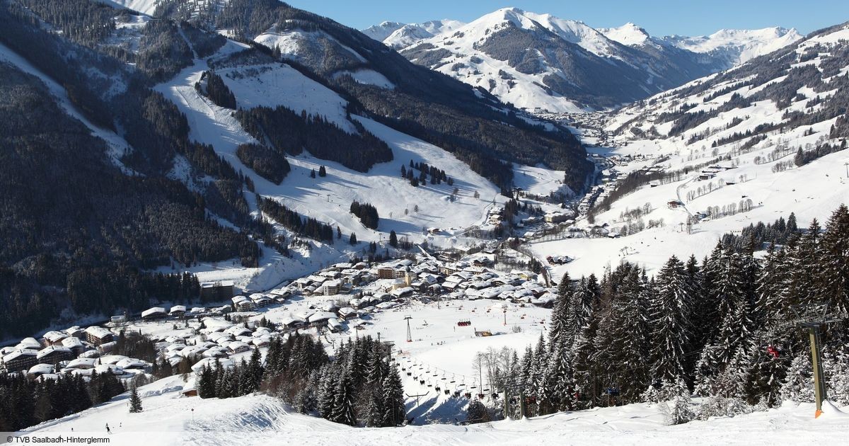
实时摄像头
开放缆车: 0/69
积雪报告
- 过去24小时: 0 厘米
- 过去72小时: 0 厘米
- 过去7天: 0 厘米
- 过去7天: 山谷 0厘米 · 山腰 0厘米 · 山顶 0厘米
- 本季累计: 0 厘米
About Saalbach
Austria’s high-energy playground where legendary table-top dancing meets a vast, interconnected circuit of sun-soaked slopes.
Highlights
- Raucous après-ski
- Infinite circuit skiing
- Vibrant village core
- Modern lift infrastructure
Key Facts
- Altitude: 1033m
- Top lift: 2096m
- Ski pistes: 270km
- Ski lifts: 70
- Population: 1,827
- Lakes nearby: 17
- MTB trails: 78.3km
- Mountain huts: 47
Ski Area
已包含在以下滑雪通票中
Weather and 10-day forecast for Saalbach
- Today: 8 to 16 °C, partly cloudy, 8 h of sunshine
- Freezing level today: about 3888 m (3120 to 4170 m)
| Day | Min / max | Sky | Precipitation | Sunshine |
|---|---|---|---|---|
| 9月20日周日 | 8 / 16 °C | partly cloudy | dry | 8 h sun |
| 9月21日周一 | 4 / 10 °C | overcast | dry | 1 h sun |
| 9月22日周二 | 3 / 8 °C | partly cloudy | dry | 6 h sun |
| 9月23日周三 | 3 / 13 °C | clear sky | dry | 13 h sun |
| 9月24日周四 | 7 / 12 °C | partly cloudy | dry | 9 h sun |
| 9月25日周五 | 6 / 17 °C | partly cloudy | dry | 5 h sun |
| 9月26日周六 | 7 / 19 °C | clear sky | dry | 8 h sun |
| 9月27日周日 | 9 / 20 °C | partly cloudy | dry | 4 h sun |
| 9月28日周一 | 7 / 20 °C | clear sky | dry | 11 h sun |
| 9月29日周二 | 6 / 19 °C | partly cloudy | dry | 6 h sun |
Things to do in Saalbach
Hikes nearby — Saalbach (15)
15 curated hiking trails around Saalbach, sourced from OpenStreetMap and enriched with distance, elevation gain and difficulty.
-
Pinzgauer Marienweg (Über Berg und Tal)
-
Wnaderweg 17
-
Wanderweg 771
-
Stemmerkogel
The route ascends via the Schattberg X-press gondola to the mountain station, then crosses the Marxtenscharte to reach the Stemmerkogel summit before descending through the Hacklbergeralm and the Bergstadl to Hinterglemm. At 2,123 m, the highest point crowns a scenic mountain traverse rated as a magnificent alpine route.
-
Wandertour Schattberg Höhenrundweg mit Saalbachkogel
-
Höhenweg 4
-
Panoramatour 3 Gipfel und 2 Seen
A circular panorama route starting from the Schattberg Westgipfel, this trail bags three summits and passes two lakes, with terrain requiring sure-footedness — yet remains accessible enough for families.
-
Wandertour Hochalmspitze
-
Pinzgauer Spaziergang
A high-level ridge walk above the Salzachtal valley — 1,000 metres below — the Pinzgauer Spaziergang threads through open, grass-covered Pinzgauer Grasberge with sustained views of Hohe Tauern giants including the Großglockner, Großvenediger, Kitzsteinhorn, Granatspitze, and Sonnblick. The route passes through a chain of named cols — Kettingtörl, Kesselscharte, Rohrertörl, Klammscharte, Klingertörl, Seetörl — before reaching the Hacklberger lakes and the Schattberg above Saalbach.
-
Kammwanderung Hochalm
-
Wandertour Panoramaweg
-
The SEVEN SUMMITS of Saalbach Hinterglemm
A ridge-running circuit over the highest summits of the Glemmtal, the route carries an alpine character demanding sure-footedness and experience — with views from the Stemmerkogel stretching as far as the Venedigergruppe.
-
Wandertour Saalachtaler Höhenweg
-
Jakobsweg Österreich
Jakobsweg Österreich (Wolfsthal - Feldkirch)
-
Arnoweg (Pinzgauer Grasberge)
Mountain biking near Saalbach
- SH 31 Panorama Alm-Runde
- SH 74 X-Line
- SH 01 Panorama-Trail
- SH 02 Monti-Trail
- Learn To Ride-Park
- Monti-Line
- X-Line
- Panorama-Line
Getting to Saalbach
Door-to-door travel times as used by the MR. ALPS ranking.
- Nearest airport: Salzburg Airport (SZG), 52 km away, about 1h30 by road
- Innsbruck: 2h27 by car, 150 km
- München: 2h36 by car, 180 km
- Bolzano - Bozen: 3h40 by car, 233 km
- Graz: 3h44 by car, 277 km
- Nürnberg: 4h05 by car, 349 km
- Trento: 4h11 by car, 288 km
Where to stay in Saalbach
200 places to stay for a night on 2026-09-25, from 63 EUR per night, median 421 EUR. Prices are direct with hotels and destinations, compared live on the Saalbach page.