Rettenbach (Bernstein)
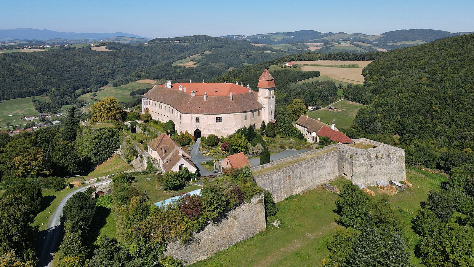
About Rettenbach (Bernstein)
A secluded retreat in the rolling hills of Southern Burgenland, where Pannonian calm meets the quiet tradition of Austrian forest life.
Highlights
- Rolling hill landscapes
- Pannonian hospitality
- Quiet forest trails
- Rural Austrian charm
Key Facts
- Altitude: 416m
- Top lift: 568m
- Ski pistes: 1km
- Ski lifts: 2
- Population: 328
- Lakes nearby: 2
- MTB trails: 147.6km
Ski Area
Weather and 10-day forecast for Rettenbach (Bernstein)
- Today: 9 to 16 °C, rain, 3 h of sunshine
- Freezing level today: about 2670 m (2180 to 3080 m)
| Day | Min / max | Sky | Precipitation | Sunshine |
|---|---|---|---|---|
| 9月24日周四 | 9 / 16 °C | rain | dry | 3 h sun |
| 9月25日周五 | 9 / 17 °C | clear sky | dry | 11 h sun |
| 9月26日周六 | 9 / 19 °C | clear sky | dry | 11 h sun |
| 9月27日周日 | 9 / 20 °C | clear sky | dry | 12 h sun |
| 9月28日周一 | 11 / 21 °C | clear sky | dry | 12 h sun |
| 9月29日周二 | 12 / 22 °C | clear sky | dry | 12 h sun |
| 9月30日周三 | 12 / 24 °C | clear sky | dry | 8 h sun |
| 10月1日周四 | 11 / 19 °C | clear sky | dry | 11 h sun |
| 10月2日周五 | 10 / 20 °C | clear sky | dry | 12 h sun |
| 10月3日周六 | 12 / 20 °C | clear sky | dry | 12 h sun |
Things to do in Rettenbach (Bernstein)
Hikes nearby — Rettenbach (Bernstein) (19)
19 curated hiking trails around Rettenbach (Bernstein), sourced from OpenStreetMap and enriched with distance, elevation gain and difficulty.
-
Alpannonia
This feeder route climbs from the village of St. Kathrein am Hauenstein — home to a small white church so beloved by East Styrian poet Peter Rosegger that he ranked its atmosphere above the cathedrals of Cologne, Milan, and Rome — up to the Hauereck, where it joins the main alpannonia trail stretching from the UNESCO World Heritage Site at Semmering toward the edge of the Pannonian plain.
-
Alpannonia Zugang/hozzáférés KoRa
zahlreiche Zubringer zu Hauptroute
-
Grodnau - Braunriegel - Kalkgraben - Schartenäcker
-
Kienbergweg
-
Planetenwanderweg
-
Alpanonia Zubringer
-
Speckkammerl Rundwanderweg (Bernstein - Stuben)
-
Bernsteinweg
-
Höhenwanderweg (Ortsteile der Großgemeinde Bernstein)
The W23 is a marked loop route that threads through the villages of Rettenbach, Dreihütten, Stuben, and Redlschlag, passing numerous viewpoints along the way. Burg Bernstein, the Kienberg, and the Pechgraben valley are among the landmarks encountered on this ridge walk through the middle Burgenland.
-
Gschaidt - Burgerschlag - Grametschlag - Maltern
-
Waldlehrpfad (Redlschlag - Steinbruch)
-
Redlschlag - Bernstein über Bienenhaus
-
Naturerlebnispfad Willersdorfer Schlucht - Aschauer Au
-
Wanderweg 940, Schäffern - Pinggau
-
Rundwanderweg Bergwerk/Neustift - Schloss/Tauchental/Sonnleiten
-
Bubendorf - Raipel - Bernstein
-
Almenweg (Bad Schönau - Hutwisch - Schlägen Rundwanderweg)
-
Bad Schönau - Hutwisch
-
Bad Schönau - Schloß Krumbach
Mountain biking near Rettenbach (Bernstein)
- NÖ-Burgenland-Strecke
- Dreiländereck-Strecke
- Steinkreis-Strecke
- Herz Kreislauf-Strecke
- Tannwald-Strecle
- Distelleiten-Strecke
- Hutwisch-Strecke
Getting to Rettenbach (Bernstein)
Door-to-door travel times as used by the MR. ALPS ranking.
- Nearest airport: Graz Airport (GRZ), 76 km away, about 1h09 by road
- Graz: 1h16 by car, 103 km
- Wien: 1h26 by car, 110 km
- München: 5h23 by car, 490 km
- Padova: 5h46 by car, 537 km
- Nürnberg: 6h06 by car, 585 km
- Innsbruck: 6h12 by car, 561 km
Where to stay in Rettenbach (Bernstein)
31 places to stay for a night on 2026-09-25, from 351 EUR per night, median 425 EUR. Prices are direct with hotels and destinations, compared live on the Rettenbach (Bernstein) page.