Pokljuka – Goreljek
About Pokljuka – Goreljek
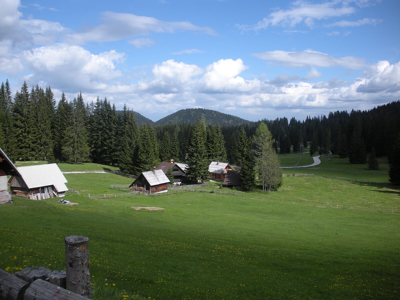
A quiet plateau of spruce forests where biathlon legends train amidst traditional wooden shepherd huts and wild nature.
Highlights
- World-class biathlon trails
- Ancient spruce forests
- Traditional wooden architecture
- Triglav wilderness access
Key Facts
- Altitude: 1258m
- Top lift: 1564m
- Ski pistes: 2.1km
- Ski lifts: 6
- Population: 7
- Lakes nearby: 10
- MTB trails: 20.8km
- Mountain huts: 26
Ski Area
Weather and 10-day forecast for Pokljuka – Goreljek
- Today: 3 to 11 °C, clear sky, 11 h of sunshine
- Freezing level today: about 2900 m (2290 to 3560 m)
| Day | Min / max | Sky | Precipitation | Sunshine |
|---|---|---|---|---|
| 9月23日周三 | 3 / 11 °C | clear sky | dry | 11 h sun |
| 9月24日周四 | 5 / 13 °C | rain showers | dry | 2 h sun |
| 9月25日周五 | 4 / 12 °C | clear sky | dry | 12 h sun |
| 9月26日周六 | 5 / 14 °C | clear sky | dry | 11 h sun |
| 9月27日周日 | 8 / 16 °C | clear sky | dry | 11 h sun |
| 9月28日周一 | 6 / 15 °C | clear sky | dry | 9 h sun |
| 9月29日周二 | 7 / 15 °C | clear sky | dry | 11 h sun |
| 9月30日周三 | 7 / 15 °C | clear sky | dry | 11 h sun |
| 10月1日周四 | 7 / 16 °C | clear sky | dry | 11 h sun |
| 10月2日周五 | 8 / 16 °C | drizzle | dry | 8 h sun |
Things to do in Pokljuka – Goreljek
Hikes nearby — Pokljuka – Goreljek (20)
20+ curated hiking trails around Pokljuka – Goreljek, sourced from OpenStreetMap and enriched with distance, elevation gain and difficulty.
-
Rudno polje - Uskovnica
-
Zaka - Šport hotel Pokljuka
-
Juliana Trail
-
Učna pot Mrzli studenec
-
Krnica - Pl. Kranjska dolina
-
Rudno polje - Blejska koča
-
Rudno polje - Viševnik
From the ski slopes and spruce forests of the Pokljuka plateau, the route climbs past an abandoned hunting observatory and through small saddles to the 2050-metre summit of Viševnik — one of the most visited two-thousanders in Slovenia. The top opens onto sweeping views of Pokljuka and the surrounding peaks of the Julian Alps.
-
Pri Rupah - Debela peč
The route climbs from Pokljuka to Debela peč, the easternmost two-thousander of the Julian Alps, where the western wall drops steeply into the Krma valley. From the 2,014 m summit, the views open across the central Julian Alps, the Karavanke range, and the Bled-Radovljica plain.
-
Rudno polje - Studorski preval - Vodnikov dom
-
JK10
Fernwanderweg Südalpen-Umrundung ab April 2019, 720 km, 45 000 Hm, 270 Std. Gehzeit – Alpine Vereine: Kärnten, Slovenija und Friuli-Venezia Giulia – siehe im Internet: Julius-Kugy-Dreiländerweg in 30 Etappen – Berge der Freundschaft
-
Uskovnica - Pl. Konjščica - Srenjski preval
-
Pl. Pokljuka - Pl. Klek - Blejska koča
-
Blejska koča - Viševnik
-
Blejska koča - Mrežce - Lipanski vrh - Brda
-
Pokljuška soteska
-
Bohinjska Bistrica - Pl. za Črno goro - Črna prst
-
Bohinjska Bistrica - Soriška pl.
-
Blejska Dobrava-Zg. Radovna-Mojstrana
-
Bitenjska pl. - Ratitovec
-
Blejski razgledni trail
Mountain biking near Pokljuka – Goreljek
- Family Line
- Expert Line
Getting to Pokljuka – Goreljek
Door-to-door travel times as used by the MR. ALPS ranking.
- Nearest airport: Ljubljana Jože Pučnik Airport (LJU), 39 km away, about 58 min by road
- Graz: 2h58 by car, 224 km
- Padova: 3h41 by car, 265 km
- München: 4h23 by car, 373 km
- Verona: 4h29 by car, 347 km
- Bolzano - Bozen: 4h39 by car, 313 km
- Wien: 4h46 by car, 380 km
Where to stay in Pokljuka – Goreljek
200 places to stay for a night on 2026-09-25, from 111 EUR per night, median 317 EUR. Prices are direct with hotels and destinations, compared live on the Pokljuka – Goreljek page.