Péra – Trun
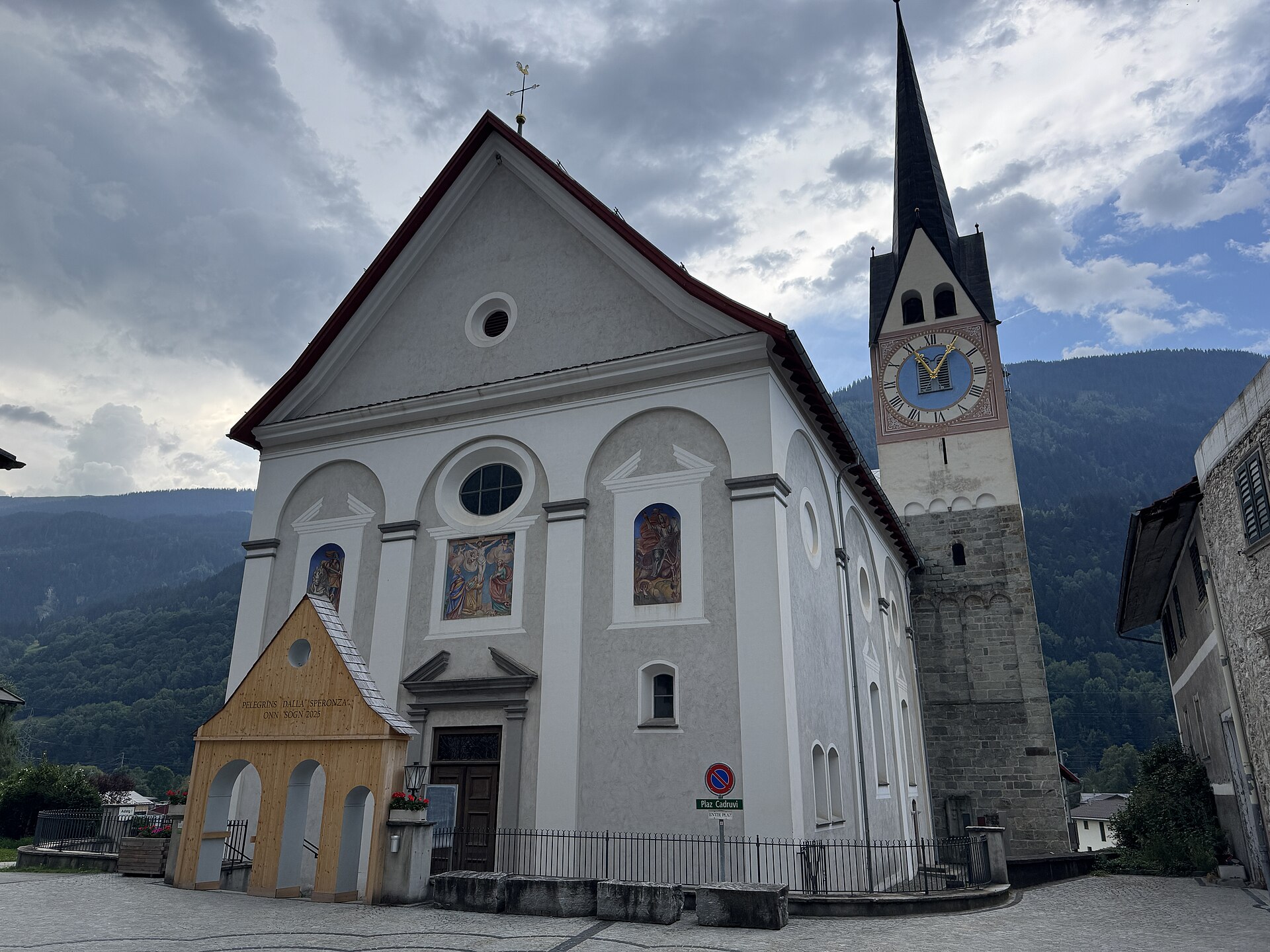
About Péra – Trun
A quiet Romansh-speaking enclave where deep-rooted Swiss traditions meet a slow-paced, authentic Surselva valley lifestyle.
Highlights
- Romansh cultural heritage
- Traditional stone architecture
- Quiet valley trails
- Authentic local character
Key Facts
- Altitude: 918m
- Top lift: 1040m
- Ski pistes: 1km
- Ski lifts: 1
- Population: 1,421
- Lakes nearby: 8
- MTB trails: 197.6km
- Mountain huts: 15
Ski Area
Weather and 10-day forecast for Péra – Trun
- Today: 7 to 20 °C, clear sky, 12 h of sunshine
- Freezing level today: about 3820 m (3690 to 4020 m)
| Day | Min / max | Sky | Precipitation | Sunshine |
|---|---|---|---|---|
| 9月23日周三 | 7 / 20 °C | clear sky | dry | 12 h sun |
| 9月24日周四 | 9 / 21 °C | clear sky | dry | 8 h sun |
| 9月25日周五 | 9 / 20 °C | partly cloudy | dry | 4 h sun |
| 9月26日周六 | 10 / 22 °C | clear sky | dry | 12 h sun |
| 9月27日周日 | 12 / 25 °C | clear sky | dry | 12 h sun |
| 9月28日周一 | 14 / 26 °C | clear sky | dry | 12 h sun |
| 9月29日周二 | 14 / 26 °C | clear sky | dry | 12 h sun |
| 9月30日周三 | 14 / 24 °C | clear sky | dry | 12 h sun |
| 10月1日周四 | 11 / 20 °C | drizzle | dry | 1 h sun |
| 10月2日周五 | 7 / 9 °C | snow showers | dry | 0 h sun |
Things to do in Péra – Trun
Hikes nearby — Péra – Trun (20)
20+ curated hiking trails around Péra – Trun, sourced from OpenStreetMap and enriched with distance, elevation gain and difficulty.
-
Via son Giachen
-
Walserweg Gottardo - Etappe 13
-
Walserweg Gottardo - Etappe 14
From the hamlet of Val, the route drops to a bridge over the Rein da Sumvitg before climbing 700 steep metres through forest, over pastures and Maiensässe (seasonal alpine meadows). Two wild ravines must be crossed before the path delivers you into the Walser settlement of St. Martin — the final destination of the roughly 200-kilometre Walserweg Gottardo.
-
Via son Giachen
-
Tavanasa Cumpadials
-
Punt Russein-Campadials
-
08-Alpenpässe-Weg
-
09-Alpenpässe-Weg
-
Via Glaralpina
-
Alp Cavrain Sut-Punt Russein
-
Disla-Punt Russein
-
Hochtal Val Frisal
-
Alp Sezner Obersaxen
-
Kistenpass
-
Cavardirashütte-Alp Cavrain Sut
-
Walserweg Gottardo: Val - St. Martin
-
Senda Sursilvana: Sumvitg - Breil/Brigels
-
Jakobsweg Graubünden: Trun - Disentis/Mustér Staziun
-
Jakobsweg Graubünden: Andiast Vitg - Trun
-
Walserweg Gottardo: Curaglia - Val
Mountain biking near Péra – Trun
- Graubünden Bike - Etappe 1 (Trun - Laax)
- Alpine Bike
- Vorderalpstrasse
- Via Dalisch
- Walserweg
- Senda Cuolms da Nadels
Getting to Péra – Trun
Door-to-door travel times as used by the MR. ALPS ranking.
- Nearest airport: Lugano Airport (LUG), 82 km away, about 1h54 by road
- Luzern: 1h44 by car, 114 km
- Zürich: 2h09 by car, 168 km
- Basel: 2h47 by car, 208 km
- Milano: 2h48 by car, 195 km
- Biel/Bienne: 2h57 by car, 221 km
- Bern: 2h58 by car, 223 km
Where to stay in Péra – Trun
40 places to stay for a night on 2026-09-25, from 161 EUR per night, median 295 EUR. Prices are direct with hotels and destinations, compared live on the Péra – Trun page.