Naggler Alm – Techendorf (Weissensee)
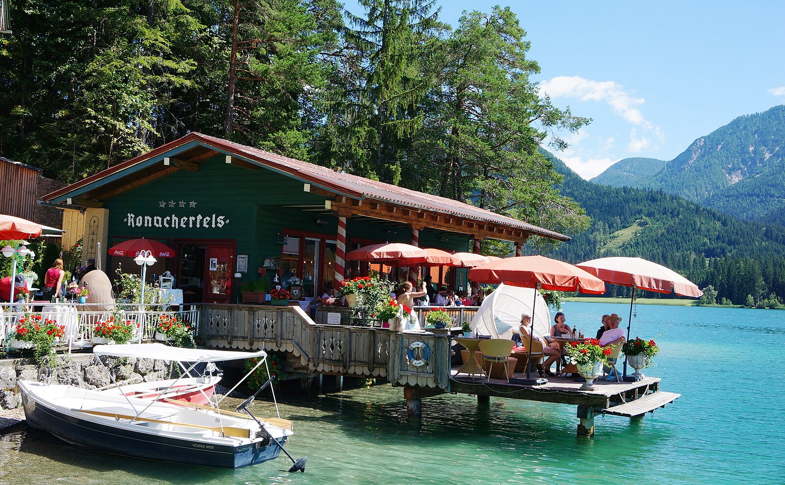
About Naggler Alm – Techendorf (Weissensee)
A slow-paced sanctuary where frozen lake skating meets organic mountain dining and a strictly sustainable approach to Alpine life.
Highlights
- Frozen lake skating
- Organic mountain huts
- Slow food movement
- Eco-conscious atmosphere
Key Facts
- Altitude: 1328m
- Top lift: 1324m
- Ski pistes: 6km
- Ski lifts: 7
- Population: 306
- Lakes nearby: 5
- MTB trails: 123.3km
- Mountain huts: 23
Ski Area
Weather and 10-day forecast for Naggler Alm – Techendorf (Weissensee)
- Today: 5 to 14 °C, clear sky, 13 h of sunshine
- Freezing level today: about 2558 m (2400 to 2880 m)
| Day | Min / max | Sky | Precipitation | Sunshine |
|---|---|---|---|---|
| 9月22日周二 | 5 / 14 °C | clear sky | dry | 13 h sun |
| 9月23日周三 | 2 / 13 °C | clear sky | dry | 13 h sun |
| 9月24日周四 | 6 / 14 °C | rain showers | dry | 6 h sun |
| 9月25日周五 | 5 / 15 °C | partly cloudy | dry | 8 h sun |
| 9月26日周六 | 6 / 18 °C | clear sky | dry | 12 h sun |
| 9月27日周日 | 8 / 19 °C | clear sky | dry | 12 h sun |
| 9月28日周一 | 6 / 21 °C | clear sky | dry | 11 h sun |
| 9月29日周二 | 7 / 20 °C | clear sky | dry | 10 h sun |
| 9月30日周三 | 9 / 22 °C | partly cloudy | dry | 6 h sun |
| 10月1日周四 | 8 / 20 °C | overcast | dry | 1 h sun |
Things to do in Naggler Alm – Techendorf (Weissensee)
Hikes nearby — Naggler Alm – Techendorf (Weissensee) (20)
20+ curated hiking trails around Naggler Alm – Techendorf (Weissensee), sourced from OpenStreetMap and enriched with distance, elevation gain and difficulty.
-
JK28
Fernwanderweg Südalpen-Umrundung ab April 2019, 720 km, 45 000 Hm, 270 Std. Gehzeit – Alpine Vereine: Kärnten, Slovenija und Friuli-Venezia Giulia – siehe im Internet: Julius-Kugy-Dreiländerweg in 30 Etappen – Berge der Freundschaft
-
Weg des Buches - Etappe 9
This easy pilgrimage route threads through the quiet, sparsely settled Gitschtal valley on pleasant forest paths, passing a waterfall at the Madatsche before continuing through the village of Radnig and on to Hermagor.
-
Rupertiweg
Spittal - Goldeck - Gusenalm - Techendorfer Alm - Techendorf - Naggler Alm - St.Lorenzen/Gitschtal - Hermagor
-
JK27
Fernwanderweg Südalpen-Umrundung ab April 2019, 720 km, 45 000 Hm, 270 Std. Gehzeit – Alpine Vereine: Kärnten, Slovenija und Friuli-Venezia Giulia – siehe im Internet: Julius-Kugy-Dreiländerweg in 30 Etappen – Berge der Freundschaft
-
Weg des Buches - Etappe 9A
-
Weg des Buches - Etappe 8
-
Wanderweg 259
-
Wanderweg 261
Fellbach-Grundgraben-(Fellberger Alm)-Almspitz
-
Weg des Buches - Etappe 9B
-
Wanderweg 246
-
Wanderweg 266
-
Wanderweg 265
Weissensee Ostufer-Stosia (Techendorfer Alm)
-
Wanderweg 268
Kleblach-Lind-Ochsengraben-Althausalm-Wernischalm-Siflitzer Kuhalm-Abzw Rupertiweg
-
Wanderweg 249
-
Wanderweg 271
Kleblach-Lind-Siflitzgraben-Bärnbisshtte-Siflitzer Kuhalm
-
Julius Kugy-Dreiländerweg E 28A
-
Berghöfe Rundweg
-
Bodenalmweg
-
Eggforstweg
-
Hermagor - Khünburg - Pressegger See
Mountain biking near Naggler Alm – Techendorf (Weissensee)
- Weiße Wand - Alm hinterm Brunn - Weissensee
- Naggler Alm Runde Weissensee
- Rund um die Gatschacher Weide
- Naggl Trail
- Weißensee Trail
- Panorama Trail
Getting to Naggler Alm – Techendorf (Weissensee)
Door-to-door travel times as used by the MR. ALPS ranking.
- Nearest airport: Klagenfurt Airport (KLU), 79 km away, about 2h23 by road
- Graz: 3h55 by car, 244 km
- Bolzano - Bozen: 4h by car, 201 km
- Padova: 4h14 by car, 290 km
- Innsbruck: 4h29 by car, 234 km
- München: 4h31 by car, 321 km
- Trento: 4h31 by car, 257 km
Where to stay in Naggler Alm – Techendorf (Weissensee)
176 places to stay for a night on 2026-09-25, from 100 EUR per night, median 208 EUR. Prices are direct with hotels and destinations, compared live on the Naggler Alm – Techendorf (Weissensee) page.