Ladis
实时摄像头

开放缆车: 0/38
积雪报告
- 过去24小时: 0 厘米
- 过去72小时: 0 厘米
- 过去7天: 0 厘米
- 过去7天: 山谷 0.1厘米 · 山腰 0厘米 · 山顶 0.1厘米
- 本季累计: 13.9 厘米
About Ladis
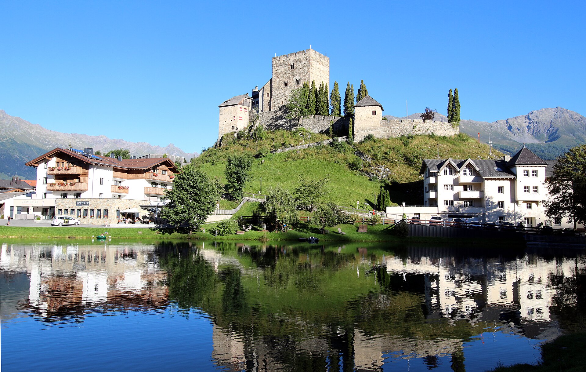
A quiet Tyrolean retreat where medieval castle ruins overlook a sun-drenched plateau favored by families and heritage seekers.
Highlights
- Cliffslope castle ruins
- Quiet village atmosphere
- Family-centric terrain
- Traditional farm architecture
Key Facts
- Altitude: 1213m
- Top lift: 2828m
- Ski pistes: 214km
- Ski lifts: 39
- Population: 531
- Lakes nearby: 19
- MTB trails: 328.8km
- Mountain huts: 27
Ski Area
已包含在以下滑雪通票中
Weather and 10-day forecast for Ladis
- Today: 4 to 10 °C, clear sky, 12 h of sunshine
- Freezing level today: about 2945 m (2870 to 3130 m)
| Day | Min / max | Sky | Precipitation | Sunshine |
|---|---|---|---|---|
| 9月22日周二 | 4 / 10 °C | clear sky | dry | 12 h sun |
| 9月23日周三 | 4 / 14 °C | clear sky | dry | 12 h sun |
| 9月24日周四 | 2 / 9 °C | overcast | dry | 3 h sun |
| 9月25日周五 | 1 / 12 °C | clear sky | dry | 12 h sun |
| 9月26日周六 | 5 / 16 °C | clear sky | dry | 10 h sun |
| 9月27日周日 | 7 / 17 °C | partly cloudy | dry | 7 h sun |
| 9月28日周一 | 6 / 19 °C | partly cloudy | dry | 5 h sun |
| 9月29日周二 | 7 / 20 °C | clear sky | dry | 12 h sun |
| 9月30日周三 | 8 / 15 °C | drizzle | dry | 2 h sun |
| 10月1日周四 | 8 / 17 °C | overcast | dry | 1 h sun |
Things to do in Ladis
Hikes nearby — Ladis (19)
19 curated hiking trails around Ladis, sourced from OpenStreetMap and enriched with distance, elevation gain and difficulty.
-
Wanderweg 6
-
Wanderweg 5
-
Wanderweg 15
-
Wanderweg 4
-
Wanderweg 7
-
Hexenweg
-
Wanderweg 11
-
Fisser Kraft und Sinnesweg
-
Wanderweg 9B
-
Wanderweg 25
-
Wanderweg 9
-
Wanderweg 4
-
Wanderweg 8
-
Goldener Mann Weg
A themed trail built around the story of a mighty giant with a golden heart, featuring interactive play and puzzle stations along the way.
-
Panorama Genussweg
Strung across the Sonnenplateau at around 1,900 m, this broad, well-built path links Serfaus, Fiss, and Ladis through the Serfauser Jochwiesen meadows and the Königsleithewald forest, passing the Möseralm hut along the way. Scattered rest stations fitted with hammocks and sun loungers punctuate the route, while nearly 3,000 m peaks fill the horizon throughout.
-
Quellenweg
A themed trail tracing the spring-waters of the Serfaus-Fiss-Ladis high plateau, it descends gently from the Fisser Joch ridge through the alpine zone to Komperdell and on to Serfaus, with information panels at every station and "wave loungers" positioned along the way. Suitable for buggies, the route passes through avalanche terrain and invites walkers to discover the sources of the plateau's waters at a series of rest stops.
-
Blumensteig
-
Dorfrunde
-
Aachener Höhenweg
Mountain biking near Ladis
- Pitztal Bike
- Hochgallmigg Tour
- Schöngampalm Tour
- Pfundser Tschey - Platzer Alm
- Windles Wiesen Tour
- Familientour Schönegg
- Familientour Rabuschl
- Frommestrail
Getting to Ladis
Door-to-door travel times as used by the MR. ALPS ranking.
- Nearest airport: Innsbruck Airport (INN), 56 km away, about 1h03 by road
- Innsbruck: 1h08 by car, 90 km
- Bolzano - Bozen: 2h20 by car, 143 km
- München: 2h29 by car, 177 km
- Trento: 2h49 by car, 193 km
- Zürich: 3h02 by car, 237 km
- Luzern: 3h23 by car, 253 km
Where to stay in Ladis
200 places to stay for a night on 2026-09-25, from 118 EUR per night, median 352 EUR. Prices are direct with hotels and destinations, compared live on the Ladis page.