Kalte Kuchl – Innerhalbach
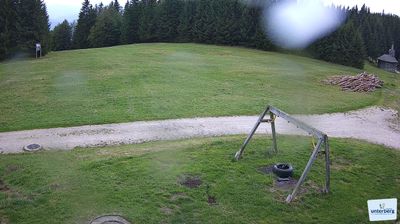
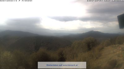
实时摄像头
开放缆车: 0%
积雪报告
- 过去24小时: 0 厘米
- 过去72小时: 0 厘米
- 过去7天: 0 厘米
- 过去7天: 山谷 0厘米 · 山腰 0厘米 · 山顶 0厘米
- 本季累计: 0 厘米
About Kalte Kuchl – Innerhalbach
A legendary stopover for motorcycle enthusiasts, famous for its rustic hospitality and the region’s most iconic curd cheese strudel.
Highlights
- Motorcycle culture
- Traditional curd strudel
- Rustic alpine inn
- Winding forest roads
Key Facts
- Altitude: 722m
- Top lift: 759m
- Ski pistes: 1km
- Ski lifts: 2
- Population: 96
- MTB trails: 27.8km
- Mountain huts: 18
Ski Area
Weather and 10-day forecast for Kalte Kuchl – Innerhalbach
- Today: 6 to 14 °C, clear sky, 10 h of sunshine
- Freezing level today: about 2408 m (1890 to 3140 m)
| Day | Min / max | Sky | Precipitation | Sunshine |
|---|---|---|---|---|
| 9月23日周三 | 6 / 14 °C | clear sky | dry | 10 h sun |
| 9月24日周四 | 8 / 13 °C | rain showers | dry | 2 h sun |
| 9月25日周五 | 7 / 14 °C | partly cloudy | dry | 4 h sun |
| 9月26日周六 | 7 / 19 °C | clear sky | dry | 12 h sun |
| 9月27日周日 | 8 / 21 °C | clear sky | dry | 12 h sun |
| 9月28日周一 | 10 / 21 °C | clear sky | dry | 12 h sun |
| 9月29日周二 | 10 / 21 °C | clear sky | dry | 12 h sun |
| 9月30日周三 | 10 / 23 °C | clear sky | dry | 12 h sun |
| 10月1日周四 | 13 / 20 °C | partly cloudy | dry | 5 h sun |
| 10月2日周五 | 11 / 14 °C | rain showers | dry | 1 h sun |
Things to do in Kalte Kuchl – Innerhalbach
Hikes nearby — Kalte Kuchl – Innerhalbach (20)
20+ curated hiking trails around Kalte Kuchl – Innerhalbach, sourced from OpenStreetMap and enriched with distance, elevation gain and difficulty.
-
Wiener Mariazellerweg 06
Wiener Mariazellerweg 06从Perchtoldsdorf穿越丘陵、山地和森林等多样地貌,沿标记徒步小径、林间小道和小路延伸至Mariazell。Sportliche Pilger可直接从Araburg攀登至Kieneck,而一条较为平缓的替代路线则蜿蜒穿行于Maria Raisenmarkt与Muggendorf之间的乡村地带。
-
Wanderweg 204A Voralpenweg Variante
-
Furthof - Andersbach - Reisalpe
-
Blümelhof-Brennalm
-
Innerfahrafeld - Kleinzeller Hinteralm -Wiesenfeld - Schwarzenbach (Bahnhof)
-
Nagelland Alm - Traisner Hütte
über Gscheidboden
-
Fensterbach - Hammerleck
-
Jochart - Hammerleck - Rohr im Gebirge
-
Gasthaus zur Klaus - Sonnsteinsattel-Kleinzell
-
Rohr im Gebirge - Schacherkreuz-Jochart
-
Rossbachklamm-Rohr im Gebirge
-
Bergmanderlweg
NONE (The excerpts describe the Tümpflweg, not the Bergmanderlweg — no facts about the Bergmanderlweg's scenery, terrain, or landmarks are present in the provided sources.)
-
Kumpfmühle - Brennalm
-
Luger-Kashof
kein offiziell markierter Wanderweg mehr!!!
-
Werkstatt, Wald und Wasser
-
Waldlehrpfad Waldesruhe
-
Sagenumwobener Tümpflweg
-
Kleinzell - Reisalpe
-
Voralpenweg 04A Tormäuervariante
-
Kuntner-Weg
Mountain biking near Kalte Kuchl – Innerhalbach
- Muckenkogel-Strecke
- Mucki trail
- Mucki Trail 1
- Sutte
Getting to Kalte Kuchl – Innerhalbach
Door-to-door travel times as used by the MR. ALPS ranking.
- Nearest airport: Vienna International Airport (VIE), 67 km away, about 2h by road
- Wien: 1h47 by car, 79 km
- Graz: 2h51 by car, 164 km
- München: 4h51 by car, 384 km
- Nürnberg: 5h33 by car, 478 km
- Innsbruck: 5h40 by car, 455 km
- Stuttgart: 6h57 by car, 603 km
Where to stay in Kalte Kuchl – Innerhalbach
6 places to stay for a night on 2026-09-25, from 154 EUR per night, median 154 EUR. Prices are direct with hotels and destinations, compared live on the Kalte Kuchl – Innerhalbach page.