Hilchenbach
About Hilchenbach
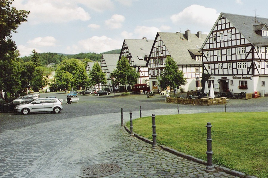
A tranquil gateway to the Rothaarsteig trail, defined by half-timbered heritage and dense forests for serious hikers.
Highlights
- Half-timbered architecture
- Dense forest trails
- Open-air theater
- Rothaarsteig hiking access
Key Facts
- Altitude: 584m
- Top lift: 642m
- Ski pistes: 0.4km
- Ski lifts: 1
- Lakes nearby: 4
- MTB trails: 30.2km
Ski Area
Weather and 10-day forecast for Hilchenbach
- Today: 9 to 17 °C, overcast, 4 h of sunshine
- Freezing level today: about 3314 m (3160 to 3510 m)
| Day | Min / max | Sky | Precipitation | Sunshine |
|---|---|---|---|---|
| 10月4日周日 | 9 / 17 °C | overcast | dry | 4 h sun |
| 10月5日周一 | 9 / 18 °C | clear sky | dry | 9 h sun |
| 10月6日周二 | 8 / 18 °C | clear sky | dry | 8 h sun |
| 10月7日周三 | 8 / 18 °C | partly cloudy | dry | 6 h sun |
| 10月8日周四 | 6 / 12 °C | partly cloudy | dry | 3 h sun |
| 10月9日周五 | 4 / 9 °C | partly cloudy | dry | 4 h sun |
| 10月10日周六 | 6 / 11 °C | partly cloudy | dry | 6 h sun |
| 10月11日周日 | 5 / 10 °C | drizzle | dry | 2 h sun |
| 10月12日周一 | 7 / 14 °C | drizzle | dry | 2 h sun |
| 10月13日周二 | 6 / 15 °C | clear sky | dry | 8 h sun |
Things to do in Hilchenbach
Hikes nearby - Hilchenbach (16)
16 curated hiking trails around Hilchenbach, sourced from OpenStreetMap and enriched with distance, elevation gain and difficulty.
-
X3 Talsperrenweg
Talsperrenweg是20世纪初在Sauerländischer Gebirgsverein协会区域内开辟的一条主要徒步路线,与所有其他主要徒步路线一样,以白色圣安德烈十字X作为路标,在交叉点处附加数字3。
-
Jung-Stilling-Rundweg
-
Netphener Rundweg
环绕内特芬(锡根兰)城区的环形路线
-
nördlicher Rothaarsteig-Zuweg Hilchenbach
-
Keltenweg Netphen
途经昔日凯尔特人Wallburgen的Rundweg
-
Hilchenbacher Höhenring
-
Leimbachtal Rundweg A3
vom Parkplatz Leimbachtal wird der Humberg umrundet
-
Hilchenbacher Windwanderweg
-
Doppelbalken Netphen - Forsthaus Hohenroth
内特芬(锡根兰)经布劳尔斯多夫至福斯特豪斯·霍恩罗特
-
Sonnenhang Rundweg A5
Rundwanderweg. Start und Ziel am Wanderparkplatz Sonnenhang.
-
Leimbachtal Rundweg A1
从Leimbachtal停车场穿越Leimbachtal
-
Leimbachtal Rundweg A4
vom Parkplatz Leimbachtal am Burggraben (Ringwall) vorbei
-
Kalorienpfad
Auf Waldwegen zu Trimmdich-Stationen rund um die Breitenbach-alsperre
-
Dreieck Kirchhundem-Hilchenbach
-
Leimbachtal Rundweg A2
从 Leimbachtal 停车场出发,绕行整个山谷。
-
Afholderbacher Weiher Rundweg A4 - Alte Netphe
Vom Parkplatz Afholderbacher Weiher
Getting to Hilchenbach
Door-to-door travel times as used by the MR. ALPS ranking.
- Nearest airport: Cologne Bonn Airport (CGN), 73 km away, about 1h28 by road
- Frankfurt am Main: 1h54 by car, 147 km
- Koblenz: 1h54 by car, 121 km
- Mannheim: 2h34 by car, 223 km
- Bruxelles: 3h37 by car, 318 km
- Stuttgart: 3h49 by car, 341 km
- Nürnberg: 3h54 by car, 363 km
Where to stay in Hilchenbach
44 places to stay for a night on 2026-10-09, from 67 EUR per night, median 76 EUR. Prices are direct with hotels and destinations, compared live on the Hilchenbach page.