Hilchenbach
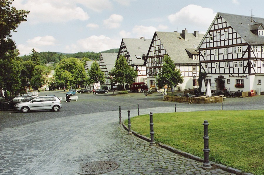
About Hilchenbach
A tranquil gateway to the Rothaarsteig trail, defined by half-timbered heritage and dense forests for serious hikers.
Highlights
- Half-timbered architecture
- Dense forest trails
- Open-air theater
- Rothaarsteig hiking access
Key Facts
- Altitude: 584m
- Top lift: 642m
- Ski pistes: 0.4km
- Ski lifts: 1
- Lakes nearby: 4
- MTB trails: 30.2km
Ski Area
Weather and 10-day forecast for Hilchenbach
- Today: 9 to 17 °C, overcast, 4 h of sunshine
- Freezing level today: about 3314 m (3160 to 3510 m)
| Day | Min / max | Sky | Precipitation | Sunshine |
|---|---|---|---|---|
| niedz., 4 paź | 9 / 17 °C | overcast | dry | 4 h sun |
| pon., 5 paź | 9 / 18 °C | clear sky | dry | 9 h sun |
| wt., 6 paź | 8 / 18 °C | clear sky | dry | 8 h sun |
| śr., 7 paź | 8 / 18 °C | partly cloudy | dry | 6 h sun |
| czw., 8 paź | 6 / 12 °C | partly cloudy | dry | 3 h sun |
| pt., 9 paź | 4 / 9 °C | partly cloudy | dry | 4 h sun |
| sob., 10 paź | 6 / 11 °C | partly cloudy | dry | 6 h sun |
| niedz., 11 paź | 5 / 10 °C | drizzle | dry | 2 h sun |
| pon., 12 paź | 7 / 14 °C | drizzle | dry | 2 h sun |
| wt., 13 paź | 6 / 15 °C | clear sky | dry | 8 h sun |
Things to do in Hilchenbach
Hikes nearby - Hilchenbach (16)
16 curated hiking trails around Hilchenbach, sourced from OpenStreetMap and enriched with distance, elevation gain and difficulty.
-
X3 Talsperrenweg
Talsperrenweg to główny szlak turystyczny utworzony na początku XX wieku na terenie Sauerländischer Gebirgsverein, który podobnie jak wszystkie inne główne trasy posiada jako znak szlaku białe krzyż świętego Andrzeja X, uzupełniony o cyfrę 3 w punktach skrzyżowań.
-
Jung-Stilling-Rundweg
-
Netphener Rundweg
Okrężna trasa wokół obszaru miejskiego Netphen (Siegerland)
-
nördlicher Rothaarsteig-Zuweg Hilchenbach
-
Keltenweg Netphen
Rundweg obok dawnych celtyckich Wallburgen
-
Hilchenbacher Höhenring
-
Leimbachtal Rundweg A3
vom Parkplatz Leimbachtal wird der Humberg umrundet
-
Hilchenbacher Windwanderweg
-
Doppelbalken Netphen - Forsthaus Hohenroth
Netphen (Siegerland) przez Brauersdorf do Forsthaus Hohenroth
-
Sonnenhang Rundweg A5
Rundwanderweg. Start und Ziel am Wanderparkplatz Sonnenhang.
-
Leimbachtal Rundweg A1
Z parkingu Leimbachtal przez Leimbachtal
-
Leimbachtal Rundweg A4
vom Parkplatz Leimbachtal am Burggraben (Ringwall) vorbei
-
Kalorienpfad
Auf Waldwegen zu Trimmdich-Stationen rund um die Breitenbach-alsperre
-
Dreieck Kirchhundem-Hilchenbach
-
Leimbachtal Rundweg A2
Z parkingu Leimbachtal okrąża się dolinę.
-
Afholderbacher Weiher Rundweg A4 - Alte Netphe
Vom Parkplatz Afholderbacher Weiher
Getting to Hilchenbach
Door-to-door travel times as used by the MR. ALPS ranking.
- Nearest airport: Cologne Bonn Airport (CGN), 73 km away, about 1h28 by road
- Frankfurt am Main: 1h54 by car, 147 km
- Koblenz: 1h54 by car, 121 km
- Mannheim: 2h34 by car, 223 km
- Bruxelles: 3h37 by car, 318 km
- Stuttgart: 3h49 by car, 341 km
- Nürnberg: 3h54 by car, 363 km
Where to stay in Hilchenbach
44 places to stay for a night on 2026-10-09, from 67 EUR per night, median 76 EUR. Prices are direct with hotels and destinations, compared live on the Hilchenbach page.