Zermatt
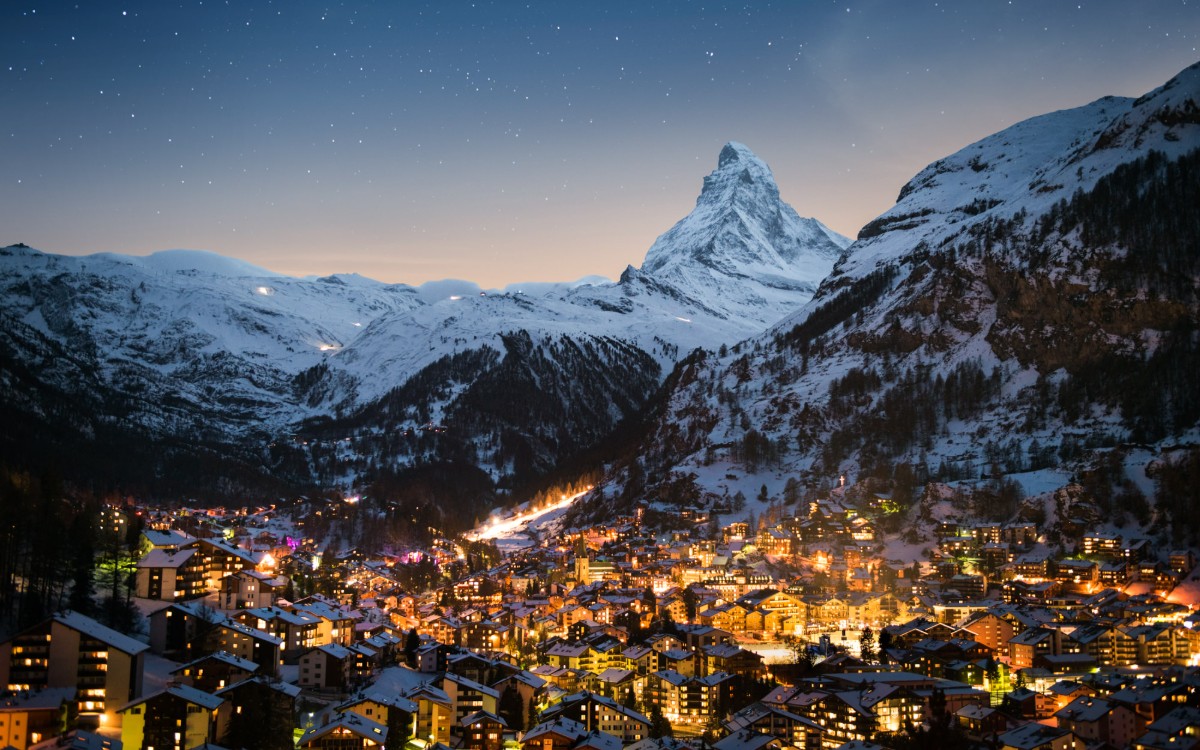
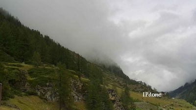
Webcam na żywo

Otwarte wyciągi: 0/51
Raport śniegowy
- Ostatnie 24h: 0 cm
- Ostatnie 72h: 0 cm
- Ostatnie 7 dni: 0 cm
- Ostatnie 7 dni: Dolina 0cm · Środek stoku 0cm · Szczyt 0cm
- Suma sezonowa: 8.1 cm
Ośrodki narciarskie otwarte teraz · Raport śniegowy
About Zermatt
A historic Valais village situated at 1,613m, providing access to 322km of pistes reaching a 3,800m top lift. Shoulder season visitors find significantly quieter trails and more space across the Matterhorn-Cervino Paradise network, which accepts the Ikon Pass for international access.
Highlights
- Iconic peak views
- Car-free streets
- Luxury mountain dining
- Year-round glacier skiing
Key Facts
- Altitude: 1613m
- Top lift: 3820m
- Ski pistes: 322km
- Ski lifts: 51
- Population: 5,847
- 4000m+ peaks nearby: 36
- Lakes nearby: 14
- MTB trails: 63.8km
- Mountain huts: 30
Ski Area
Matterhorn-Cervino Paradise – Zermatt/Breuil-Cervinia/Valtournenche
Karnety sezonowe obejmujące tę miejscowość
Weather and 10-day forecast for Zermatt
- Today: 5 to 11 °C, partly cloudy, 7 h of sunshine
- Freezing level today: about 3866 m (3590 to 4030 m)
| Day | Min / max | Sky | Precipitation | Sunshine |
|---|---|---|---|---|
| czw., 24 wrz | 5 / 11 °C | partly cloudy | dry | 7 h sun |
| pt., 25 wrz | 5 / 12 °C | partly cloudy | dry | 7 h sun |
| sob., 26 wrz | 4 / 11 °C | clear sky | dry | 12 h sun |
| niedz., 27 wrz | 3 / 11 °C | clear sky | dry | 12 h sun |
| pon., 28 wrz | 3 / 10 °C | clear sky | dry | 12 h sun |
| wt., 29 wrz | 4 / 11 °C | clear sky | dry | 10 h sun |
| śr., 30 wrz | 7 / 12 °C | partly cloudy | dry | 4 h sun |
| czw., 1 paź | 2 / 10 °C | clear sky | dry | 10 h sun |
| pt., 2 paź | 1 / 5 °C | snow showers | dry | 3 h sun |
| sob., 3 paź | 0 / 6 °C | clear sky | dry | 11 h sun |
Things to do in Zermatt
Hikes nearby — Zermatt (20)
20+ curated hiking trails around Zermatt, sourced from OpenStreetMap and enriched with distance, elevation gain and difficulty.
-
Path to Freedom
-
Matterhorn glacier trail
Dominated throughout by the Matterhorn's west face looming overhead, the trail passes several small mountain lakes and a glacier stream before a rough scramble over loose rocks and scree, with snow possible even in August. The route offers excellent views of the Furgg glacier, and the terrain shifts from marked paths to wild, open valley on the mountain's far side.
-
Tour Monte Rosa tappa 1
The trail climbs steeply through the valley of the Triftbach directly behind the train station, then opens onto Zermatt's high balcony, where the Gasthaus Edelweiß marks the point where breathtaking views of the Matterhorn and the Valais 4,000-metre peaks unfold.
-
Kulturweg
Kulturweg Zermatt->Zmutt & Weiler Zmutt & Aroleyt->Zermatt
-
Zermatt Furi-Zermatt
-
Furi-Weg
The trail begins with a gondola ride up to the Furi mountain station, where the Matterhorn stands watch overhead, then winds through a nature reserve of alpine plants and striking rock formations, with larch forest filtering sunlight between the trees. Along the way, rustic chalets dot the route and park benches mark quiet viewpoints opening onto the Valais mountain panorama.
-
Arwenweg
-
Blumenweg
-
Naturweg
-
Wisshornweg
The trail climbs through a small larch forest on partially steep terrain, ultimately delivering views of the southeast face of the Weisshorn pyramid at 2,936 m — all with the Matterhorn visible across the valley.
-
Mark Twain Weg
At around 2,600 metres, the Mark Twain Weg traverses alpine terrain near Riffelberg and Gagenhaupt, where yellow alpine flowers push through the rocky ground against a wide mountain panorama. The path connects Riffelberg to Riffelalp through scenery characteristic of the Swiss Alps above Zermatt.
-
Swiss Top Walk
-
Murmelweg
-
Lärchenweg
The Lärchenweg descends point-to-point from the Schwarzsee cable car station — where a small lake sits beside the mountain terminal — through larch and pine forest to the village of Furi. The forest is nutcracker country: each bird collects between 30,000 and 100,000 pine seeds per year, a behaviour so vital to the woodland's regeneration that hunting the species was banned in the mid-1950s.
-
Abenteuerweg
The trail climbs from Tufteren over the Ritzengrat ridge to the Rothorn, delivering views of the Matterhorn, Weisshorn, and the surrounding four-thousanders on one side and the quiet Zermatt valley on the other. In the Tufterkumme, chamois can be spotted moving through the valley below.
-
Matternhorn-Trail
-
5-Seenweg
Five mountain lakes — each with its own shape, colour, and character — string together beneath the Matterhorn, which mirrors itself in three of them. At Grünsee, Swiss stone pines cling to scree and sand, while rare flowers grow at Grindjisee's edge, and Leisee invites a swim at the trail's end.
-
Gamsweg
A descending mountain path through one of Switzerland's largest wildlife reserves, where chamois — mothers with grown kids, young bucks, or whole herds — graze along rocky ledges and alpine meadows, sometimes lying so still against the terrain that only a patient, unhurried gaze will find them. Edelweiss grows along the way.
-
Riffelseeweg
-
5-Seenweg Zermatt
Mountain biking near Zermatt
- Riffelberg Trail
- Sunnegga-Trail
- Sunnegga Trail Zermatt
- Arvenweg
- Riffelberg-Trail
Getting to Zermatt
Door-to-door travel times as used by the MR. ALPS ranking.
- Nearest airport: Lugano Airport (LUG), 90 km away, about 3h11 by road
- Lausanne: 2h19 by car, 174 km
- Bern: 2h50 by train, 132 km
- Genève: 2h58 by car, 236 km
- Biel/Bienne: 3h01 by train, 165 km
- Luzern: 3h10 by car, 194 km
- Milano: 3h24 by car, 232 km
Where to stay in Zermatt
200 places to stay for a night on 2026-09-25, from 263 EUR per night, median 532 EUR. Prices are direct with hotels and destinations, compared live on the Zermatt page.