Tristeli – St. Margrethenberg
Webcam na żywo


Otwarte wyciągi: 0%
Raport śniegowy
- Ostatnie 24h: 0 cm
- Ostatnie 72h: 0 cm
- Ostatnie 7 dni: 0 cm
- Ostatnie 7 dni: Dolina 0cm · Środek stoku 0cm · Szczyt 0cm
- Suma sezonowa: 0 cm
Ośrodki narciarskie otwarte teraz · Raport śniegowy
About Tristeli – St. Margrethenberg
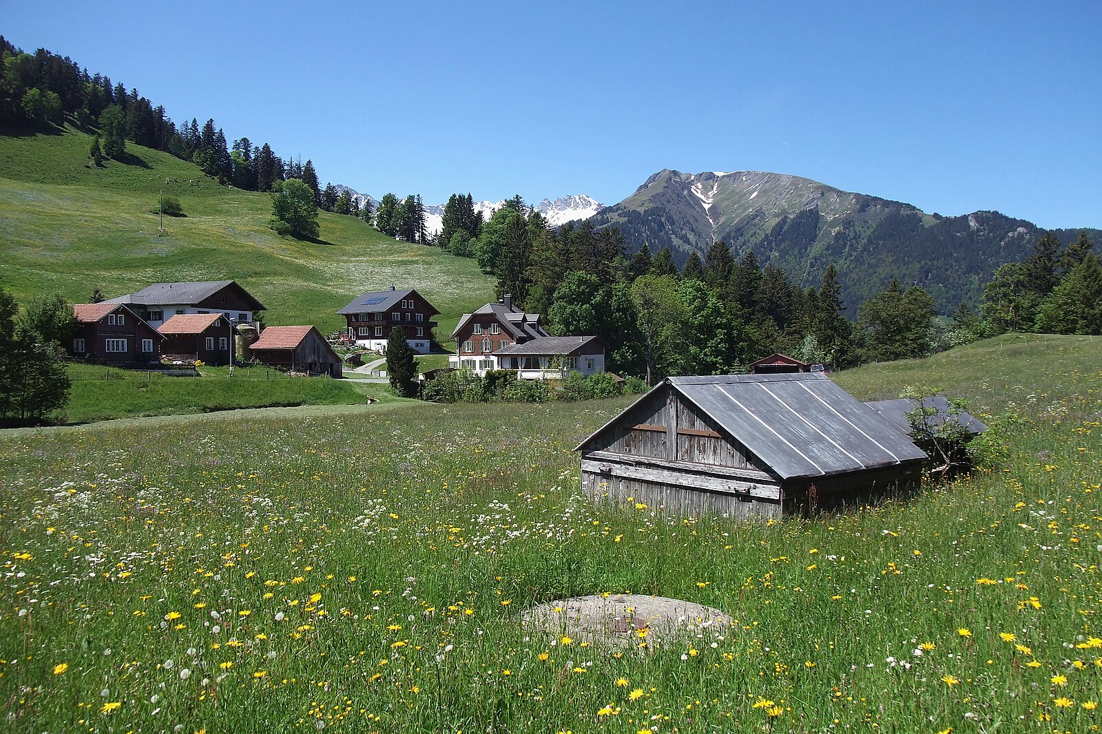
A quiet plateau above the Rhine Valley known for its pastoral serenity and local hiking trails away from the tourist crowds.
Highlights
- Rural Swiss charm
- Panoramic valley views
- Off-grid tranquility
- Sun-drenched plateaus
Key Facts
- Altitude: 1184m
- Top lift: 1447m
- Ski pistes: 1km
- Ski lifts: 1
- Population: 29
- Lakes nearby: 14
- MTB trails: 323.5km
- Mountain huts: 7
Ski Area
Weather and 10-day forecast for Tristeli – St. Margrethenberg
- Today: 6 to 15 °C, clear sky, 12 h of sunshine
- Freezing level today: about 3850 m (3220 to 4170 m)
| Day | Min / max | Sky | Precipitation | Sunshine |
|---|---|---|---|---|
| pt., 25 wrz | 6 / 15 °C | clear sky | dry | 12 h sun |
| sob., 26 wrz | 10 / 19 °C | clear sky | dry | 12 h sun |
| niedz., 27 wrz | 12 / 21 °C | clear sky | dry | 12 h sun |
| pon., 28 wrz | 12 / 22 °C | partly cloudy | dry | 5 h sun |
| wt., 29 wrz | 12 / 23 °C | clear sky | dry | 11 h sun |
| śr., 30 wrz | 11 / 20 °C | overcast | dry | 4 h sun |
| czw., 1 paź | 11 / 21 °C | clear sky | dry | 10 h sun |
| pt., 2 paź | 8 / 12 °C | rain showers | dry | 0 h sun |
| sob., 3 paź | 7 / 17 °C | drizzle | dry | 11 h sun |
| niedz., 4 paź | 7 / 17 °C | overcast | dry | 1 h sun |
Things to do in Tristeli – St. Margrethenberg
Hikes nearby — Tristeli – St. Margrethenberg (20)
20+ curated hiking trails around Tristeli – St. Margrethenberg, sourced from OpenStreetMap and enriched with distance, elevation gain and difficulty.
-
WALSA-Weg - Etappe 1
From Bad Ragaz — where thermal waters have flowed since 1840 — the route climbs through open mixed forest past the walkable ruins of Freudenberg castle, opening onto sweeping views across the Rhine valley and the Graubünden mountain world. The final ascent threads through the Valeistobel gorge, crossing seven bridges before reaching the hamlet of Garschlu.
-
Taminaschlucht Rundweg
The Taminaschlucht Rundweg leads through a legendary landscape where nature, history, and culture converge, with the mystical Tamina gorge at its heart.
-
Prättigauer Höhenweg - Etappe 1
The route traces the Swiss-Austrian border through the Silvrettagruppe and Rätikon, cresting the Jägglischhorn before descending to the Bergsteigerdorf St. Antönien. Views from the ridge stretch across the peaks of the Rätikon, with the Schesaplana — at 2'965 m the highest summit in the Prättigau — commanding the northern horizon.
-
Tardisbrugg- Bad Ragaz
-
Bad Ragaz (Bf) - Tardisbrugg
-
Meienfeld - Jenins
-
Fläsch - Meienfeld
-
Meienfeld - Malans
-
Mainefeld Enderlinhütte
-
Heidipfad
-
Parkplatz Chrützli-St. Luzisteig
-
Garschlu - Bad Ragaz
-
Via Alpina
-
WALSA-Weg - Etappe 2
-
Rütiwald - Garschlu
-
WALSA-Weg: Bad Ragaz Bahnhof - 3923
-
Ellhorn Rundweg
-
5-Seen-Wanderung Pizol
-
Via Alpina: Sargans - Weisstannen
-
Prättigauer Höhenweg: Landquart Bahnhof - Schesaplana Hütte
Mountain biking near Tristeli – St. Margrethenberg
- Graubünden Bike - Etappe 2 (Laax - Untervaz)
- Pizol Pardiel Bike
- Ochsenbergweg
- Neuwald
- Chimmispitz Flowtrail
- Fadellaweg
- Martinsbrunnen
- Pardielstrasse
Getting to Tristeli – St. Margrethenberg
Door-to-door travel times as used by the MR. ALPS ranking.
- Nearest airport: Sankt Gallen Altenrhein Airport (ACH), 56 km away, about 57 min by road
- Zürich: 1h22 by car, 107 km
- Luzern: 1h41 by car, 130 km
- Basel: 2h19 by car, 190 km
- Innsbruck: 2h45 by car, 205 km
- Biel/Bienne: 2h45 by car, 228 km
- Bern: 2h46 by car, 229 km
Where to stay in Tristeli – St. Margrethenberg
63 places to stay for a night on 2026-09-25, from 274 EUR per night, median 382 EUR. Prices are direct with hotels and destinations, compared live on the Tristeli – St. Margrethenberg page.