Rifflsee
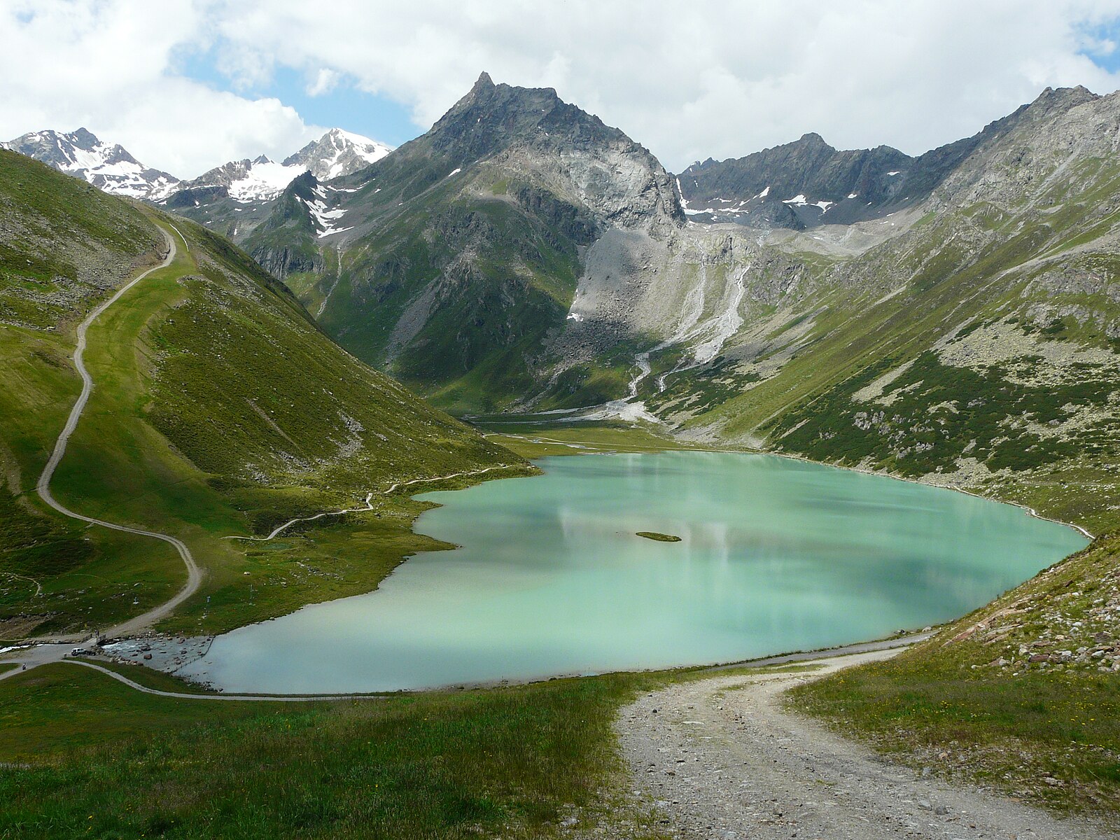
About Rifflsee
High-altitude Pitztal escape where rugged granite peaks frame a turquoise glacial lake and quiet, uncrowded slopes.
Highlights
- Glacial lake views
- High-alpine tranquility
- Beginner-friendly terrain
- Authentic mountain huts
Key Facts
- Altitude: 1640m
- Top lift: 2800m
- Ski pistes: 26km
- Ski lifts: 6
- Lakes nearby: 19
- MTB trails: 188.2km
- Mountain huts: 34
Ski Area
Karnety sezonowe obejmujące tę miejscowość
Weather and 10-day forecast for Rifflsee
- Today: 2 to 11 °C, partly cloudy, 4 h of sunshine
- Freezing level today: about 3043 m (2600 to 3290 m)
| Day | Min / max | Sky | Precipitation | Sunshine |
|---|---|---|---|---|
| czw., 24 wrz | 2 / 11 °C | partly cloudy | dry | 4 h sun |
| pt., 25 wrz | 2 / 11 °C | clear sky | dry | 10 h sun |
| sob., 26 wrz | 6 / 15 °C | clear sky | dry | 11 h sun |
| niedz., 27 wrz | 9 / 17 °C | clear sky | dry | 12 h sun |
| pon., 28 wrz | 9 / 17 °C | clear sky | dry | 12 h sun |
| wt., 29 wrz | 11 / 19 °C | rain showers | dry | 6 h sun |
| śr., 30 wrz | 11 / 19 °C | clear sky | dry | 8 h sun |
| czw., 1 paź | 8 / 16 °C | clear sky | dry | 10 h sun |
| pt., 2 paź | 5 / 7 °C | drizzle | dry | 0 h sun |
| sob., 3 paź | -1 / 9 °C | drizzle | dry | 2 h sun |
Things to do in Rifflsee
Hikes nearby — Rifflsee (17)
17 curated hiking trails around Rifflsee, sourced from OpenStreetMap and enriched with distance, elevation gain and difficulty.
-
Wanderweg 927
-
Wanderweg 926
-
Ötztal Trek Etappe 19
Rüsselsheimer Hütte → Hauerseehütte
-
Ötztal Trek Etappe 18
Braunschweiger Hütte → Rüsselsheimer Hütte
-
Via Alpina Yellow B35
The trail descends beside the glacier tongue of the Mittelbergferner and the roaring Pitze river, leaving the world of glaciers behind. From the valley, a Postbus carries walkers along the Pitztal back into civilisation.
-
Wanderweg 925
-
Wanderweg 924
This panoramic trail in Tyrol begins at a parking area near a *Herberg* (inn) and follows the Taschachbach, set within the high-alpine terrain of Kaunergrat Nature Park.
-
Cottbuser Höhenweg
-
Fuldaer Höhenweg
-
Offenbacher Höhenweg
-
Mainzer Höhenweg
The Mainzer Höhenweg is a demanding multi-day alpine trail (rated T6) traversing rugged terrain between the Rüsselsheimer Hütte in the north and the Braunschweiger Hütte in the south, through the Geigenkamm subgroup of the Ötztal Alps. Its highest point is the Wassertalkogel at 3,252 m, near which sits the Rheinland-Pfalz-Biwak emergency bivouac at 3,247 m — a nine-bunk shelter amid dark rock and scree — with views stretching to the Wildspitze.
-
Via Alpina Yellow B33
Vent - Zwieselstein
-
Ötztal Trek Etappe 17
Breslauer Hütte → Braunschweiger Hütte
-
Venter Höhenweg
-
Sonnberg-Höhenweg
-
Aachener Höhenweg
-
Panoramaweg
Mountain biking near Rifflsee
- Polltal - Breitlehn Alm
- Langetsberg
- Fallwand - Tiefental
- Verpeilalm
- Arzler Alm - Tiefental
- Mittelbergweg
- 34 A
- Troalen Line
Getting to Rifflsee
Door-to-door travel times as used by the MR. ALPS ranking.
- Nearest airport: Innsbruck Airport (INN), 50 km away, about 1h18 by road
- Innsbruck: 2h13 by train, 97 km
- München: 3h41 by car, 188 km
- Bolzano - Bozen: 3h44 by car, 209 km
- Trento: 4h15 by car, 265 km
- Zürich: 4h33 by car, 278 km
- Luzern: 4h54 by car, 294 km
Where to stay in Rifflsee
93 places to stay for a night on 2026-09-25, from 108 EUR per night, median 245 EUR. Prices are direct with hotels and destinations, compared live on the Rifflsee page.