Davos
Webcam na żywo


Otwarte wyciągi: 0/56
Raport śniegowy
- Ostatnie 24h: 0 cm
- Ostatnie 72h: 0 cm
- Ostatnie 7 dni: 0 cm
- Ostatnie 7 dni: Dolina 0cm · Środek stoku 0cm · Szczyt 0cm
- Suma sezonowa: 27.2 cm
Ośrodki narciarskie otwarte teraz · Raport śniegowy
About Davos
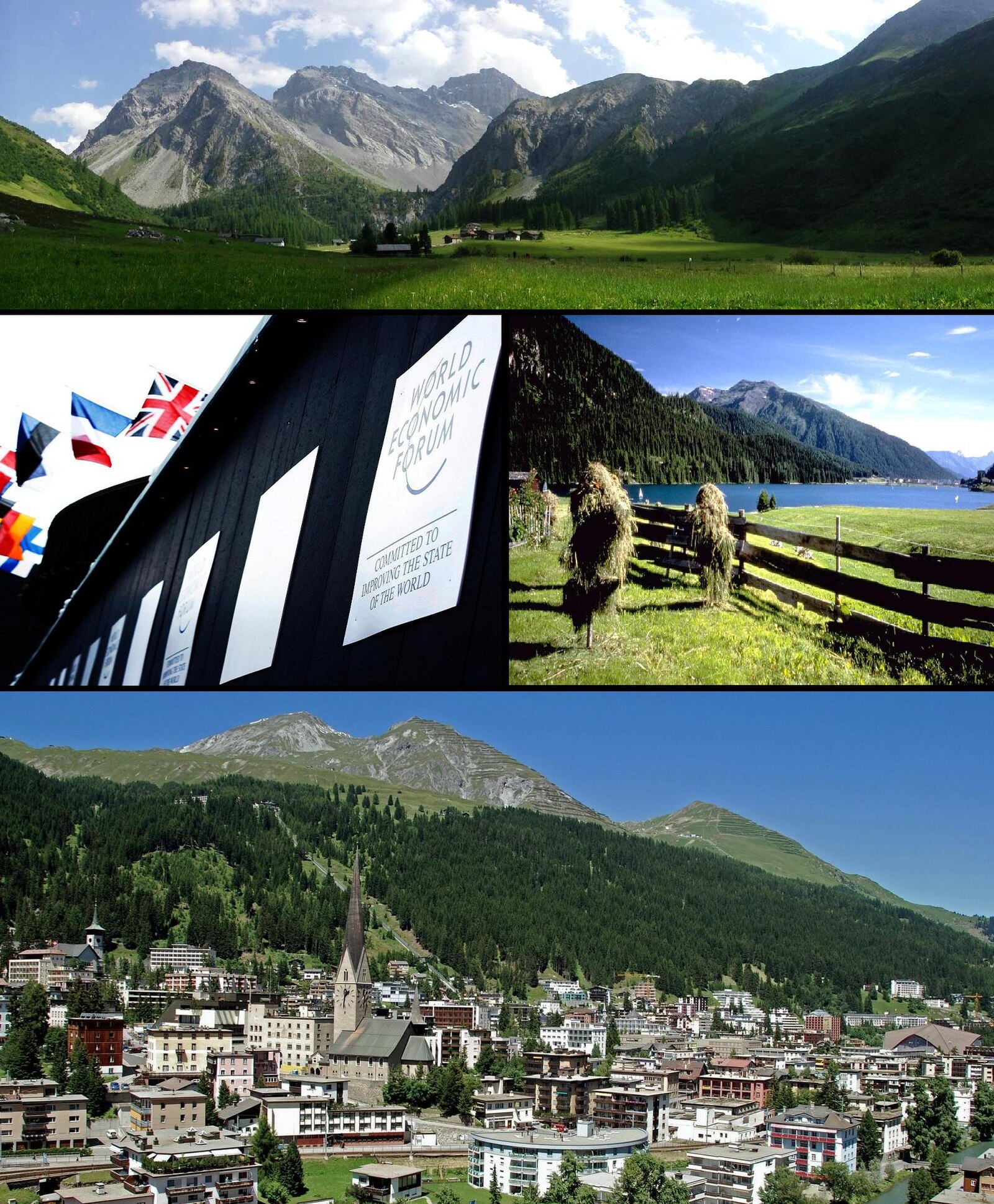
The highest town in Europe, famous for the World Economic Forum and extensive cross-country trails.
Highlights
- World Economic Forum
- Cross-country paradise
- Largest town in Alps
- Sanatorium heritage
Key Facts
- Altitude: 1569m
- Top lift: 2844m
- Ski pistes: 248km
- Ski lifts: 56
- Population: 10,832
- Lakes nearby: 19
- MTB trails: 202km
- Mountain huts: 10
Ski Area
Karnety sezonowe obejmujące tę miejscowość
Weather and 10-day forecast for Davos
- Today: 3 to 17 °C, clear sky, 12 h of sunshine
- Freezing level today: about 3705 m (3500 to 3840 m)
| Day | Min / max | Sky | Precipitation | Sunshine |
|---|---|---|---|---|
| śr., 23 wrz | 3 / 17 °C | clear sky | dry | 12 h sun |
| czw., 24 wrz | 5 / 16 °C | overcast | dry | 3 h sun |
| pt., 25 wrz | 4 / 17 °C | clear sky | dry | 12 h sun |
| sob., 26 wrz | 7 / 20 °C | clear sky | dry | 12 h sun |
| niedz., 27 wrz | 10 / 22 °C | clear sky | dry | 12 h sun |
| pon., 28 wrz | 11 / 22 °C | clear sky | dry | 12 h sun |
| wt., 29 wrz | 12 / 22 °C | clear sky | dry | 12 h sun |
| śr., 30 wrz | 11 / 22 °C | mainly clear | dry | 12 h sun |
| czw., 1 paź | 9 / 20 °C | rain showers | 16 mm rain | 11 h sun |
| pt., 2 paź | 5 / 10 °C | rain showers | 25 mm rain | 0 h sun |
Things to do in Davos
Hikes nearby — Davos (20)
20+ curated hiking trails around Davos, sourced from OpenStreetMap and enriched with distance, elevation gain and difficulty.
-
Mittelbünden-Panoramaweg Stage 2
The route passes through Alp Medergen, a former Walser Alp with a mountain tavern, before narrowing to a mountain trail where the "Tritt" serves as a defining landmark. From there, the path opens to sweeping views of Davos far below.
-
Walserweg - Etappe 14
This stage of the Walserweg long-distance trail through the canton of Graubünden runs as a point-to-point route from Sertig Dörfli — a small mountain village with a little church, set in the Sertigtal valley beneath peaks including the Mittagshorn, Plattenflue, and Hoch Ducan — into Davos. The trail begins in a landscape described as "hinter den Eggen," where cattle graze on pastures and a village fountain murmurs beside a handful of houses.
-
Via son Giachen
-
Schanfigger Höhenweg - Etappe 2
The second stage of the Schanfigger Höhenweg runs from Tschiertschen/Furgglis to Arosa, tracing old mule-driver paths through the Schanfigg valley on its way toward the alpine resort. Along the route, walkers pass through original Walser settlements and across sunny high plateaus, with the side valleys of Sapün and Fondei cutting away into wilder terrain.
-
Via son Giachen
-
Walserweg - Etappe 15
-
Hohe Promenade
-
Jakobshorn - Ischalp
-
Davosersee Rundweg
Rollstuhlwanderung
-
Davos - Clavadel
-
Drusatscha - Chaltboden
-
Strelapass - Parsennhütte
-
Alpenweg Davos
A high-altitude traverse along the sunny side of the Landwasser valley, the Alpenweg Davos runs as a point-to-point route from the Höhenweg station down to Glaris, delivering a magnificent mountain panorama throughout.
-
Chaltboden - Pischa
The route follows the Pischagrat ridge from Tschuggen, passing over the Hüreli before descending to Alp Drusatscha and on into Davos Dorf. At its highest, the trail reaches 2483 m — a ridge walk that drops nearly 1000 m to the valley floor below.
-
Dörferweg Schanfigg
Wanderweg durch traditionelle Dörfer im Tal Schanfigg. Bis Peist als Rundwanderung möglich, danach Stich bis Arosa. Im Tal kann auch die Bahn genutzt werden. Teil der Wanderwege Graubünden. Zwischen Peist und Langwies Wegführung unklar.
-
Jakobsweg Graubünden: Davos Dorf - Langwies Dorf
-
Schanfigger Höhenweg: Jatz Heimeli - Strassberg
-
Jakobsweg Graubünden: Dürrboden - Davos Dorf
-
Walserweg: Sertig Dörfli - Davos Platz Bahnhof
-
Mittelbünden-Panoramaweg: Arosa Obersee - Davos Platz Bahnhof
Mountain biking near Davos
- Parsenn
- Davoser Taltour
- Panoramaweg
- Bolgen-Trail
- Büschalpweg
- Strelapassweg
- Podestatenalpweg
- Chüggelibahn
Getting to Davos
Door-to-door travel times as used by the MR. ALPS ranking.
- Nearest airport: Bodensee Airport Friedrichshafen (FDH), 100 km away, about 2h05 by road
- Zürich: 1h56 by car, 148 km
- Luzern: 2h16 by car, 171 km
- Innsbruck: 2h30 by car, 178 km
- Bolzano - Bozen: 2h50 by car, 167 km
- Basel: 2h54 by car, 231 km
- Trento: 3h19 by car, 218 km
Where to stay in Davos
200 places to stay for a night on 2026-09-25, from 115 EUR per night, median 288 EUR. Prices are direct with hotels and destinations, compared live on the Davos page.