Crans-Montana (Crans Montana)
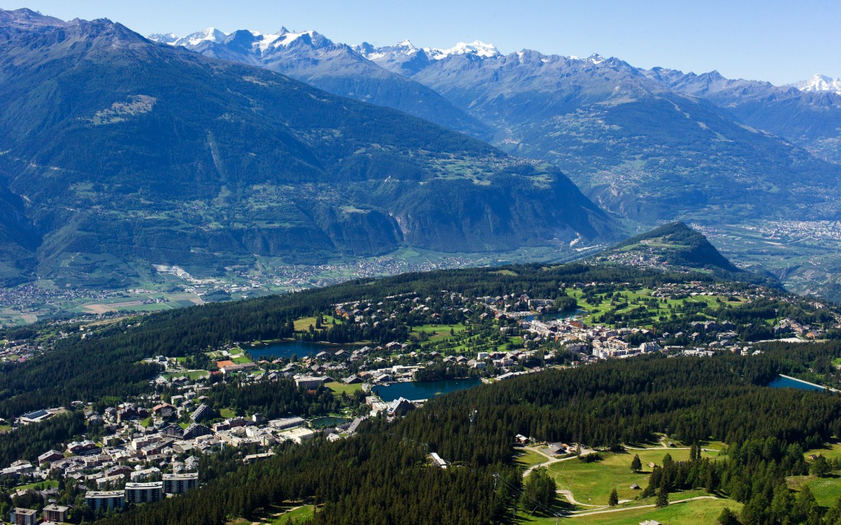
Webcam na żywo
Otwarte wyciągi: 0/24
Raport śniegowy
- Ostatnie 24h: 0 cm
- Ostatnie 72h: 0 cm
- Ostatnie 7 dni: 0 cm
- Ostatnie 7 dni: Dolina 0cm · Środek stoku 0cm · Szczyt 0cm
- Suma sezonowa: 0 cm
Ośrodki narciarskie otwarte teraz · Raport śniegowy
About Crans-Montana (Crans Montana)
A high-altitude urban plateau where luxury shopping and championship golf meet the sunniest slopes in the Swiss Valais.
Highlights
- Designer boutique shopping
- Championship golf courses
- Sun-drenched south-facing slopes
- Cosmopolitan mountain vibe
Key Facts
- Altitude: 1506m
- Top lift: 2878m
- Ski pistes: 140km
- Ski lifts: 19
- Population: 10,488
- Lakes nearby: 28
- MTB trails: 112km
- Mountain huts: 17
Ski Area
Karnety sezonowe obejmujące tę miejscowość
Weather and 10-day forecast for Crans-Montana (Crans Montana)
- Today: 7 to 19 °C, partly cloudy, 7 h of sunshine
- Freezing level today: about 4175 m (3830 to 4400 m)
| Day | Min / max | Sky | Precipitation | Sunshine |
|---|---|---|---|---|
| pt., 25 wrz | 7 / 19 °C | partly cloudy | dry | 7 h sun |
| sob., 26 wrz | 10 / 20 °C | clear sky | dry | 11 h sun |
| niedz., 27 wrz | 10 / 22 °C | clear sky | dry | 12 h sun |
| pon., 28 wrz | 10 / 22 °C | partly cloudy | dry | 8 h sun |
| wt., 29 wrz | 10 / 22 °C | partly cloudy | dry | 5 h sun |
| śr., 30 wrz | 11 / 23 °C | clear sky | dry | 10 h sun |
| czw., 1 paź | 11 / 20 °C | partly cloudy | dry | 7 h sun |
| pt., 2 paź | 9 / 16 °C | overcast | 0 mm rain | 11 h sun |
| sob., 3 paź | 6 / 16 °C | drizzle | 1 mm rain | 11 h sun |
| niedz., 4 paź | 7 / 13 °C | drizzle | 7 mm rain | 11 h sun |
Things to do in Crans-Montana (Crans Montana)
Hikes nearby — Crans-Montana (Crans Montana) (20)
20+ curated hiking trails around Crans-Montana (Crans Montana), sourced from OpenStreetMap and enriched with distance, elevation gain and difficulty.
-
Walliser Sonnenweg Etappe 1
-
03-Chemin du Vignoble
-
04-Chemin du Vignoble
-
Cran - Er de Chermignon (Ancien bisse du Ro)
-
Pra du taillour-Pas de l'ours
The route traces the Bisse du Ro — one of the Valais region's ancient irrigation channels — passing through Les Toules and Pra du Taillour before reaching the Pas de l'Ours, with a dramatic suspension bridge (Passerelle du Bisse du Ro) among the landmarks along the way.
-
Bisse de lens
-
Bisse d'Ayent
-
Er de Chermignon-Pra du Taillour
-
Plaine Morte-Les Violettes
-
Rebweg
-
Mayens de Réchy-Brie
-
Bisse de Bitailla
The Bisse de Bitailla, first documented in 1307, leads through the Vallo de la Sionne from the water intake at Les Évouettes to St-Romain, following a channel that runs alternately enclosed and open through the landscape via Saxonne. One of the few bisses in Valais to carry water year-round, the route follows the "Chemin des papillons" and the Tour du Gô markings along this ancient irrigation channel.
-
Iffigenalp-Stierenläger
-
Lenk (Ritzdole) - Lenk (Sibe Brünne - Rezlibergli)
-
Ritzdole-Iffigen Läger
-
Grand Bisse d'Ayent
-
Chemin du vignoble: 5 - Venthône
-
Sentier Panorama 4000
-
Walliser Sonnenweg: Crans - Leukerbad
-
Chemin du vignoble: Venthône - Leuk SBB / Susten
Mountain biking near Crans-Montana (Crans Montana)
- Freeride Grand Montana
- Flowtrail Montana-Village – Loc
- Bisse du Ro
- mtb_red_freeride
- Chemin de Cry d'Er
- Grand Bisse de Lens
Getting to Crans-Montana (Crans Montana)
Door-to-door travel times as used by the MR. ALPS ranking.
- Nearest airport: Geneva International Airport (GVA), 106 km away, about 2h19 by road
- Lausanne: 1h37 by car, 120 km
- Bern: 2h13 by car, 177 km
- Genève: 2h15 by car, 182 km
- Biel/Bienne: 2h41 by car, 216 km
- Annecy: 2h47 by car, 188 km
- Chambéry: 3h11 by car, 232 km
Where to stay in Crans-Montana (Crans Montana)
200 places to stay for a night on 2026-10-02, from 91 EUR per night, median 763 EUR. Prices are direct with hotels and destinations, compared live on the Crans-Montana (Crans Montana) page.