Druogno
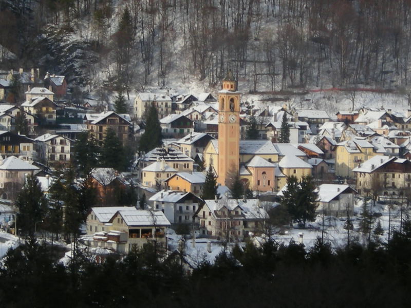
About Druogno
A gateway to the Vigezzo Valley where Italian pine forests meet the Vigezzina railway for a slow-paced, rustic escape.
Highlights
- Alpine pine forests
- Historic narrow-gauge rail
- Piedmontese mountain cuisine
- Quiet meadow trails
Key Facts
- Altitude: 828m
- Top lift: 888m
- Ski pistes: 0.7km
- Ski lifts: 1
- Lakes nearby: 3
- MTB trails: 59.5km
- Mountain huts: 6
Ski Area
Weather and 10-day forecast for Druogno
- Today: 12 to 19 °C, clear sky, 8 h of sunshine
- Freezing level today: about 4042 m (3920 to 4270 m)
| Day | Min / max | Sky | Precipitation | Sunshine |
|---|---|---|---|---|
| wo 23 sep | 12 / 19 °C | clear sky | dry | 8 h sun |
| do 24 sep | 12 / 22 °C | overcast | dry | 3 h sun |
| vr 25 sep | 12 / 18 °C | overcast | dry | 2 h sun |
| za 26 sep | 12 / 19 °C | clear sky | dry | 10 h sun |
| zo 27 sep | 11 / 21 °C | clear sky | dry | 11 h sun |
| ma 28 sep | 12 / 23 °C | clear sky | dry | 12 h sun |
| di 29 sep | 16 / 23 °C | clear sky | dry | 12 h sun |
| wo 30 sep | 16 / 21 °C | partly cloudy | dry | 8 h sun |
| do 1 okt | 14 / 16 °C | drizzle | dry | 0 h sun |
| vr 2 okt | 7 / 14 °C | rain showers | dry | 3 h sun |
Things to do in Druogno
Hikes nearby — Druogno (17)
17 curated hiking trails around Druogno, sourced from OpenStreetMap and enriched with distance, elevation gain and difficulty.
-
M21 - Toceno - San Pantaleone
-
M27 - Vocogno - Piana di Vigezzo
-
M15 - Arvogno - Pizzo la Scheggia
-
M17 - Coier - Passo Campeia
-
M29 - Craveggia - Bocchetta della Cima
-
M00 - Via del Mercato da Masera a Re (prima sezione)
-
M23 - bivio M21 presso San Gerolamo - Bocchetta di Muino
-
M19 - Alpe Verzasca - Pioda di Crana
Well marked path. First part in the forest path not too obvious, then trail ridge also exposed. Steep slopes; last stretch very exposed to avoid in case of rain
-
M35 - Zornasco - Alpe Fontana Verde
Initially very steep path once you reach the ridge follow it with easier slopes. A small stretch at altitude 1147 on a steep slope on the north side requires attention. The last stretch from altitude 1410 to Alpe Fontana Verde is suitable for tourists
-
M16 - Malesco - Cappella del Group
-
M31 - Craveggia - Bocchetta della Cima
-
M25 - Promez - Forcola di Larecchio
-
L02 - Altoggio - Pizzo della Forcola
-
M33 - in Bies - Bocchetta di Sant'Antonio
-
M47 - Alpe Cortaccio - Laghetti dei Muini
-
Alta Via dei Gridoni - Tappa 1
-
A00a - Via Francisca (prima sezione)
Mountain biking near Druogno
- Downhill-Track
- La Colma
Getting to Druogno
Door-to-door travel times as used by the MR. ALPS ranking.
- Nearest airport: Lugano Airport (LUG), 40 km away, about 1h26 by road
- Milano: 1h50 by car, 141 km
- Torino: 2h21 by car, 193 km
- Brescia: 2h42 by car, 227 km
- Luzern: 2h52 by car, 198 km
- Genova: 2h55 by car, 256 km
- Lausanne: 3h05 by car, 221 km
Where to stay in Druogno
79 places to stay for a night on 2026-09-18, from 146 EUR per night, median 156 EUR. Prices are direct with hotels and destinations, compared live on the Druogno page.