Val Gardena-Gröden
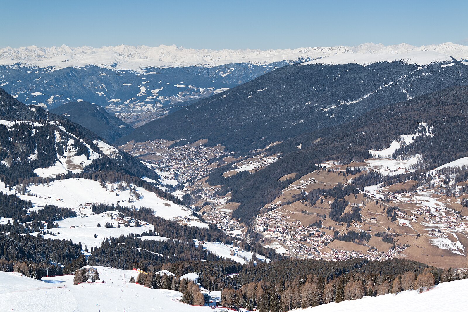
Live webcam
Open liften: 0/156
Sneeuwbericht
- Laatste 24 uur: 0 cm
- Laatste 72 uur: 0 cm
- Laatste 7 dagen: 0 cm
- Laatste 7 dagen: Dal 0cm · Middenstation 0cm · Top 0cm
- Seizoenstotaal: 0.1 cm
Skigebieden nu open · Sneeuwbericht
About Val Gardena-Gröden
A Ladin-speaking valley where jagged Dolomite peaks meet refined South Tyrolean hospitality and the legendary Sellaronda circuit.
Highlights
- Ladin woodcarving heritage
- Gourmet mountain huts
- Dramatic limestone spires
- Panoramic ski circuits
Key Facts
- Altitude: 1313m
- Top lift: 2507m
- Ski pistes: 116.3km
- Ski lifts: 79
- Population: 10,000
- Lakes nearby: 5
- MTB trails: 256km
- Mountain huts: 57
Ski Area
Sella Ronda – Alta Badia/Arabba-Marmolada/Val Gardena-Gröden/Canazei
Inbegrepen in deze seizoenpassen
Weather and 10-day forecast for Val Gardena-Gröden
- Today: 7 to 17 °C, partly cloudy, 8 h of sunshine
- Freezing level today: about 4108 m (3840 to 4280 m)
| Day | Min / max | Sky | Precipitation | Sunshine |
|---|---|---|---|---|
| zo 20 sep | 7 / 17 °C | partly cloudy | dry | 8 h sun |
| ma 21 sep | 7 / 14 °C | overcast | dry | 4 h sun |
| di 22 sep | 4 / 12 °C | clear sky | dry | 13 h sun |
| wo 23 sep | 3 / 12 °C | clear sky | dry | 10 h sun |
| do 24 sep | 5 / 14 °C | clear sky | dry | 12 h sun |
| vr 25 sep | 6 / 16 °C | overcast | dry | 1 h sun |
| za 26 sep | 6 / 17 °C | clear sky | dry | 11 h sun |
| zo 27 sep | 7 / 15 °C | partly cloudy | dry | 4 h sun |
| ma 28 sep | 6 / 18 °C | clear sky | dry | 11 h sun |
| di 29 sep | 7 / 18 °C | partly cloudy | dry | 6 h sun |
Things to do in Val Gardena-Gröden
Hikes nearby — Val Gardena-Gröden (17)
17 curated hiking trails around Val Gardena-Gröden, sourced from OpenStreetMap and enriched with distance, elevation gain and difficulty.
-
Dolomites World Heritage Geotrail 10
-
La Ferata
-
Hans und Paula Steger Weg - Sentiero Hans e Paula Steger
-
Troi Paian
The Troi Paian — "Pagan's Pathway" — is an ancient trade route dating to the Bronze Age that once connected Venetia with Valle Isarco. It leads to the Church of St. Jakob, the oldest and highest church in Val Gardena, a late-Gothic bell tower of brilliant white stone perched above steep evergreen slopes at more than 1,500 m elevation.
-
Poststeig
-
Dolomites World Heritage Geotrail 11
-
Planetenweg
-
Raida dl luech
A village loop through the heart of Santa Cristina, this Ladin-named circuit passes a Romanesque-Gothic church first mentioned in 1342, life-size bronze figures, the world's biggest hand-carved crib, and two waterfalls. The route can be walked clockwise or anticlockwise, with shortcut options at various points along the way.
-
Via Alpina Yellow B25
Rifugio Antermoia - Schlernhaus / Rifugio Bolzano
-
Alta via n. 9 delle Dolomiti - Dolomiten-Höhenweg Nr. 9
L’Alta via delle Dolomiti n. 9, chiamata anche La trasversale, è un percorso di circa 150 km che parte da Danta - Santo Stefano di Cadore, in provincia di Belluno, e arriva a Bagni di Lavinia Bianca - Tires, in provincia di Bolzano.
-
Geotrail Bula - Pufels - Bulla
-
Puflatschumrundung - Giro del Bulacia
-
Seiser-Alm-Steig - Sentiero Alpe di Siusi
-
Wassersteig
-
Geologensteig
-
Adolf Munkel Weg - Via delle Odle
-
Col Pelous
Mountain biking near Val Gardena-Gröden
- MTB 3: Raida da Sacun
- MTB 21: Raida de Gherdëina
- Variante La Buja
- Variante Mastlé - Sacun
- Family Tour Val d'Anna
Getting to Val Gardena-Gröden
Door-to-door travel times as used by the MR. ALPS ranking.
- Nearest airport: Innsbruck Airport (INN), 83 km away, about 1h54 by road
- Bolzano - Bozen: 43 min by car, 39 km
- Trento: 1h16 by car, 96 km
- Innsbruck: 1h39 by car, 116 km
- Verona: 2h14 by car, 191 km
- Brescia: 2h44 by car, 227 km
- Padova: 2h58 by car, 270 km
Where to stay in Val Gardena-Gröden
200 places to stay for a night on 2026-09-25, from 287 EUR per night, median 618 EUR. Prices are direct with hotels and destinations, compared live on the Val Gardena-Gröden page.