Terenten (Terento)
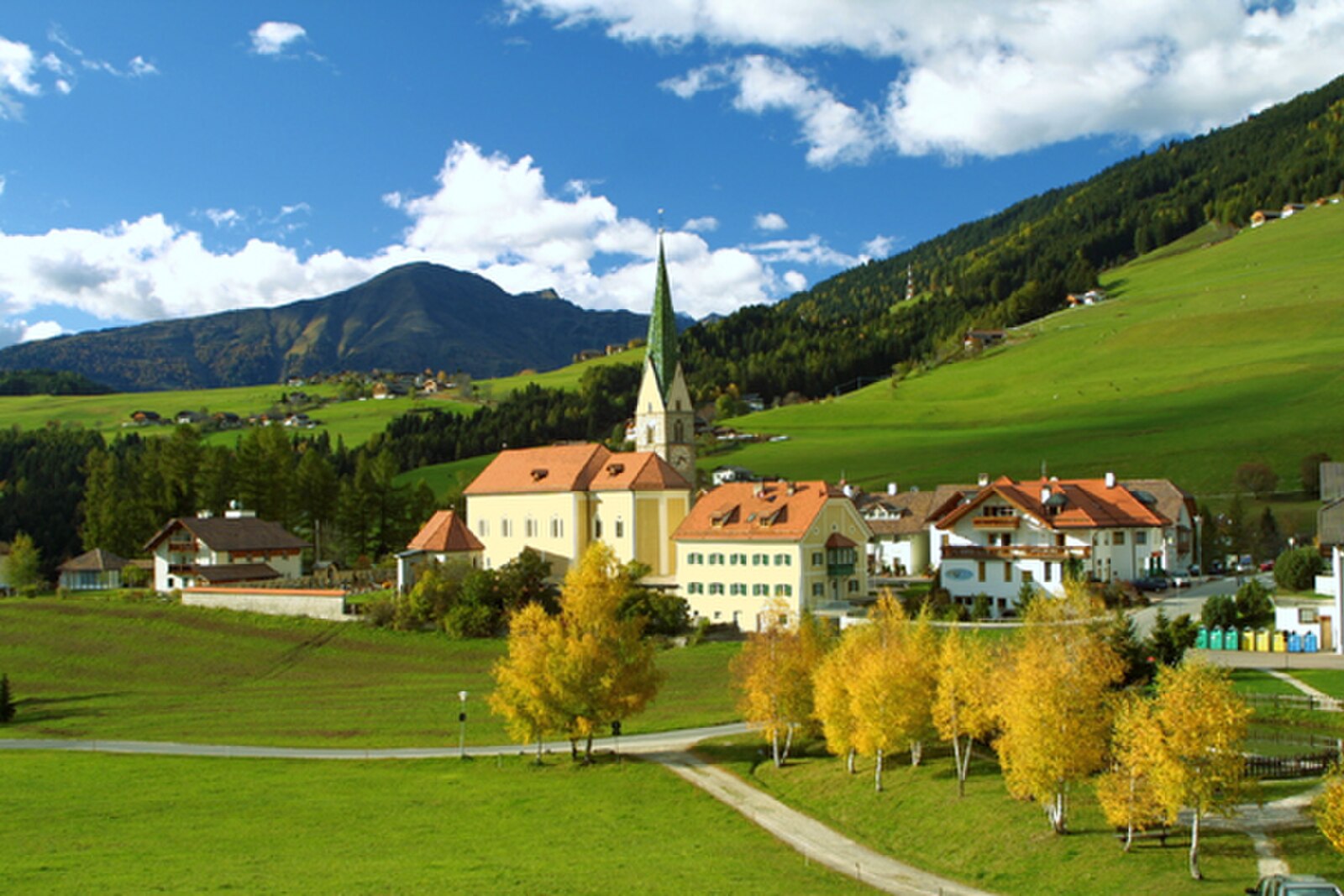
Live webcam



Open liften: 0%
Sneeuwbericht
- Laatste 24 uur: 0 cm
- Laatste 72 uur: 0 cm
- Laatste 7 dagen: 0 cm
- Laatste 7 dagen: Dal 0cm · Middenstation 0cm · Top 0cm
- Seizoenstotaal: 0 cm
Skigebieden nu open · Sneeuwbericht
About Terenten (Terento)
Known as the sun parlor of the Puster Valley, this South Tyrolean village thrives on ancient grain mills and long daylight hours.
Highlights
- Historic water mills
- Sun-drenched plateau
- Traditional grain festivals
- Panoramic hiking trails
Key Facts
- Altitude: 1221m
- Top lift: 1404m
- Ski pistes: 1km
- Ski lifts: 1
- Population: 1,799
- Lakes nearby: 15
- MTB trails: 29.8km
- Mountain huts: 5
Ski Area
Weather and 10-day forecast for Terenten (Terento)
- Today: 10 to 18 °C, overcast, 5 h of sunshine
- Freezing level today: about 3625 m (3080 to 4080 m)
| Day | Min / max | Sky | Precipitation | Sunshine |
|---|---|---|---|---|
| ma 21 sep | 10 / 18 °C | overcast | dry | 5 h sun |
| di 22 sep | 7 / 15 °C | clear sky | dry | 13 h sun |
| wo 23 sep | 4 / 16 °C | clear sky | dry | 11 h sun |
| do 24 sep | 7 / 17 °C | partly cloudy | dry | 4 h sun |
| vr 25 sep | 4 / 16 °C | clear sky | dry | 9 h sun |
| za 26 sep | 7 / 19 °C | clear sky | dry | 10 h sun |
| zo 27 sep | 9 / 18 °C | partly cloudy | dry | 6 h sun |
| ma 28 sep | 8 / 23 °C | clear sky | dry | 11 h sun |
| di 29 sep | 7 / 25 °C | clear sky | dry | 11 h sun |
| wo 30 sep | 7 / 22 °C | clear sky | dry | 11 h sun |
Things to do in Terenten (Terento)
Hikes nearby — Terenten (Terento) (20)
20+ curated hiking trails around Terenten (Terento), sourced from OpenStreetMap and enriched with distance, elevation gain and difficulty.
-
Pfunderer Höhenweg - Alta Via di Fundres
Jagged high-alpine terrain gives way to gentle grass slopes thick with alpine flowers, while mountain lakes sit quietly in rocky cirques and marmots whistle from somewhere unseen. The route runs between Vipiteno (Sterzing) and Bruneck through the Zillertal Alps — remote enough that, by one account, every second hiker turns back before the end.
-
Kaltwassertal
-
Murmeltierweg
-
6 - Meransen => Pfunders
-
11 - Vals => Meransen => Niedervintl
-
7 - Franzensfeste => Mühlbach
-
Rundweg Altfasstal
-
15 - 6 => 17
-
Confinweg/Schöpfungsweg
-
5 - 7 => Spinges
-
Leitensteig
-
Talweg
-
Rundweg Spinges
-
5A - Samweg
-
Valser Rundweg
-
14 - Lüsen
-
11 - Ehrenburg
-
2 - Lüsen => Montal
-
3B - Lüsen
-
1 - Dörferrundweg (Vintl)
Mountain biking near Terenten (Terento)
- Lüsner Alm
- Alter Rodenecker Almweg
- Almweg - Via della Malga
- Jakobstöckl - Colle di San Giacomo
- Schmalzensteig
- Lindenweg
Getting to Terenten (Terento)
Door-to-door travel times as used by the MR. ALPS ranking.
- Nearest airport: Bolzano Airport (BZO), 54 km away, about 59 min by road
- Bolzano - Bozen: 54 min by car, 62 km
- Innsbruck: 1h23 by car, 95 km
- Trento: 1h24 by car, 118 km
- Verona: 2h22 by car, 213 km
- Brescia: 2h53 by car, 249 km
- München: 3h06 by car, 230 km
Where to stay in Terenten (Terento)
200 places to stay for a night on 2026-09-25, from 113 EUR per night, median 489 EUR. Prices are direct with hotels and destinations, compared live on the Terenten (Terento) page.