Superdévoluy
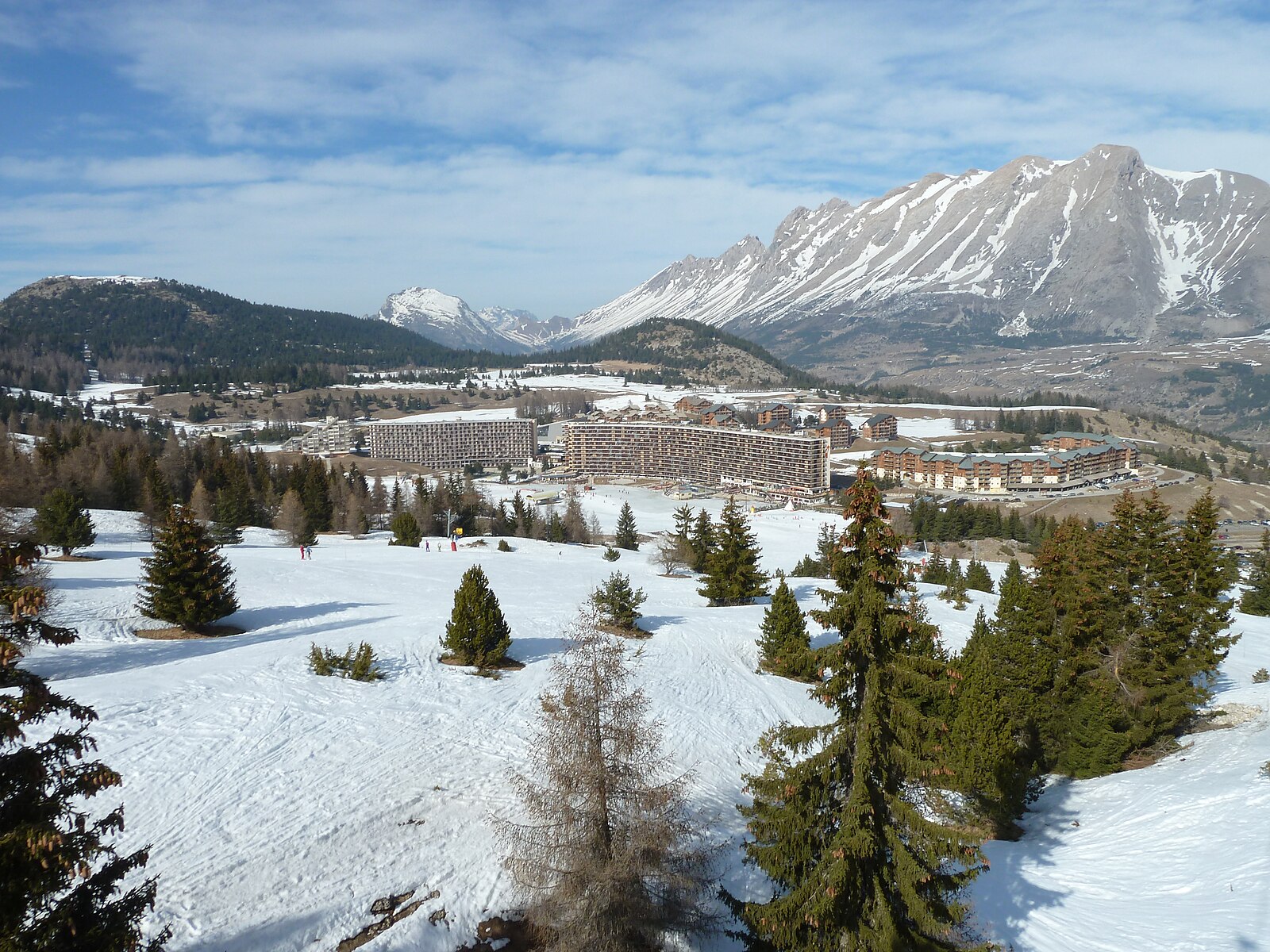
Live webcam
Open liften: 0/20
Sneeuwbericht
- Laatste 24 uur: 0 cm
- Laatste 72 uur: 0 cm
- Laatste 7 dagen: 0 cm
- Laatste 7 dagen: Dal 0cm · Middenstation 0cm · Top 0cm
- Seizoenstotaal: 0 cm
Skigebieden nu open · Sneeuwbericht
About Superdévoluy
A brutalist concrete icon built for convenience, offering a self-contained ski experience with everything housed under one futuristic roof.
Highlights
- Brutalist architecture
- Ski-in convenience
- Family-centric layout
- Massive monolith design
Key Facts
- Altitude: 1499m
- Top lift: 2500m
- Ski pistes: 100km
- Ski lifts: 21
- Population: 885
- Lakes nearby: 5
- MTB trails: 483.2km
- Mountain huts: 6
Ski Area
Weather and 10-day forecast for Superdévoluy
- Today: 11 to 19 °C, clear sky, 10 h of sunshine
- Freezing level today: about 4573 m (4450 to 4800 m)
| Day | Min / max | Sky | Precipitation | Sunshine |
|---|---|---|---|---|
| ma 21 sep | 11 / 19 °C | clear sky | dry | 10 h sun |
| di 22 sep | 8 / 19 °C | clear sky | dry | 12 h sun |
| wo 23 sep | 11 / 20 °C | clear sky | dry | 8 h sun |
| do 24 sep | 11 / 20 °C | partly cloudy | dry | 4 h sun |
| vr 25 sep | 11 / 22 °C | partly cloudy | dry | 6 h sun |
| za 26 sep | 11 / 22 °C | clear sky | dry | 12 h sun |
| zo 27 sep | 12 / 19 °C | overcast | dry | 4 h sun |
| ma 28 sep | 9 / 21 °C | partly cloudy | dry | 11 h sun |
| di 29 sep | 8 / 22 °C | overcast | dry | 11 h sun |
| wo 30 sep | 9 / 21 °C | overcast | dry | 11 h sun |
Things to do in Superdévoluy
Hikes nearby — Superdévoluy (18)
18 curated hiking trails around Superdévoluy, sourced from OpenStreetMap and enriched with distance, elevation gain and difficulty.
-
Eldorado ! Le col du Charnier
-
Col de l'Aup
The trail climbs through forest before opening onto alpine pastures, with views over the summits of the Dévoluy, the Plateau of Pellafol, and the Lake of Sautet. The path crosses steep gullies and rocky ridges before arriving at the col's high pastures.
-
Tour du Dévoluy
A five-day circuit through the Hautes-Alpes, the Tour du Dévoluy threads together rocky summits, dense forests, alpine clearings, mountain lakes, and imposing limestone cliffs and caves — all in a corner of Provence-Alpes-Côte d'Azur that remains far from overcrowded trails. The hardest stage alone climbs 1,226 metres, departing from Superdévoluy village toward the hamlet of Pré Fontaine.
-
Tour du Puy
-
Gorges du Rif
This loop trail climbs from the hamlet of Le Pré toward Truziaud, then opens onto the La Grésière plateau, where a panorama of the northern slopes of the Pic de Bure unfolds.
-
GP Col de Rioupes to Agnières en Dévoluy
-
GP Col de Festre to Agnières en Dévoluy
This loop departs from the Col du Festre and threads through the hamlets of Vaugelé and Agnières-en-Dévoluy, passing through the Bois de Chagier and the ski village of La Joue du Loup, with the route crossing the Torrent along the way.
-
GP Pont du Villard <> GP Bois Rond
-
GP Col de Festre to Lachaup
-
Sentier botanique Dominique Villars
-
Pic de Bure
-
Le Faï
-
Le Puits des Bans
-
GP Vaugelé <> GP Serre du Lievre
-
GP La Cluse <> GP Mouche Chat
-
Traversée du Vercors
-
Col d'Aune
-
Col de Plate Contier
Mountain biking near Superdévoluy
- Les Chemins du Soleil : Valence – Gap – Sisteron
- Tour du Champsaur
- Route du Dévoluy
- Chemin du Clot du Bois
- Chemin des Sagnes
- Chemin dessous des Bois
Getting to Superdévoluy
Door-to-door travel times as used by the MR. ALPS ranking.
- Nearest airport: Lyon Saint-Exupéry Airport (LYS), 134 km away, about 2h26 by road
- Grenoble: 1h32 by car, 96 km
- Chambéry: 2h10 by car, 155 km
- Annecy: 2h42 by car, 202 km
- Lyon: 2h43 by car, 197 km
- Marseille: 2h44 by car, 220 km
- Genève: 3h09 by car, 240 km
Where to stay in Superdévoluy
28 places to stay for a night on 2026-09-25, from 57 EUR per night, median 97 EUR. Prices are direct with hotels and destinations, compared live on the Superdévoluy page.