Schaan
Live webcam



Open liften: 0%
Sneeuwbericht
- Laatste 24 uur: 0 cm
- Laatste 72 uur: 0 cm
- Laatste 7 dagen: 0 cm
- Laatste 7 dagen: Dal 0cm · Middenstation 0cm · Top 0cm
- Seizoenstotaal: 0 cm
Skigebieden nu open · Sneeuwbericht
About Schaan
A refined industrial hub where contemporary art meets Alpine tradition, serving as the cultural and economic heartbeat of the principality.
Highlights
- Modernist architecture
- Thriving arts scene
- High-tech industry
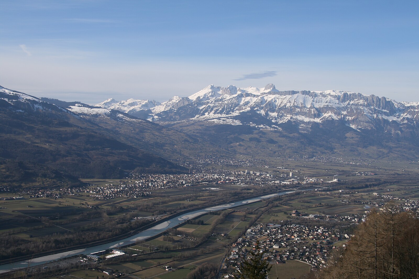
- Rhine valley vistas
Key Facts
- Altitude: 559m
- Top lift: 580m
- Ski lifts: 1
- Population: 473
- Lakes nearby: 21
- MTB trails: 155.9km
- Mountain huts: 15
Ski Area
Weather and 10-day forecast for Schaan
- Today: 8 to 19 °C, clear sky, 12 h of sunshine
- Freezing level today: about 3707 m (3400 to 3910 m)
| Day | Min / max | Sky | Precipitation | Sunshine |
|---|---|---|---|---|
| wo 23 sep | 8 / 19 °C | clear sky | dry | 12 h sun |
| do 24 sep | 12 / 18 °C | overcast | dry | 1 h sun |
| vr 25 sep | 8 / 19 °C | clear sky | dry | 11 h sun |
| za 26 sep | 9 / 23 °C | clear sky | dry | 12 h sun |
| zo 27 sep | 12 / 24 °C | clear sky | dry | 12 h sun |
| ma 28 sep | 11 / 26 °C | clear sky | dry | 12 h sun |
| di 29 sep | 11 / 25 °C | clear sky | dry | 12 h sun |
| wo 30 sep | 11 / 24 °C | partly cloudy | dry | 8 h sun |
| do 1 okt | 9 / 24 °C | partly cloudy | dry | 4 h sun |
| vr 2 okt | 11 / 24 °C | partly cloudy | dry | 7 h sun |
Things to do in Schaan
Hikes nearby — Schaan (20)
20+ curated hiking trails around Schaan, sourced from OpenStreetMap and enriched with distance, elevation gain and difficulty.
-
Gafadurahuette - Drei Schwestern - Kemmi - Silum - Steg
The route passes the Gafadurahütte and climbs through rocky terrain to the Drei Schwestern summits, with views stretching across the Rheinebene and as far as the Bodensee. Along the way, the path threads through stone features including a hollow rock window, with border markers at the Saroja ridge tracing the edge between Austria and Liechtenstein.
-
Via Alpina Stage 57: Gafadurahütte - Sücka
-
Via Alpina Green C1
Suecka -Glaflei- Vaduz
-
Via Alpina Green C2
Beschreibung Zeitraum Länge URL 2001 Vaduz - Sevelen (Teilstueck der VIA ALPINA Route C2 Vaduz - Sargans)
-
Via Alpina Stage 58: Sücka - Sargans
The route passes through the Saminatal valley and the Walsersiedlung Steg before climbing to the Pfälzerhütte, rewarding hikers with a distinctive Alpine panorama. The Pfälzerhütte offers food and overnight accommodation between June and October.
-
Lichtenstein-Weg - Stadtrundgang Vaduz
-
Via Alpina
-
Kuegrat - Vaduz
The route descends roughly 1000 metres from the alpine station at Gaflei through forest and past the medieval ruins of Burgruine Schalun before arriving at Schloss Vaduz and the capital below. Along the way it passes through named waypoints including Masescha, Letzi, and Hinder Prufatscheng, tracing a long ridge-to-valley line above the Rhine plain.
-
Planken - Vaduz
-
Schaan - Vaduz
This point-to-point route threads from the Schaan-Vaduz train station through the village, into forest, and along the Rhine — making it easily accessible by public transport.
-
Masescha - Schaan
-
Gafadurahuette - Bargaella - Steg
The full route descends from the Gafadurahütte — a former hunting lodge rebuilt into a modern Alpine club hut at 1428 m above sea level — through shady forest past the Bargälla area and down to Steg, with the ascent portion running largely beneath tree cover through green alpine meadows. The hut, belonging to the Liechtenstein Alpine Association, sits within a gentle alpine landscape of forest and pasture.
-
Gafadura - Garsella Alp - Chemi - Bargella - Gaflei
-
Gafadurahuette - Gaflei
-
Masescha - Baholz - Vaduz
-
Gaflei - Schaan
From the Gaflei car park at the Clinicum Alpinum, the trail descends steadily westward through forests and past the ruins of Schalun, finishing in the village of Schaan.
-
Gaflei - Baholz - Vaduz
-
Gaflei - Letzi - Vaduz
From a parking lot at the Clinicum Alpinum, this point-to-point route descends through forest into Vaduz, threading past the Gaflei observation tower, the Schalun ruins, and a viewing platform before arriving at Castle Vaduz and the historic old town below.
-
Triesenberg - Baholz - Vaduz
The route descends from the Walser village of Triesenberg through forest and past a protected historic farmstead (Prufatscheng) to reach Vaduz, with views over the Rhine valley and the mountains along the way, finishing near the Prince's castle.
-
Gafadurahuette - Silum - Steg
The route starts at the idyllic Gänglesee lake in Steg, climbs through quiet forest and past flower meadows to the Alp Sücka at 1,400 m, then passes through an old tunnel to emerge on the western side of the ridge. From there, the trail offers views on both sides of the mountain crest, with the Gafadurahütte serving as the well-known starting landmark.
Mountain biking near Schaan
- Gafadura-Tour
- Paulahuette Lower Part
- Älpele Güterweg
- Herrenweg
- Saminaweg
Getting to Schaan
Door-to-door travel times as used by the MR. ALPS ranking.
- Nearest airport: Sankt Gallen Altenrhein Airport (ACH), 35 km away, about 36 min by road
- Zürich: 1h23 by car, 115 km
- Luzern: 1h43 by car, 138 km
- Innsbruck: 2h18 by car, 169 km
- Basel: 2h21 by car, 198 km
- München: 2h31 by car, 234 km
- Biel/Bienne: 2h47 by car, 236 km
Where to stay in Schaan
100 places to stay for a night on 2026-09-25, from 131 EUR per night, median 252 EUR. Prices are direct with hotels and destinations, compared live on the Schaan page.