Saas-Balen
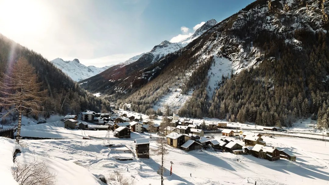
About Saas-Balen
A historic Valais village situated at 1,489m within the Saas-Fee/Saastal sub-region. During the off-peak months, the area’s authentic character remains intact with fewer crowds on the 144km of local pistes, all accessible via the Snow Pass Valais.
Highlights
- Baroque round church
- Glacial waterfall views
- Traditional sun-bleached chalets
- Serene mountain hiking
Key Facts
- Altitude: 1489m
- Top lift: 1526m
- Ski pistes: 1km
- Ski lifts: 38
- Population: 341
- 4000m+ peaks nearby: 15
- Lakes nearby: 15
- MTB trails: 149.9km
- Mountain huts: 14
Ski Area
Weather and 10-day forecast for Saas-Balen
- Today: 11 to 19 °C, overcast, 2 h of sunshine
- Freezing level today: about 3987 m (3840 to 4500 m)
| Day | Min / max | Sky | Precipitation | Sunshine |
|---|---|---|---|---|
| ma 21 sep | 11 / 19 °C | overcast | dry | 2 h sun |
| di 22 sep | 10 / 19 °C | clear sky | dry | 12 h sun |
| wo 23 sep | 11 / 20 °C | clear sky | dry | 12 h sun |
| do 24 sep | 10 / 17 °C | clear sky | dry | 12 h sun |
| vr 25 sep | 9 / 20 °C | clear sky | dry | 9 h sun |
| za 26 sep | 10 / 22 °C | clear sky | dry | 11 h sun |
| zo 27 sep | 10 / 19 °C | overcast | dry | 1 h sun |
| ma 28 sep | 7 / 23 °C | clear sky | dry | 12 h sun |
| di 29 sep | 8 / 23 °C | drizzle | dry | 8 h sun |
| wo 30 sep | 9 / 22 °C | overcast | dry | 1 h sun |
Things to do in Saas-Balen
Hikes nearby — Saas-Balen (20)
20+ curated hiking trails around Saas-Balen, sourced from OpenStreetMap and enriched with distance, elevation gain and difficulty.
-
Gemsweg Saas-Fee
-
19-Alpenpässe-Weg
-
20-Alpenpässse-Weg
The route traverses the steep western flank of the Saas Valley along an exposed high-altitude path — some sections secured with wire cables — delivering constant panoramas of the Mischabel group, the Fletschhorn, the Weissmies, and the Matterhorn, with vertiginous views straight down into the valley below. The terrain shifts from open larch forest through boulder fields and across several avalanche chutes before arriving at the sunny terrace of Grächen.
-
Swiss Tour Monte Rosa
A high-altitude panoramic traverse linking Saas-Fee to Zermatt, the route strings together views of 13 four-thousanders visible from Saas-Fee alone, threading the steep flanks of the Mischabel group along the Europaweg before crossing the 500 m Charles Kuonen suspension bridge — the world's longest pedestrian suspension bridge — with the Matterhorn waiting at the far end.
-
Saas-Balen - Bidermatten
-
Hoferälpi - Tewald
-
Saas-Balen - Heimsichgarten
-
Bidermatten - Stafelälpli
-
Siwibudu - Tewaldji
-
Hoferälpi - Kreuzboden
The trail climbs through high-alpine terrain alongside ski run edges, with views of the Mischabel mountain group, to reach the mountain lake at Kreuzboden.
-
Hannigalp-Saas-Fee
-
Kreuzboden - Hohsaas
-
Steinwildpfad
From the gondola station at Hannig, a steep zigzag climb past old avalanche barriers and a glacier moraine leads to the summit of Mällig at 2,700 m, then threads across four smaller summits along a ridge with sweeping views of the Saas valley and the surrounding four-thousanders. Above the tree line, the rocky terrain is prime habitat for ibex — the long-horned wild goats that give the trail its name.
-
Bärenfalle - Hannig
-
Alpenblumen Promenade
Botanists from Horace Bénédict de Saussure to the Prior of the Great St. Bernard once roamed these slopes, and the trail from Kreuzboden still threads through one of the finest alpine flower regions in the Swiss Alps, high above the Saastal. The route descends from a gondola station ringed by four-thousand-metre peaks toward Saas-Grund, tracing an easy path through what the sources call a nearly forgotten paradise of alpine blooms.
-
Saas-Grund - Saas-Fee
The route descends from Saas-Fee through forest and along the Saaser-Vispa river, climbing through Zermeiggern and Chapfwald to the lunch stop at Furggstalden, before returning via a panoramic ridge path through Spisswald and Zum Moss down to Saas-Grund.
-
Saas-Fee - Hannig
The trail climbs from the village's rear district of Wildi through the Bärufalla to the Mälchbodu, where two small ponds, a playground, and grills sit in a clearing amid larch forest. It follows the sledding piste up to the Hannig mountain restaurant, making it the designated family route on this side of Saas-Fee.
-
Alpenpässe-Weg: Gspon - Saas-Fee
-
Alpenpässe-Weg: Saas-Fee - Grächen
-
Swiss Tour Monte Rosa: Saas-Fee - Grächen
Mountain biking near Saas-Balen
- Trift flowtrail
- Gsponer Höhenweg
- Brunnenweg
- MTB Freeride
- Kreuzbodenweg
Getting to Saas-Balen
Door-to-door travel times as used by the MR. ALPS ranking.
- Nearest airport: Lugano Airport (LUG), 78 km away, about 2h52 by road
- Lausanne: 2h by car, 158 km
- Bern: 2h06 by train, 116 km
- Biel/Bienne: 2h21 by train, 149 km
- Genève: 2h38 by car, 220 km
- Zürich: 2h44 by train, 233 km
- Luzern: 2h51 by car, 178 km
Where to stay in Saas-Balen
200 places to stay for a night on 2026-09-25, from 141 EUR per night, median 555 EUR. Prices are direct with hotels and destinations, compared live on the Saas-Balen page.