Pontresina
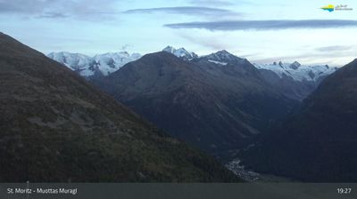
Live webcam


Open liften: 0/10
Sneeuwbericht
- Laatste 24 uur: 0 cm
- Laatste 72 uur: 0 cm
- Laatste 7 dagen: 0 cm
- Laatste 7 dagen: Dal 0cm · Middenstation 0cm · Top 0cm
- Seizoenstotaal: 14.5 cm
Skigebieden nu open · Sneeuwbericht
About Pontresina
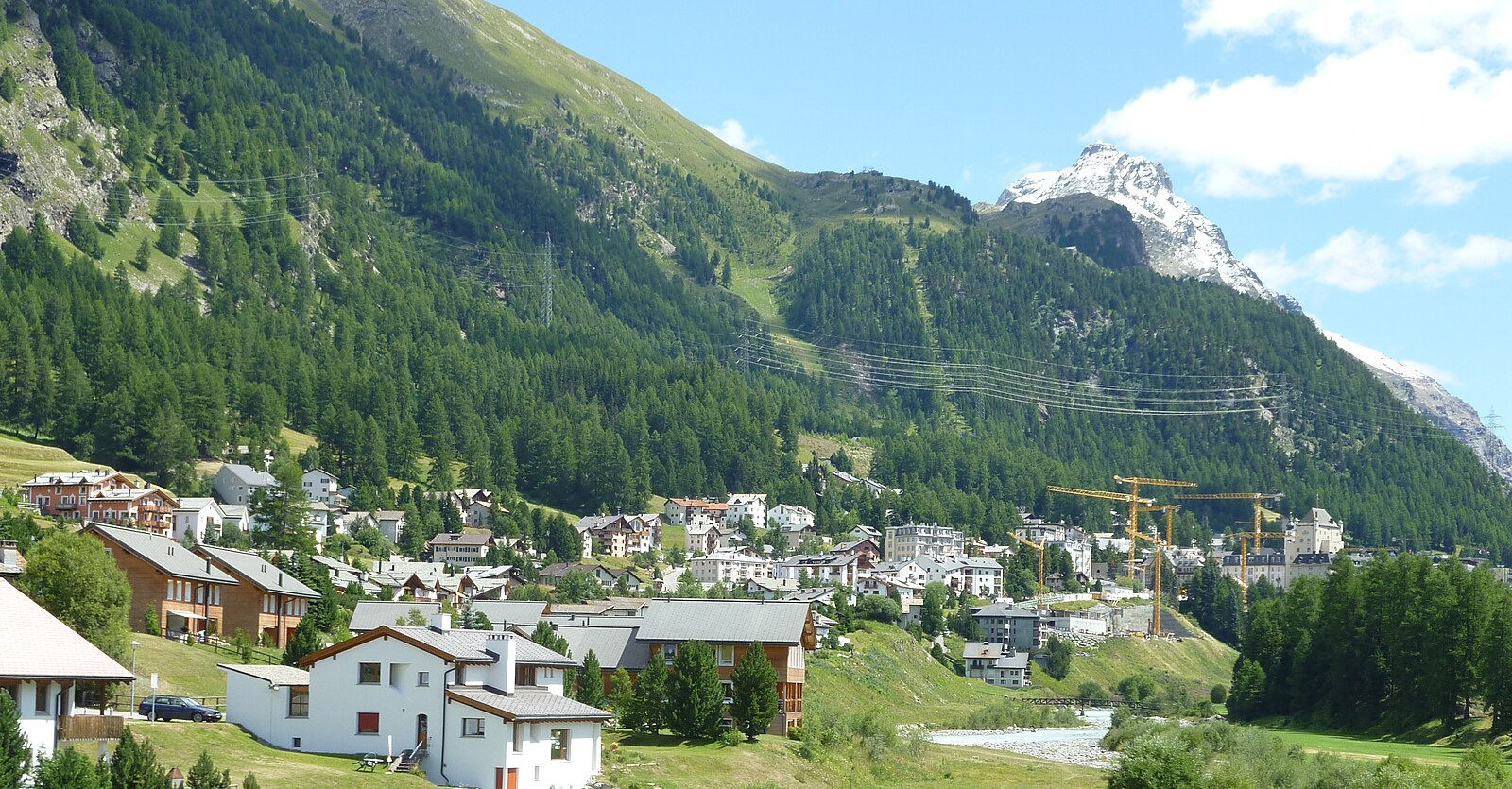
A refined Engadin retreat where Belle Époque grandeur meets rugged mountaineering culture amidst ancient stone pines and larch forests.
Highlights
- Belle Époque architecture
- High-alpine mountaineering
- Sun-drenched stone houses
- Glacier-fed valleys
Key Facts
- Altitude: 1805m
- Top lift: 2456m
- Ski pistes: 1km
- Ski lifts: 5
- Population: 2,072
- 4000m+ peaks nearby: 1
- Lakes nearby: 30
- MTB trails: 201.1km
- Mountain huts: 22
Ski Area
Inbegrepen in deze seizoenpassen
Weather and 10-day forecast for Pontresina
- Today: 5 to 12 °C, overcast, 3 h of sunshine
- Freezing level today: about 3448 m (2900 to 3910 m)
| Day | Min / max | Sky | Precipitation | Sunshine |
|---|---|---|---|---|
| do 24 sep | 5 / 12 °C | overcast | dry | 3 h sun |
| vr 25 sep | 3 / 12 °C | clear sky | dry | 10 h sun |
| za 26 sep | 4 / 16 °C | clear sky | dry | 11 h sun |
| zo 27 sep | 5 / 17 °C | clear sky | dry | 9 h sun |
| ma 28 sep | 5 / 18 °C | clear sky | dry | 12 h sun |
| di 29 sep | 8 / 18 °C | clear sky | dry | 12 h sun |
| wo 30 sep | 8 / 19 °C | clear sky | dry | 12 h sun |
| do 1 okt | 7 / 16 °C | overcast | dry | 12 h sun |
| vr 2 okt | 5 / 9 °C | drizzle | 5 mm rain | 0 h sun |
| za 3 okt | 0 / 11 °C | drizzle | 2 mm rain | 11 h sun |
Things to do in Pontresina
Hikes nearby — Pontresina (20)
20+ curated hiking trails around Pontresina, sourced from OpenStreetMap and enriched with distance, elevation gain and difficulty.
-
Senda Segantini - Etappe 4
From St. Moritz's train station, the route threads along Lake St. Moritz and through the protected Staz forest to a peat bog before climbing steeply past railing-guarded slopes toward Alp Languard, with the Bernina Massif, Piz Nair, and Corviglia spread out across the horizon. The trail culminates at Capanna Segantini, the historic high-altitude site associated with painter Giovanni Segantini.
-
Bernina Tour
-
Via Albula/Bernina
-
Bernina Tour
The Bernina Tour circles Piz Bernina — the only four-thousand-metre peak in the eastern Alps and the highest in Graubünden at 4049 m — revealing glaciers, the turquoise-blue Lej da Diavolezza, the flowery Val Roseg, and the shores of Lago Bianco where the red trains of the Rhaetian Railway pass. From the Bernina Pass at 2328 m, the route descends through the culturally significant Engadine villages and the Upper Engadine lakes, while the southern start in Poschiavo brings a Mediterranean atmosphere against an alpine backdrop.
-
Via Valtellina
-
Unterer Schafberg - Bergstation Alp Languard
-
Morteratsch-Pontresina
Het pad loopt door de glacierwereld van het Berninamassief — bekend als de "Festsaal der Alpen" — met uitzicht op de Pers- en Morteratschgletsjers en torenhoge toppen waaronder Piz Palü en Piz Bernina (4.049 m). Het leidt vanuit het dal omhoog naar het bergstation Diavolezza op 2.978 m, gelegen te midden van wat de bronnen omschrijven als een archaische, hoogalpien ijslandschap.
-
Muottas Muragl - Chna. Segantini
-
Muottas Muragl - Unterer Schafberg
A high-level traverse above Pontresina, this well-trodden Höhenweg delivers sweeping views across the entire Oberengadin and passes through terrain laced with rocky outcrops, where the scent of Arven pines, mountain pines, and herbs drifts across the path. The route connects the historic 1905 funicular station at Muottas Muragl with the restaurant at Unterer Schafberg, threading a ridge where the hillside drops away steeply enough that children need a hand to hold.
-
Muottas Muragl-Fuorcla Muragl
-
Senda Muottas da Schlarigna
The route climbs steeply through an old forest of larch and Swiss stone pine to Muottas da Schlarigna at 2,305 m, where a panoramic view opens over Pontresina and the lakes of the Upper Engadin — including a striking close look at the complex of avalanche dams and catchment areas built above the town in 2003. Near the start, beside a bench at Alp Staz, stands a thousand-year-old Swiss stone pine.
-
Puntraschigna - Roseg
From Pontresina, the path traces the Rosegbach upstream through ancient forest, past avalanche corridors where chamois roam and moss-edged streams run crystal clear, before the valley opens to reveal the snow-covered Sella group and the Sella and Roseg glaciers. Horse-drawn carriages share the route, and the journey ends at Hotel Roseg Gletscher with its glacier panorama.
-
Senda Val Champagna
-
Aussichtsweg Morteratschgletscher
-
Flaz Uferweg
-
Seerundgang
-
Morteratsch-chamanna da Boval
Het pad klimt van Morteratsch naar de Chamanna da Boval-hut, gelegen op 2.495 m in het kanton Graubünden, langs de rivier de Ova da Morteratsch. Het maakt deel uit van een langere route naar de Berninagroep, waar de hut dienst doet als tussenstop boven de omliggende gletsjers.
-
Morteratsch-Vadret da Morteratsch
-
Senda Segantini: St. Moritz Bahnhof - Muottas Muragl
-
Via Albula/Bernina: St. Moritz Bahnhof - Ospizio Bernina Stazione
Getting to Pontresina
Door-to-door travel times as used by the MR. ALPS ranking.
- Nearest airport: Milano Linate Airport (LIN), 126 km away, about 3h02 by road
- Innsbruck: 2h43 by car, 190 km
- Zürich: 2h46 by car, 209 km
- Bolzano - Bozen: 2h51 by car, 168 km
- Milano: 2h59 by car, 174 km
- Brescia: 3h02 by car, 176 km
- Luzern: 3h05 by car, 231 km
Where to stay in Pontresina
200 places to stay for a night on 2026-09-25, from 212 EUR per night, median 620 EUR. Prices are direct with hotels and destinations, compared live on the Pontresina page.