Peisey-Vallandry
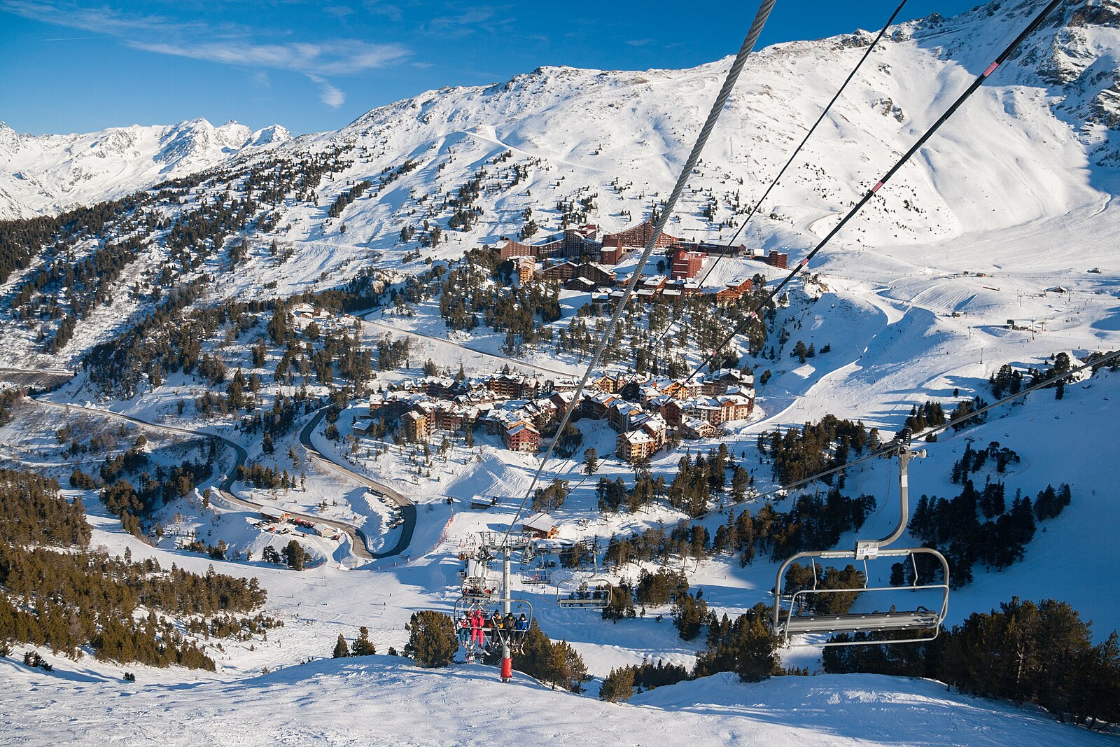
Live webcam
Open liften: 0/127
Sneeuwbericht
- Laatste 24 uur: 0 cm
- Laatste 72 uur: 0 cm
- Laatste 7 dagen: 0 cm
- Laatste 7 dagen: Dal 0cm · Middenstation 0cm · Top 0cm
- Seizoenstotaal: 2.5 cm
Skigebieden nu open · Sneeuwbericht
About Peisey-Vallandry
A rustic Savoyard sanctuary that trades high-altitude glitz for authentic stone hamlets and immediate gateway access to the Vanoise wilderness.
Highlights
- Traditional stone architecture
- Nordic ski trails
- Quiet forest runs
- National park gateway
Key Facts
- Altitude: 1326m
- Top lift: 3226m
- Ski pistes: 200km
- Ski lifts: 127
- Population: 650
- Lakes nearby: 21
- MTB trails: 217km
- Mountain huts: 18
Ski Area
Paradiski - La Plagne/Les Arcs/Peisey-Vallandry/Champagny-en-Vanoise
Weather and 10-day forecast for Peisey-Vallandry
- Today: 11 to 21 °C, partly cloudy, 5 h of sunshine
- Freezing level today: about 4036 m (3920 to 4140 m)
| Day | Min / max | Sky | Precipitation | Sunshine |
|---|---|---|---|---|
| do 24 sep | 11 / 21 °C | partly cloudy | dry | 5 h sun |
| vr 25 sep | 12 / 22 °C | mainly clear | dry | 7 h sun |
| za 26 sep | 10 / 21 °C | clear sky | dry | 12 h sun |
| zo 27 sep | 11 / 22 °C | clear sky | dry | 12 h sun |
| ma 28 sep | 11 / 22 °C | clear sky | dry | 12 h sun |
| di 29 sep | 14 / 24 °C | clear sky | dry | 11 h sun |
| wo 30 sep | 14 / 22 °C | overcast | dry | 3 h sun |
| do 1 okt | 14 / 24 °C | drizzle | 1 mm rain | 11 h sun |
| vr 2 okt | 8 / 15 °C | drizzle | 18 mm rain | 5 h sun |
| za 3 okt | 5 / 15 °C | overcast | dry | 11 h sun |
Things to do in Peisey-Vallandry
Hikes nearby — Peisey-Vallandry (15)
15 curated hiking trails around Peisey-Vallandry, sourced from OpenStreetMap and enriched with distance, elevation gain and difficulty.
-
Notre-Dame des Vernettes
A loop through forest and mountain pastures in Peisey-Nancroix, this trail leads to the Notre-Dame des Vernettes sanctuary, with a detour to a "Source Miraculeuse" on the return. Vanoise National Park ranger Benjamin Plumecocq notes that here, peaks, alpine pastures, and religious buildings conspire toward contemplation — rewarding naturalists and photographers alike.
-
Boucle de Roche de Mio
This loop departs from the upper car park at Belle Plagne and passes through the tunnel des Inversens, threading between high-altitude ski stations of La Plagne.
-
Chemin de Szombathely, Col du Petit Saint-Bernard - Moûtiers
-
Grande Traversée des Alpes - variante Montchavin (ancien tracé principal)
-
Circuit du Ragairon
-
K2 - Landry Aiguille Grive
-
La Maïtaz
-
Tour du Golf
-
Les Frasses
-
Boucle du Carroley
-
Sentier de Cyprien
-
Boucle du Cavard
-
BSM <> Arc 1600 par Plan Devin
-
BSM <> Arc 1600 par Courbaton
-
Circuit de la Comtesse Cécile
Mountain biking near Peisey-Vallandry
- Boucles des Frasses
- Hot Wheels
- Descente des Bauches
- Déval'Landry
- Mont-blanc
- Les Pierres Blanches
- Woodstock
- Elle Chablatte
Getting to Peisey-Vallandry
Door-to-door travel times as used by the MR. ALPS ranking.
- Nearest airport: Lyon Saint-Exupéry Airport (LYS), 131 km away, about 2h10 by road
- Chambéry: 1h24 by car, 107 km
- Grenoble: 1h47 by car, 137 km
- Annecy: 1h47 by car, 103 km
- Genève: 2h21 by car, 146 km
- Lyon: 2h33 by car, 204 km
- Lausanne: 3h01 by car, 208 km
Where to stay in Peisey-Vallandry
198 places to stay for a night on 2026-09-25, from 93 EUR per night, median 136 EUR. Prices are direct with hotels and destinations, compared live on the Peisey-Vallandry page.