Nax
About Nax
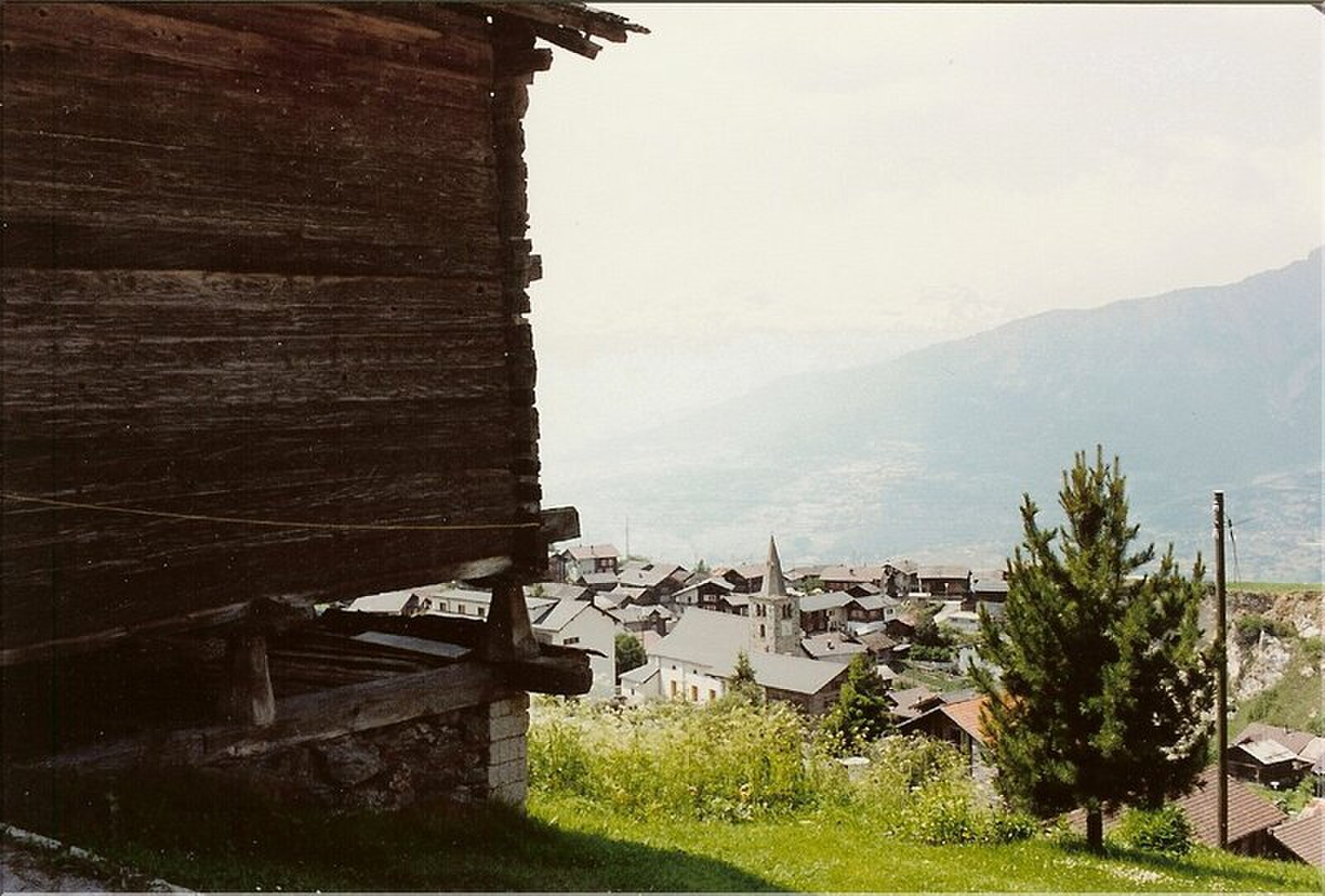
Known as the balcony of the sky, this quiet Valaisan retreat offers a slow-paced alternative to the high-octane resorts nearby.
Highlights
- Traditional timber chalets
- Panoramic valley views
- Unspoiled natural slopes
- Authentic mountain soul
Key Facts
- Altitude: 1254m
- Top lift: 2638m
- Ski pistes: 19.7km
- Ski lifts: 5
- Population: 403
- Lakes nearby: 20
- MTB trails: 18.8km
- Mountain huts: 15
Ski Area
Inbegrepen in deze seizoenpassen
Weather and 10-day forecast for Nax
- Today: 6 to 16 °C, clear sky, 9 h of sunshine
- Freezing level today: about 4193 m (3910 to 4300 m)
| Day | Min / max | Sky | Precipitation | Sunshine |
|---|---|---|---|---|
| zo 20 sep | 6 / 16 °C | clear sky | dry | 9 h sun |
| ma 21 sep | 7 / 15 °C | partly cloudy | dry | 4 h sun |
| di 22 sep | 6 / 17 °C | clear sky | dry | 12 h sun |
| wo 23 sep | 9 / 18 °C | clear sky | dry | 12 h sun |
| do 24 sep | 9 / 18 °C | partly cloudy | dry | 8 h sun |
| vr 25 sep | 9 / 18 °C | overcast | dry | 1 h sun |
| za 26 sep | 6 / 19 °C | clear sky | dry | 12 h sun |
| zo 27 sep | 9 / 19 °C | overcast | dry | 2 h sun |
| ma 28 sep | 7 / 19 °C | clear sky | dry | 12 h sun |
| di 29 sep | 6 / 20 °C | clear sky | dry | 11 h sun |
Things to do in Nax
Hikes nearby — Nax (20)
20+ curated hiking trails around Nax, sourced from OpenStreetMap and enriched with distance, elevation gain and difficulty.
-
03-Chemin du Vignoble
-
00-Tour pédestre du Val d'Hérens
The route descends from the Cabane des Becs de Bosson at 2985 m — renovated in 2012 and perched below the 3149 m summit with panoramic views of Valais 4000-metre peaks — through the wild and remote Vallon de Réchy. It finishes at Nax, known as the "Balcony of the Sky" for its elevated position.
-
06-Tour pédestre du Val d'Hérens
-
05-Chemin des Bisses
This stage of the seven-day Suonenweg follows two historic irrigation channels — the Bisse de St-Martin and the Bisse de Tsa Crêta — built centuries ago by Valais farmers to water their fields, finishing at the traditional Walliser village of Nax at 1268 m.
-
05-Tour pédestre du Val d'Hérens
The five-stage loop threads through the Val d'Hérens and Val d'Anniviers, passing through the wild Vallon de Réchy and reaching the Cabane des Becs de Bosson at 2985 m, a renovated mountain hut with panoramic views of numerous 4000-metre peaks. The final stage descends to Nax, known as the "Balcony of the Sky" for its elevated position.
-
06-Chemin des Bisses
-
04-Chemin des Bisses
The fifth segment of the Chemin des Bisses runs from St-Martin to Nax, tracing the course of ancient irrigation canals through a landscape of mixed forests, spectacular mountain peaks, and the constant murmur of water channelled through centuries-old bisses. These ingenious waterways, built by Valais farmers to carry water to their fields, thread through a varied flora and carry with them a deep layer of regional history.
-
Chemin de la Foire
Correspond plus ou moins à la route prise par les habitants de Mase pour se rendre à la foire sur la place de la Planta (Sion) pour vendre leur produits et bétail. Les premières voitures qui se sont rendues au village ont aussi utilisé cette route.
-
Chemin du Grand Bisse de Vex
A historic irrigation channel — the "bisse" — runs beside you through dense larch and spruce forest, its quiet broken only by sudden open views across the wide valley floor to the mountain world beyond. Tiny glades and secluded picnic spots punctuate the mostly wide path through this idyllic region above the valley.
-
Mayens de Réchy-Brie
-
Bisse de lens
-
Bisse de Bitailla
The Bisse de Bitailla, first documented in 1307, leads through the Vallo de la Sionne from the water intake at Les Évouettes to St-Romain, following a channel that runs alternately enclosed and open through the landscape via Saxonne. One of the few bisses in Valais to carry water year-round, the route follows the "Chemin des papillons" and the Tour du Gô markings along this ancient irrigation channel.
-
Bisse de Savièse (Torrent-Neuf)
-
Bisse de Savièse (Torrent-Neuf)
Gebouwd aan het begin van de 15e eeuw om water van de rivier de Morge te transporteren, vereist dit oude irrigatiekanaalpad stevige zenuwen: de heen-en-terugRoute van ongeveer 8 km kruist vier hangbruggen, elk ongeveer 100 meter lang, die boven steile afgronden door de heuvels boven Savièse slingeren.
-
Bisse d'Ayent
-
Chemin des Bisses: Saint-Martin - Nax
-
Chemin du vignoble: 5 - Venthône
-
Chemin d’Ossona
-
Chemin des Bisses: Nax - Vercorin
-
Bisses de Lentine et de Mont d'Orge
Mountain biking near Nax
- Route du Ban
Getting to Nax
Door-to-door travel times as used by the MR. ALPS ranking.
- Nearest airport: Geneva International Airport (GVA), 102 km away, about 2h05 by road
- Lausanne: 1h22 by car, 111 km
- Bern: 1h59 by car, 168 km
- Genève: 2h01 by car, 173 km
- Biel/Bienne: 2h27 by car, 207 km
- Annecy: 2h32 by car, 179 km
- Chambéry: 2h57 by car, 223 km
Where to stay in Nax
200 places to stay for a night on 2026-09-25, from 122 EUR per night, median 179 EUR. Prices are direct with hotels and destinations, compared live on the Nax page.