Münster-Geschinen
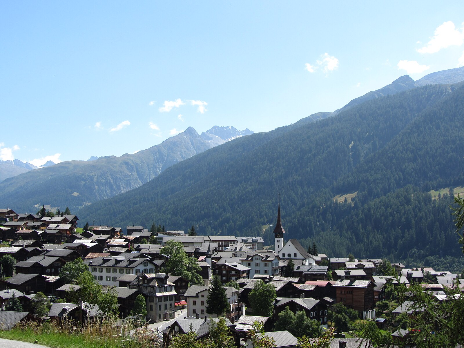
About Münster-Geschinen
A quiet Goms valley retreat where sun-blackened timber houses meet some of the finest cross-country ski tracks in the Swiss Alps.
Highlights
- Historic sun-blackened chalets
- Elite Nordic trails
- Wallis culinary traditions
- Slow-paced mountain living
Key Facts
- Altitude: 1389m
- Top lift: 1645m
- Ski pistes: 3km
- Ski lifts: 2
- Population: 489
- 4000m+ peaks nearby: 6
- Lakes nearby: 32
- MTB trails: 27.9km
- Mountain huts: 23
Ski Area
Inbegrepen in deze seizoenpassen
Weather and 10-day forecast for Münster-Geschinen
- Today: 7 to 17 °C, clear sky, 12 h of sunshine
- Freezing level today: about 4062 m (3900 to 4290 m)
| Day | Min / max | Sky | Precipitation | Sunshine |
|---|---|---|---|---|
| di 22 sep | 7 / 17 °C | clear sky | dry | 12 h sun |
| wo 23 sep | 6 / 18 °C | clear sky | dry | 12 h sun |
| do 24 sep | 4 / 16 °C | clear sky | dry | 11 h sun |
| vr 25 sep | 1 / 17 °C | clear sky | dry | 10 h sun |
| za 26 sep | 5 / 21 °C | clear sky | dry | 12 h sun |
| zo 27 sep | 9 / 20 °C | overcast | dry | 4 h sun |
| ma 28 sep | 13 / 18 °C | thunderstorm | dry | 6 h sun |
| di 29 sep | 12 / 19 °C | drizzle | dry | 8 h sun |
| wo 30 sep | 8 / 18 °C | drizzle | dry | 2 h sun |
| do 1 okt | 10 / 15 °C | rain showers | dry | 0 h sun |
Things to do in Münster-Geschinen
Hikes nearby — Münster-Geschinen (20)
20+ curated hiking trails around Münster-Geschinen, sourced from OpenStreetMap and enriched with distance, elevation gain and difficulty.
-
9 Seen-Weg
The 9 Seen-Weg departs from the Grimselpass and follows a path with alpine character past the Trützisee before descending to Geschinen. The route runs far above the valley floor, threading through dramatic high-alpine scenery on its way between nine lakes.
-
14a-Sentiero dei passi alpini
-
Geschinen - Galehitte
-
Ulrichen - Geschinen
The trail begins at Münster's train station and follows the young river Rotten along the edge of the small town before continuing through the valley toward Ulrichen and Geschinen.
-
Geschinen - Trützisee
-
Rottenweg
The Rottenweg traces the young Rhone — locally called the Rotten — along the floor of Obergoms, threading from village to village across wide meadows and through bright forests. The route runs the full length of Obergoms from Oberwald to Niederwald, keeping to practically flat ground the entire way.
-
Ladstafel-Ulrichen
-
Triebtenseelücke - Trützisee
-
Fieschertal - Burghütte - Märjele
-
14-Sentiero dei passi alpini
-
Münster - Reckingen
-
Münster - Stockji
-
Geschinen - Brudelhorn
-
Blinnentalweg
-
Reckingen - Männlibode
-
Gommer Höhenweg
-
7-Seenwanderweg Bellwald
-
Oberaar Trail
-
Vier-Quellen-Weg: Cap. Piansecco - Obergesteln Bahnhof
-
ViaSbrinz: Obergesteln - Ponte (I)
Mountain biking near Münster-Geschinen
- Gotthard Bike Nufenen Andermatt
- Gommer Höhenweg
- Winterstrasse
Getting to Münster-Geschinen
Door-to-door travel times as used by the MR. ALPS ranking.
- Nearest airport: Lugano Airport (LUG), 73 km away, about 1h47 by road
- Luzern: 1h46 by car, 118 km
- Bern: 2h08 by car, 138 km
- Zürich: 2h16 by car, 155 km
- Lausanne: 2h26 by car, 183 km
- Biel/Bienne: 2h32 by car, 174 km
- Milano: 2h37 by car, 200 km
Where to stay in Münster-Geschinen
112 places to stay for a night on 2026-09-25, from 133 EUR per night, median 405 EUR. Prices are direct with hotels and destinations, compared live on the Münster-Geschinen page.