Marbach
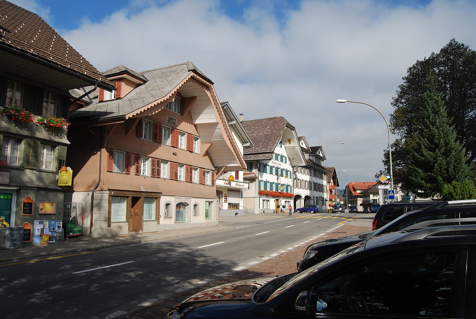
Live webcam



Open liften: 0/5
Sneeuwbericht
- Laatste 24 uur: 0 cm
- Laatste 72 uur: 0 cm
- Laatste 7 dagen: 0 cm
- Laatste 7 dagen: Dal 0cm · Middenstation 0cm · Top 0cm
- Seizoenstotaal: 0 cm
Skigebieden nu open · Sneeuwbericht
About Marbach
A quiet Emmental escape where rolling hills meet rugged limestone peaks, defined by slow-paced living and authentic folk traditions.
Highlights
- Biosphere reserve trails
- Traditional farmhouse architecture
- Family-run mountain inns
- Local cheese production
Key Facts
- Altitude: 882m
- Top lift: 1474m
- Ski pistes: 7km
- Ski lifts: 5
- Population: 1,212
- Lakes nearby: 3
- MTB trails: 273.5km
- Mountain huts: 3
Ski Area
Inbegrepen in deze seizoenpassen
Weather and 10-day forecast for Marbach
- Today: 7 to 16 °C, clear sky, 12 h of sunshine
- Freezing level today: about 4068 m (3900 to 4190 m)
| Day | Min / max | Sky | Precipitation | Sunshine |
|---|---|---|---|---|
| di 22 sep | 7 / 16 °C | clear sky | dry | 12 h sun |
| wo 23 sep | 8 / 19 °C | clear sky | dry | 12 h sun |
| do 24 sep | 9 / 17 °C | overcast | 0 mm rain | 1 h sun |
| vr 25 sep | 5 / 18 °C | clear sky | dry | 10 h sun |
| za 26 sep | 7 / 20 °C | partly cloudy | dry | 6 h sun |
| zo 27 sep | 9 / 22 °C | overcast | dry | 3 h sun |
| ma 28 sep | 10 / 23 °C | clear sky | dry | 11 h sun |
| di 29 sep | 10 / 24 °C | clear sky | dry | 11 h sun |
| wo 30 sep | 14 / 24 °C | drizzle | 1 mm rain | 11 h sun |
| do 1 okt | 13 / 18 °C | rain showers | 13 mm rain | 6 h sun |
Things to do in Marbach
Hikes nearby — Marbach (20)
20+ curated hiking trails around Marbach, sourced from OpenStreetMap and enriched with distance, elevation gain and difficulty.
-
Trans Swiss Trail
The trail follows the young Emme River through a valley framed by the rock faces of Hohgant and Schrattenflue, passing the former bathhouse at Kemmeriboden-Bad before reaching the wetland biotopes near Sörenberg — terrain so ecologically significant it anchors a UNESCO biosphere reserve.
-
Grenzpfad Napfbergland
This fifth stage of the Grenzpfad Napfbergland traces the cantonal border between Bern and Luzern, climbing through the Entlebuch biosphere reserve toward the Brienzer Rothorn. The route follows a long-distance trail opened in 1998, passing through terrain where hostile border skirmishes were still taking place 150 years ago.
-
Trans Swiss Trail
-
Marbach - Dorfrundweg
-
Ober Sidenmoos - Nesslenboden
-
Marbach Talstaion - Marbachegg
-
Nesslenboden - Unt. Schübelsmoos - Hürnli
-
Marbach - Wiggen
-
Nesslenboden - Hürnli
-
Marbachegg - Imbrig
-
Hürnli - Hilferenhüttli
-
Schärligbad - Geissholle
-
Steinwang - Vorder Bättenalp
-
Kemmeriboden-Bad - Imbrig
-
Emmenuferweg - Etappe 2
-
Grenzpfad Napfbergland: Trubschachen - Bachmatte
-
Trans Swiss Trail: Eggiwil - Schangnau
-
Grenzpfad Napfbergland: Bachmatte - Rothorn
-
Trans Swiss Trail: Schangnau - Sörenberg
-
Trans Swiss Trail: Langnau - Eggiwil
Mountain biking near Marbach
- Rund um die Schrattenfluh
- Panorama Bike - Etappe 9
- Südelhöchi - Ällgäuwlicka - Brienz
- Marbacher Panoramarunde
- Clientis Flowtrail Marbachegg
- Wanderweg Herbrig
Getting to Marbach
Door-to-door travel times as used by the MR. ALPS ranking.
- Nearest airport: Bern Airport (BRN), 31 km away, about 54 min by road
- Bern: 58 min by car, 58 km
- Luzern: 59 min by car, 47 km
- Biel/Bienne: 1h21 by car, 93 km
- Zürich: 1h33 by car, 95 km
- Basel: 1h46 by car, 113 km
- Lausanne: 2h09 by car, 164 km
Where to stay in Marbach
11 places to stay for a night on 2026-09-25, from 261 EUR per night, median 316 EUR. Prices are direct with hotels and destinations, compared live on the Marbach page.