Le Tour, Balme
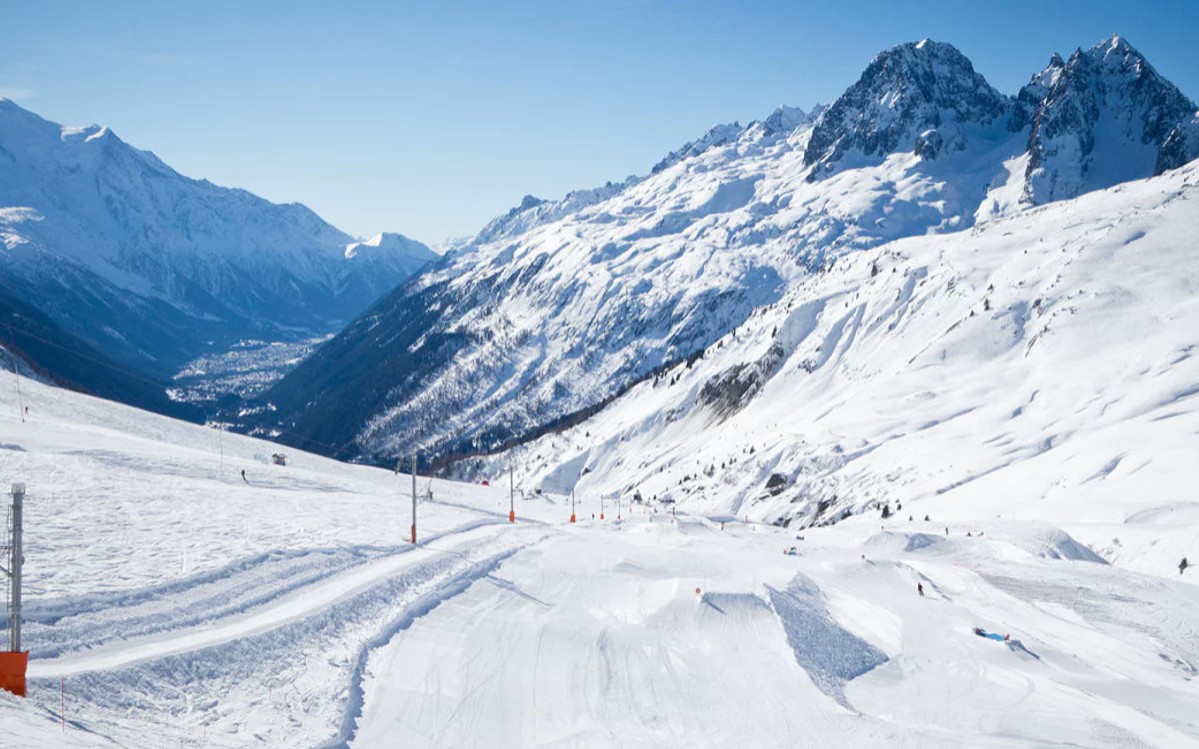
Live webcam
Open liften: 6/16
Sneeuwbericht
- Laatste 24 uur: 0 cm
- Laatste 72 uur: 0 cm
- Laatste 7 dagen: 0 cm
- Laatste 7 dagen: Dal 0cm · Middenstation 0cm · Top 0cm
- Seizoenstotaal: 4 cm
Skigebieden nu open · Sneeuwbericht
About Le Tour, Balme
A quiet outpost at the Chamonix valley's edge, favored by purists for its wide, rolling slopes and spectacular Mont Blanc views.
Highlights
- Wide-open bowls
- Family-friendly terrain
- Sun-soaked plateaus
- Traditional Savoyard charm
Key Facts
- Altitude: 1462m
- Top lift: 2250m
- Ski pistes: 29km
- Ski lifts: 7
- Population: 8,673
- 4000m+ peaks nearby: 21
- Lakes nearby: 14
- MTB trails: 30.3km
- Mountain huts: 32
Ski Area
Inbegrepen in deze seizoenpassen
Weather and 10-day forecast for Le Tour, Balme
- Today: 8 to 18 °C, clear sky, 9 h of sunshine
- Freezing level today: about 4227 m (4080 to 4310 m)
| Day | Min / max | Sky | Precipitation | Sunshine |
|---|---|---|---|---|
| zo 20 sep | 8 / 18 °C | clear sky | dry | 9 h sun |
| ma 21 sep | 8 / 17 °C | partly cloudy | dry | 4 h sun |
| di 22 sep | 8 / 16 °C | clear sky | dry | 12 h sun |
| wo 23 sep | 9 / 16 °C | clear sky | dry | 10 h sun |
| do 24 sep | 8 / 15 °C | clear sky | dry | 11 h sun |
| vr 25 sep | 8 / 17 °C | clear sky | dry | 12 h sun |
| za 26 sep | 10 / 18 °C | clear sky | dry | 12 h sun |
| zo 27 sep | 11 / 18 °C | overcast | dry | 4 h sun |
| ma 28 sep | 10 / 18 °C | drizzle | dry | 2 h sun |
| di 29 sep | 8 / 18 °C | drizzle | dry | 2 h sun |
Things to do in Le Tour, Balme
Hikes nearby — Le Tour, Balme (20)
20+ curated hiking trails around Le Tour, Balme, sourced from OpenStreetMap and enriched with distance, elevation gain and difficulty.
-
Sentier des Alpages
-
Mont Buet
path nr.12 from Rother Wanderführer, Mont Blanc
-
37-Chemin des cols alpins
A high alpine pass linking France and Switzerland, Col de Balme sits near the Sources de l'Arve amid rhododendrons and working alpine pasture, with sweeping views of the Mont Blanc range, the Chamonix valley, and the Swiss Alps.
-
Tour du Mont Blanc - Variante du Tour
-
Tour Du Mont Blanc - Variante de Vallorcine
This variant of the Tour du Mont Blanc climbs through alpine meadows, conifer forests, and rocky slopes to the Col de Balme at 2,191 m, a pass straddling the French-Swiss border between the Vallée de Chamonix and the Vallée du Trient. From the top, the panorama takes in the Aiguille du Tour, the Aiguille du Chardonnet, and the Aiguille d'Argentière ranged across the Mont Blanc massif.
-
Tour Du Mont Blanc - Variante des Grands
This high-altitude variant of TMB Stage 9 breaks free of the forested Vallon Nant Noir to deliver sweeping views of the Trient glacier, climbing above the tree line to Refuge Les Grands before tracing a high traverse along the lower flanks of Les Grands Otanes (2,679m) to meet the main trail at the Col de Balme. The route begins along the historic flat balcony path of the Bisse du Trient — an ancient water channel running from the Col de la Forclaz — before ascending into this little-trodden alpine terrain.
-
Refuge Albert Ier
The trail climbs to 2,702 metres above the Glacier du Tour — the only hut managed by the CAF de Chamonix reachable in summer without crossing a glacier — with views spanning the Aiguille du Tour, Aiguille du Chardonnet, and Aiguille d'Argentière. It sits on the Haute Route between Chamonix and Zermatt, making it a crossroads for day hikers drawn by the Chamonix Valley panorama and alpinists bound for serious high-mountain routes.
-
Chalet de Loriaz
A relentless, steady climb through the heart of the Aiguilles Rouges leads to the Loriaz mountain pasture, where the Mont Blanc massif spreads across the horizon in exceptional panoramic views.
-
Chemin des Diligences
Opened in 1792, this historic path traces the old coach route linking Martigny and Chamonix via the Col des Montets, threading through the authentic hamlets of Vallorcine where local traditions have been faithfully kept alive.
-
GaB_TMB_S01
This route climbs from Chamonix-Sud at 1,033 m to the Plan de l'Aiguille at 2,314 m, then continues via cable car across the Glacier des Pèlerins to the Aiguille du Midi at 3,791 m — the highest of the Chamonix needles — where a terrace delivers the closest view of Mont Blanc without climbing it.
-
Petit Balcon Sud
Mostly forested and hugging the southern aspect of the Chamonix valley at around 1,200–1,300m, the Petit Balcon Sud traces a low-altitude path from Les Houches all the way to Argentière. It presents very little difficulty and is considered an ideal choice even on rainy days.
-
Via Alpina Stage 80: Trient - Champex-Lac
-
Via Alpina Stage 79: Vernayaz - Trient
-
36-Chemin des cols alpins
-
38-Chemin des cols alpins
-
Alpenpässe-Weg: Trient - Emosson Barrage
-
Sentier du Balcon du Mont-Blanc
-
Alpenpässe-Weg: Champex-Lac - Trient
-
Alpenpässe-Weg: Emosson Barrage - Salanfe
-
Cirque des Fonts
Mountain biking near Le Tour, Balme
- Chamonix – Argentière – Le Petit Balcon Nord
- Chevreuils
- Les Cerfs
- Les Marmottes
- Le Plan de l'Au
Getting to Le Tour, Balme
Door-to-door travel times as used by the MR. ALPS ranking.
- Nearest airport: Geneva International Airport (GVA), 70 km away, about 1h39 by road
- Genève: 1h20 by car, 94 km
- Lausanne: 1h30 by car, 109 km
- Annecy: 1h30 by car, 106 km
- Chambéry: 1h54 by car, 150 km
- Bern: 2h06 by car, 166 km
- Grenoble: 2h23 by car, 161 km
Where to stay in Le Tour, Balme
166 places to stay for a night on 2026-09-25, from 111 EUR per night, median 202 EUR. Prices are direct with hotels and destinations, compared live on the Le Tour, Balme page.