Jungholz
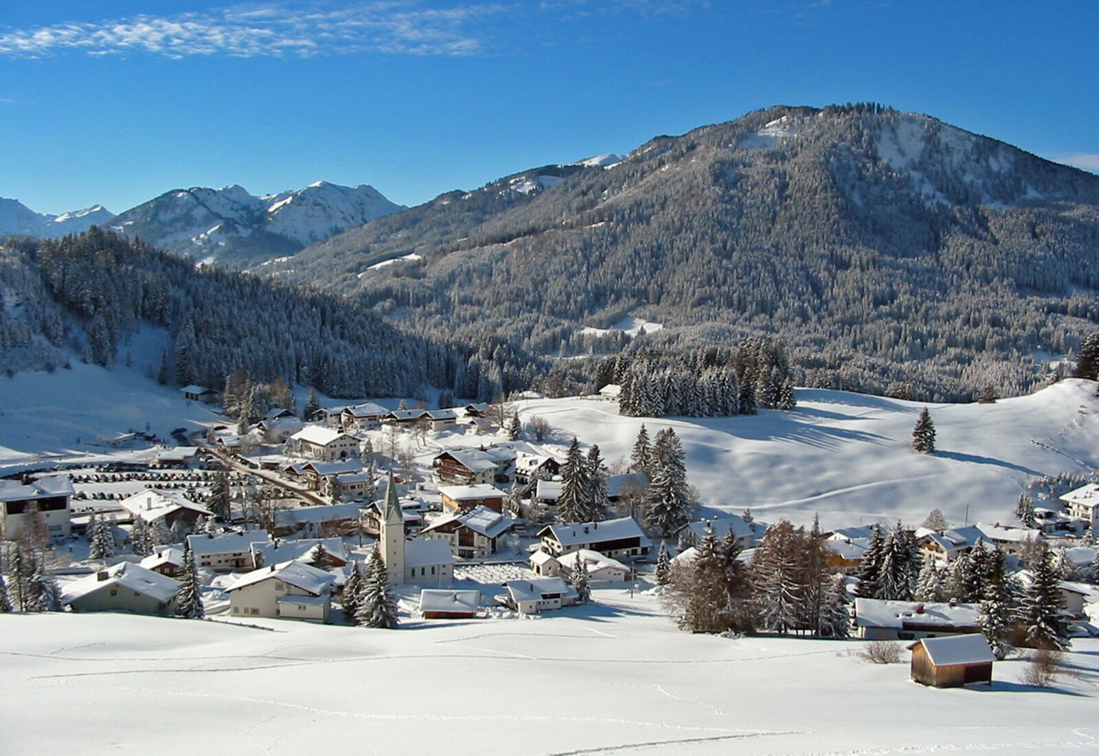
About Jungholz
A curious Austrian enclave accessible only through Germany, known for its gentle slopes and family-friendly, secluded atmosphere.
Highlights
- Geographic anomaly
- Family-oriented runs
- Quiet mountain seclusion
- Austrian-Bavarian fusion
Key Facts
- Altitude: 1050m
- Top lift: 1500m
- Ski pistes: 10km
- Ski lifts: 7
- Population: 299
- Lakes nearby: 36
- MTB trails: 195.7km
- Mountain huts: 32
Ski Area
Inbegrepen in deze seizoenpassen
Weather and 10-day forecast for Jungholz
- Today: 10 to 18 °C, partly cloudy, 5 h of sunshine
- Freezing level today: about 3938 m (3160 to 4140 m)
| Day | Min / max | Sky | Precipitation | Sunshine |
|---|---|---|---|---|
| zo 20 sep | 10 / 18 °C | partly cloudy | dry | 5 h sun |
| ma 21 sep | 7 / 13 °C | overcast | dry | 2 h sun |
| di 22 sep | 5 / 13 °C | clear sky | dry | 12 h sun |
| wo 23 sep | 4 / 15 °C | clear sky | dry | 12 h sun |
| do 24 sep | 8 / 16 °C | partly cloudy | dry | 8 h sun |
| vr 25 sep | 7 / 18 °C | overcast | dry | 4 h sun |
| za 26 sep | 8 / 20 °C | clear sky | dry | 12 h sun |
| zo 27 sep | 9 / 22 °C | partly cloudy | dry | 5 h sun |
| ma 28 sep | 12 / 22 °C | clear sky | dry | 12 h sun |
| di 29 sep | 12 / 21 °C | clear sky | dry | 12 h sun |
Things to do in Jungholz
Hikes nearby — Jungholz (17)
17 curated hiking trails around Jungholz, sourced from OpenStreetMap and enriched with distance, elevation gain and difficulty.
-
European Long distance path E 4 - part Germany (segment austria)
-
Jungholz - lokale Wanderwege
Beschilderte Wanderwege in Jungholz ohne Nummerierung
-
Jungholzer Höhenweg
-
Sebald-Weg
The Sebald-Weg descends from the German-Austrian border at Oberjoch through the gorge of the Alpsteigtobel, passing the restored Krummenbacher Kapelle and the Vordere Sorg-Alpe, before reaching the birthplace of writer W. G. Sebald in Wertach. Along the way, six stone steles bear excerpts from Sebald's book *Schwindel. Gefühle.*, marking the original locations from his writing.
-
Wertach - lokale beschilderte Wanderwege
-
82
-
Nesselwang - lokale beschilderte Wanderwege
-
Von Hütte zu Hütte rund um den Edelsberg
A hut-to-hut circuit around the Edelsberg, this route strings together five mountain huts — including the Kappeler Alp, Sportheim Böck, Fichtelhütte, Dinserhütte, and Edelsberghütte — while delivering a sweeping panorama from the Ammergauer Alps to the Nagelfluhkette in the west, with repeated glimpses over the Voralpenlandschaft and its many lakes below.
-
Oy-Mittelberg - lokale beschilderte Wanderwege
-
Via Alpina Purple A64
Pfronten - Tannheim
-
Wandertrilogie Himmelsstürmer Etappe 21 Bad Hindelang - Schattwald/Tannheimer Tal
-
Wandertrilogie Himmelsstürmer Etappe 20 Schwarzenberghütte/Hinterstein - Bad Hindelang
-
Rund um die Reuterwanne
-
Fallmühle-Schwarzwandweg
-
Rettenberg - lokale beschilderte Wanderwege
-
Breitenbergbahn -Ostlerhütte - Fallmühle
-
Auf SEINER Spur
Mountain biking near Jungholz
- MTB Marathon Pfronten
- Naturbiken Grüntenseerunde
- Lohmoosrunde
- Obere Alpe Reuterwanne
Getting to Jungholz
Door-to-door travel times as used by the MR. ALPS ranking.
- Nearest airport: Memmingen Allgau Airport (FMM), 49 km away, about 49 min by road
- München: 1h48 by car, 137 km
- Innsbruck: 2h01 by car, 136 km
- Stuttgart: 2h13 by car, 213 km
- Zürich: 2h45 by car, 223 km
- Nürnberg: 2h57 by car, 298 km
- Luzern: 3h21 by car, 274 km
Where to stay in Jungholz
200 places to stay for a night on 2026-09-25, from 126 EUR per night, median 594 EUR. Prices are direct with hotels and destinations, compared live on the Jungholz page.