Jöchelspitze – Bach
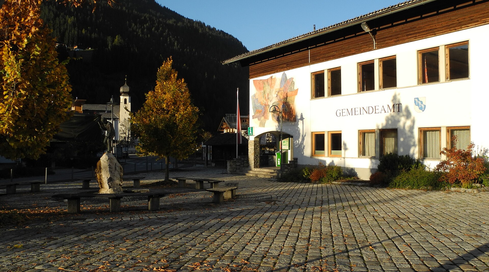
About Jöchelspitze – Bach
A quiet, family-oriented retreat in the Lechtal valley, favored by locals for its uncrowded slopes and panoramic botanical trails.
Highlights
- Alpine flower gardens
- Gentle family terrain
- Quiet mountain escape
- Scenic valley views
Key Facts
- Altitude: 1237m
- Top lift: 1768m
- Ski pistes: 5km
- Ski lifts: 2
- Population: 658
- Lakes nearby: 12
- MTB trails: 112.1km
- Mountain huts: 27
Ski Area
Weather and 10-day forecast for Jöchelspitze – Bach
- Today: 4 to 17 °C, clear sky, 12 h of sunshine
- Freezing level today: about 3699 m (3450 to 3870 m)
| Day | Min / max | Sky | Precipitation | Sunshine |
|---|---|---|---|---|
| wo 23 sep | 4 / 17 °C | clear sky | dry | 12 h sun |
| do 24 sep | 7 / 14 °C | overcast | dry | 2 h sun |
| vr 25 sep | 5 / 14 °C | clear sky | dry | 12 h sun |
| za 26 sep | 5 / 18 °C | clear sky | dry | 12 h sun |
| zo 27 sep | 6 / 20 °C | clear sky | dry | 12 h sun |
| ma 28 sep | 9 / 23 °C | clear sky | dry | 9 h sun |
| di 29 sep | 12 / 22 °C | clear sky | dry | 11 h sun |
| wo 30 sep | 11 / 22 °C | clear sky | dry | 12 h sun |
| do 1 okt | 7 / 15 °C | rain showers | dry | 0 h sun |
| vr 2 okt | 5 / 9 °C | drizzle | dry | 0 h sun |
Things to do in Jöchelspitze – Bach
Hikes nearby — Jöchelspitze – Bach (16)
16 curated hiking trails around Jöchelspitze – Bach, sourced from OpenStreetMap and enriched with distance, elevation gain and difficulty.
-
Enzensperger Weg
HvB-Hütte – Balschtesattel – Luxnacher Sattel – Griesschartl – Schwärzerscharte – Kaufbeurer Haus
-
Wanderweg 437
Ebigenalp - Karjoch - Oberes Mädjejoch - Kemptner Hütte
-
Wanderweg 436
Vanaf de bergstation op 1800 m voert de route langs een Bergheumuseum en klimt naar het topkruis van de Lachenkopf, waar je op heldere dagen paragliders kunt zien opstijgen vanaf de zuidhelling van de Jöchelspitze en hoog boven het dal daaronder zweven.
-
Via Alpina Yellow B39
Holzgau - Kemptner Hütte
-
Via Alpina Yellow B38
Memminger Hütte - Holzgau
-
Wanderweg 432
Hochalptal - Heilbronner Weg - Krottenkopfscharte - Schöneggerscharte - Hinterhornbach
-
WW08
Vanaf het bovenstation van de kabelbaan op 1800 m voert de route langs het topkruis van de Lachenkopf en een Bergheumuseum, met uitzicht op de vallei waar paragliders opstijgen vanaf de zuidhelling van de Jöchelspitze en boven je hoofd zweven.
-
Wanderweg 45
-
Wanderweg 42
Elbigenalp - Bibler Alm - Hofalm
-
Vitalweg Holzgau
This three-and-a-half-kilometre loop through Holzgau introduces walkers to the five elements of Kneipp's health theory, with information boards stationed along the way. The trail moves through a village famed for its magnificently painted houses, set at the entrance to the Höhenbach Valley Gorge.
-
Wanderweg 43
-
Wanderweg 57
Bernhardstal - Großer Krottenkopf
-
Wanderweg 56
Bernhardstal - Hermann-von-Barth-Hütte
-
Geierwally-Rundwanderweg
A loop through spruce forest and open alpine pasture, the route climbs from the Geierwally car park past the rebuilt Kasermandl hut at 1,410 m, drops into the Bernhardstal valley to cross the Bernhardsbach creek, then returns via the Gibler Alm — two rustic rest stops above the wild Lech valley.
-
Anna Stainer-Knittel Gedenkweg
www.lechtalspuren.at/wp-content/uploads/Wanderfolder.pdf
-
Düsseldorfer Weg
Mountain biking near Jöchelspitze – Bach
- Sonnalm Jöchlspitz
- Gschwoad
- Jausenstation Wase
- Alpenrosensteig
- Lechtaler Panoramaweg
- Jochweg
Getting to Jöchelspitze – Bach
Door-to-door travel times as used by the MR. ALPS ranking.
- Nearest airport: Innsbruck Airport (INN), 73 km away, about 1h34 by road
- Innsbruck: 1h43 by car, 107 km
- München: 2h26 by car, 163 km
- Zürich: 2h59 by car, 200 km
- Bolzano - Bozen: 3h06 by car, 219 km
- Stuttgart: 3h18 by car, 277 km
- Luzern: 3h23 by car, 242 km
Where to stay in Jöchelspitze – Bach
147 places to stay for a night on 2026-09-25, from 208 EUR per night, median 334 EUR. Prices are direct with hotels and destinations, compared live on the Jöchelspitze – Bach page.